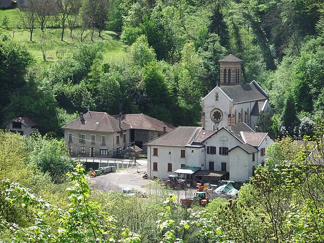
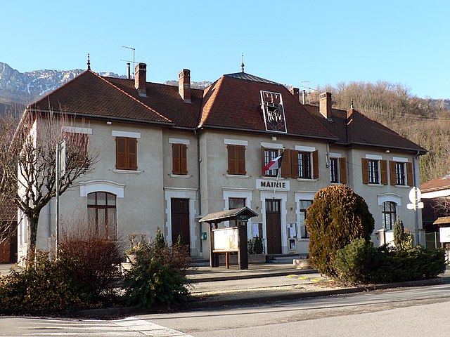
Le Cheylas (Le Cheylas)

- commune in Isère, France
 Hiking in Le Cheylas
Le Cheylas, located in the French Alps near the Isère River, is an excellent destination for hiking enthusiasts. The area offers stunning landscapes, picturesque valleys, and a variety of trails suitable for different skill levels. Here are some highlights you might consider if you're planning a hike in Le Cheylas:
Trails and Routes
-
Local Trails: There are numerous marked paths around Le Cheylas, ranging from easy walks to more challenging hikes. Some trails offer panoramic views of the surrounding mountains and valleys.
-
GR Trails: The Grande Randonnée (GR) trails, particularly GR 9, pass near Le Cheylas, providing an opportunity for longer treks that connect to wider hiking networks across the Alps.
-
Nature Reserves: The nearby Chartreuse Regional Natural Park includes trails through forests and past limestone formations, offering a chance to see diverse flora and fauna.
Tips for Hiking in Le Cheylas
-
Season: The best time for hiking in this region is typically late spring to early fall (May to October) when trails are clearer and weather is generally favorable.
-
Gear: Wear appropriate hiking boots and bring layers, as weather conditions can change rapidly in the mountains. Always carry enough water and snacks for your hike.
-
Navigation: Download maps or have a physical map handy, as some areas may not have good cellphone reception.
-
Safety: If you're tackling more challenging routes, consider hiking with a companion, and inform someone about your plans.
-
Local Resources: Check with local hiking clubs or tourism offices for organized hikes, guided tours, or any latest information on trail conditions.
Attractions
-
Scenic Views: Many hiking trails offer breathtaking views of the Chartreuse mountains and surrounding nature. Be sure to stop at viewpoints for photography.
-
Wildlife: Keep an eye out for local wildlife, including deer and various bird species, as hiking can provide a unique opportunity to experience nature.
Hiking in Le Cheylas can be a rewarding experience, combining physical activity with the chance to connect with nature and enjoy the stunning alpine environment. Be sure to plan ahead and take the necessary precautions for a safe and enjoyable adventure!
- Country:

- Postal Code: 38570
- Coordinates: 45° 22' 17" N, 5° 59' 33" E


- GPS tracks (wikiloc): [Link]
- Area: 8.44 sq km
- Population: 2612
- Web site: http://www.ville-le-cheylas.fr
- Wikipedia en: wiki(en)
- Wikipedia: wiki(fr)
- Wikidata storage: Wikidata: Q1069158
- Wikipedia Commons Category: [Link]
- Freebase ID: [/m/03nvgv5]
- GeoNames ID: Alt: [3004608]
- SIREN number: [213801004]
- BnF ID: [152579263]
- VIAF ID: Alt: [130060854]
- INSEE municipality code: 38100
Shares border with regions:


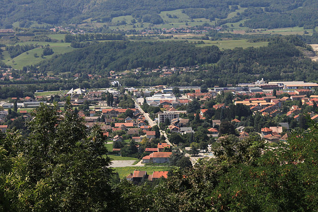
Goncelin
- commune in Isère, France
Hiking in Goncelin
Goncelin is a small commune located in the Isère department in the Auvergne-Rhône-Alpes region of southeastern France. Nestled in the picturesque Belledonne mountain range, it offers various hiking opportunities that combine beautiful scenery, diverse landscapes, and the chance to explore the local flora and fauna....
- Country:
- Postal Code: 38570
- Coordinates: 45° 20' 34" N, 5° 58' 45" E
- GPS tracks (wikiloc): [Link]
- Area: 14.36 sq km
- Population: 2334
- Web site: [Link]


Sainte-Marie-d'Alloix
- commune in Isère, France
Hiking in Sainte-Marie-d'Alloix
Sainte-Marie-d'Alloix is a charming village located in the French Alps, particularly well-known for its stunning natural landscapes and hiking opportunities. Here are some key aspects to consider when hiking in and around this area:...
- Country:
- Postal Code: 38660
- Coordinates: 45° 22' 45" N, 5° 57' 59" E
- GPS tracks (wikiloc): [Link]
- Area: 3.04 sq km
- Population: 482

Morêtel-de-Mailles
- former commune in Isère, France
Hiking in Morêtel-de-Mailles
Morêtel-de-Mailles is a picturesque village located in the Canton of Vaud in Switzerland, surrounded by beautiful natural landscapes that are ideal for hiking enthusiasts. Here are some highlights and tips for hiking in and around this area:...
- Country:
- Postal Code: 38570
- Coordinates: 45° 22' 3" N, 6° 1' 0" E
- GPS tracks (wikiloc): [Link]
- Area: 6.71 sq km
- Population: 476
- Web site: [Link]

Pontcharra
- commune in Isère, France
Hiking in Pontcharra
Pontcharra is a charming town located in the Auvergne-Rhône-Alpes region of France, nestled in the Isère department. It offers great opportunities for hiking, surrounded by beautiful natural landscapes, including the Chartreuse and Belledonne mountain ranges. Here’s an overview of what you can expect when hiking in and around Pontcharra:...
- Country:
- Postal Code: 38530
- Coordinates: 45° 25' 59" N, 6° 0' 55" E
- GPS tracks (wikiloc): [Link]
- Area: 15.58 sq km
- Population: 7258
- Web site: [Link]


Saint-Vincent-de-Mercuze
- commune in Isère, France
Hiking in Saint-Vincent-de-Mercuze
Saint-Vincent-de-Mercuze, located in the Isère department of the Auvergne-Rhône-Alpes region in southeastern France, offers a variety of hiking opportunities amidst beautiful natural landscapes. Here are some highlights of hiking in this area:...
- Country:
- Postal Code: 38660
- Coordinates: 45° 22' 27" N, 5° 56' 59" E
- GPS tracks (wikiloc): [Link]
- Area: 7.85 sq km
- Population: 1481
- Web site: [Link]

La Buissière
- commune in Isère, France
Hiking in La Buissière
La Buissière is a charming village located in France, often characterized by its scenic landscapes and proximity to nature, making it an excellent location for hiking enthusiasts. While the specific trails in La Buissière may not be widely documented, the surrounding regions typically offer various outdoor activities, including hiking paths that range from easy strolls to more challenging treks....
- Country:
- Postal Code: 38530
- Coordinates: 45° 24' 9" N, 5° 58' 42" E
- GPS tracks (wikiloc): [Link]
- Area: 7.71 sq km
- Population: 672
- Web site: [Link]