Le Fayel (Le Fayel)

- commune in Oise, France
- Country:

- Postal Code: 60680
- Coordinates: 49° 22' 20" N, 2° 41' 55" E


- GPS tracks (wikiloc): [Link]
- Area: 2.56 sq km
- Population: 219
- Wikipedia en: wiki(en)
- Wikipedia: wiki(fr)
- Wikidata storage: Wikidata: Q1161321
- Wikipedia Commons Category: [Link]
- Freebase ID: [/m/03qgn1v]
- GeoNames ID: Alt: [6615020]
- SIREN number: [216002279]
- BnF ID: [15267468v]
- INSEE municipality code: 60229
Shares border with regions:

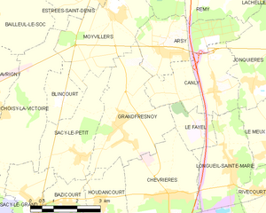
Grandfresnoy
- commune in Oise, France
- Country:
- Postal Code: 60680
- Coordinates: 49° 22' 21" N, 2° 39' 6" E
- GPS tracks (wikiloc): [Link]
- Area: 10.57 sq km
- Population: 1742


Chevrières
- commune in Oise, France
- Country:
- Postal Code: 60710
- Coordinates: 49° 20' 41" N, 2° 40' 57" E
- GPS tracks (wikiloc): [Link]
- Area: 12.4 sq km
- Population: 1938


Longueil-Sainte-Marie
- commune in Oise, France
- Country:
- Postal Code: 60126
- Coordinates: 49° 21' 24" N, 2° 43' 4" E
- GPS tracks (wikiloc): [Link]
- Area: 17 sq km
- Population: 1924
- Web site: [Link]


Canly
- commune in Oise, France
- Country:
- Postal Code: 60680
- Coordinates: 49° 23' 11" N, 2° 42' 30" E
- GPS tracks (wikiloc): [Link]
- Area: 8 sq km
- Population: 808