canton of Estrées-Saint-Denis (canton d'Estrées-Saint-Denis)

- canton of France
- Country:

- Capital: Estrées-Saint-Denis
- Coordinates: 49° 24' 7" N, 2° 41' 9" E


- GPS tracks (wikiloc): [Link]
- Population: 42618
- Wikipedia en: wiki(en)
- Wikipedia: wiki(fr)
- Wikidata storage: Wikidata: Q630878
- INSEE canton code: [6010]
Includes regions:

Francières
- commune in Oise, France
- Country:
- Postal Code: 60190
- Coordinates: 49° 26' 54" N, 2° 40' 47" E
- GPS tracks (wikiloc): [Link]
- Area: 8.23 sq km
- Population: 549

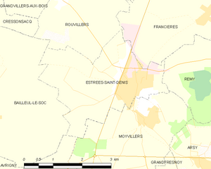
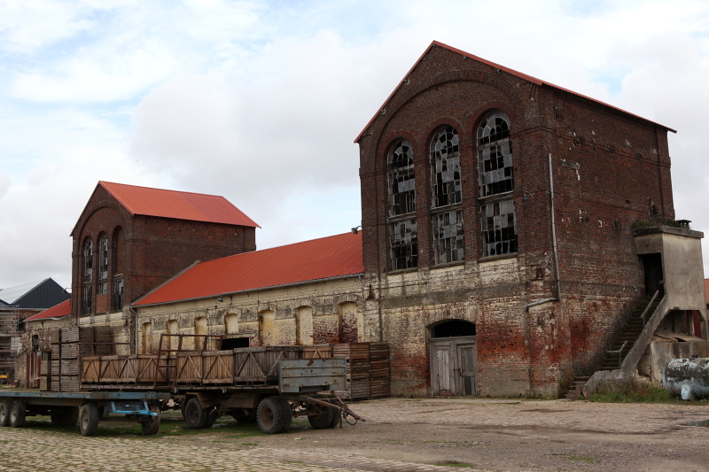
Estrées-Saint-Denis
- commune in Oise, France
- Country:
- Postal Code: 60190
- Coordinates: 49° 25' 32" N, 2° 38' 34" E
- GPS tracks (wikiloc): [Link]
- Area: 8.08 sq km
- Population: 3710
- Web site: [Link]

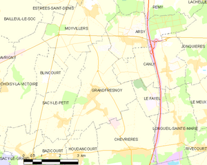
Grandfresnoy
- commune in Oise, France
- Country:
- Postal Code: 60680
- Coordinates: 49° 22' 21" N, 2° 39' 6" E
- GPS tracks (wikiloc): [Link]
- Area: 10.57 sq km
- Population: 1742

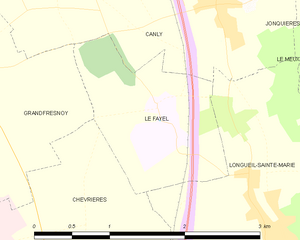
Le Fayel
- commune in Oise, France
- Country:
- Postal Code: 60680
- Coordinates: 49° 22' 20" N, 2° 41' 55" E
- GPS tracks (wikiloc): [Link]
- Area: 2.56 sq km
- Population: 219

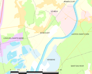
Rivecourt
- commune in Oise, France
- Country:
- Postal Code: 60126
- Coordinates: 49° 20' 52" N, 2° 44' 5" E
- GPS tracks (wikiloc): [Link]
- Area: 3.87 sq km
- Population: 582


Montmartin
- commune in Oise, France
- Country:
- Postal Code: 60190
- Coordinates: 49° 27' 50" N, 2° 41' 37" E
- GPS tracks (wikiloc): [Link]
- Area: 3.33 sq km
- Population: 257
- Web site: [Link]


Moyvillers
- commune in Oise, France
- Country:
- Postal Code: 60190
- Coordinates: 49° 24' 53" N, 2° 39' 3" E
- GPS tracks (wikiloc): [Link]
- Area: 9.06 sq km
- Population: 630


Lachelle
- commune in Oise, France
- Country:
- Postal Code: 60190
- Coordinates: 49° 26' 39" N, 2° 44' 5" E
- GPS tracks (wikiloc): [Link]
- Area: 9.07 sq km
- Population: 639
- Web site: [Link]


Houdancourt
- commune in Oise, France
- Country:
- Postal Code: 60710
- Coordinates: 49° 20' 35" N, 2° 38' 28" E
- GPS tracks (wikiloc): [Link]
- Area: 6.71 sq km
- Population: 654


Chevrières
- commune in Oise, France
- Country:
- Postal Code: 60710
- Coordinates: 49° 20' 41" N, 2° 40' 57" E
- GPS tracks (wikiloc): [Link]
- Area: 12.4 sq km
- Population: 1938


Hémévillers
- commune in Oise, France
- Country:
- Postal Code: 60190
- Coordinates: 49° 27' 48" N, 2° 40' 25" E
- GPS tracks (wikiloc): [Link]
- Area: 6.93 sq km
- Population: 449
- Web site: [Link]

Remy
- commune in Oise, France
- Country:
- Postal Code: 60190
- Coordinates: 49° 26' 17" N, 2° 42' 28" E
- GPS tracks (wikiloc): [Link]
- Area: 19.97 sq km
- Population: 1753
- Web site: [Link]


Longueil-Sainte-Marie
- commune in Oise, France
- Country:
- Postal Code: 60126
- Coordinates: 49° 21' 24" N, 2° 43' 4" E
- GPS tracks (wikiloc): [Link]
- Area: 17 sq km
- Population: 1924
- Web site: [Link]


Canly
- commune in Oise, France
- Country:
- Postal Code: 60680
- Coordinates: 49° 23' 11" N, 2° 42' 30" E
- GPS tracks (wikiloc): [Link]
- Area: 8 sq km
- Population: 808


Arsy
- commune in Oise, France
- Country:
- Postal Code: 60190
- Coordinates: 49° 24' 3" N, 2° 40' 55" E
- GPS tracks (wikiloc): [Link]
- Area: 7.27 sq km
- Population: 774