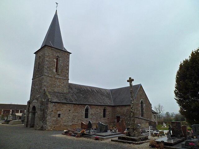
Le Guislain (Le Guislain)

- commune in Manche, France
- Country:

- Postal Code: 50410
- Coordinates: 48° 58' 20" N, 1° 13' 44" E


- GPS tracks (wikiloc): [Link]
- Area: 5.39 sq km
- Population: 128
- Wikipedia en: wiki(en)
- Wikipedia: wiki(fr)
- Wikidata storage: Wikidata: Q1071503
- Wikipedia Commons Category: [Link]
- Freebase ID: [/m/070jlg]
- Freebase ID: [/m/070jlg]
- GeoNames ID: Alt: [6456115]
- GeoNames ID: Alt: [6456115]
- SIREN number: [215002254]
- SIREN number: [215002254]
- BnF ID: [152622025]
- BnF ID: [152622025]
- INSEE municipality code: 50225
- INSEE municipality code: 50225
Shares border with regions:
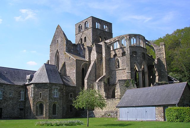

Hambye
- commune in Manche, France
- Country:
- Postal Code: 50450
- Coordinates: 48° 56' 53" N, 1° 15' 51" E
- GPS tracks (wikiloc): [Link]
- Area: 29.57 sq km
- Population: 1154
- Web site: [Link]

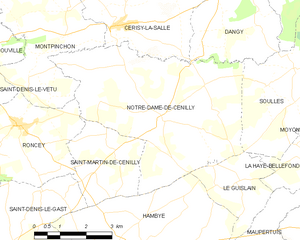
Notre-Dame-de-Cenilly
- commune in Manche, France
- Country:
- Postal Code: 50210
- Coordinates: 48° 59' 43" N, 1° 15' 29" E
- GPS tracks (wikiloc): [Link]
- Area: 25.23 sq km
- Population: 675

Maupertuis
- commune in Manche, France
- Country:
- Postal Code: 50410
- Coordinates: 48° 57' 17" N, 1° 12' 4" E
- GPS tracks (wikiloc): [Link]
- Area: 5.41 sq km
- Population: 132


La Haye-Bellefond
- commune in Manche, France
- Country:
- Postal Code: 50410
- Coordinates: 48° 59' 1" N, 1° 11' 3" E
- GPS tracks (wikiloc): [Link]
- Area: 2.82 sq km
- Population: 84


Soulles
- commune in Manche, France
- Country:
- Postal Code: 50750
- Coordinates: 49° 0' 51" N, 1° 11' 20" E
- GPS tracks (wikiloc): [Link]
- Area: 14.86 sq km
- Population: 489