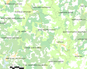
Le Jardin (Le Jardin)

- commune in Corrèze, France
- Country:

- Postal Code: 19300
- Coordinates: 45° 19' 17" N, 2° 2' 0" E


- GPS tracks (wikiloc): [Link]
- Area: 12.23 sq km
- Population: 84
- Wikipedia en: wiki(en)
- Wikipedia: wiki(fr)
- Wikidata storage: Wikidata: Q667190
- Wikipedia Commons Category: [Link]
- Freebase ID: [/m/03mfzdr]
- GeoNames ID: Alt: [6456759]
- SIREN number: [211909205]
- BnF ID: [15249728h]
- Quora topic ID: [Le-Jardin]
- INSEE municipality code: 19092
Shares border with regions:


Lafage-sur-Sombre
- commune in Corrèze, France
- Country:
- Postal Code: 19320
- Coordinates: 45° 17' 44" N, 2° 4' 18" E
- GPS tracks (wikiloc): [Link]
- Area: 18.94 sq km
- Population: 120

Saint-Hilaire-Foissac
- commune in Corrèze, France
- Country:
- Postal Code: 19550
- Coordinates: 45° 19' 51" N, 2° 7' 30" E
- GPS tracks (wikiloc): [Link]
- Area: 36.92 sq km
- Population: 200

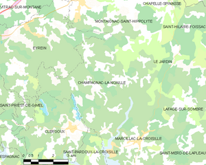
Champagnac-la-Noaille
- commune in Corrèze, France
- Country:
- Postal Code: 19320
- Coordinates: 45° 18' 29" N, 2° 1' 3" E
- GPS tracks (wikiloc): [Link]
- Area: 25.47 sq km
- Population: 244

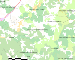
Montaignac-Saint-Hippolyte
- commune in Corrèze, France
- Country:
- Postal Code: 19300
- Coordinates: 45° 21' 14" N, 1° 58' 44" E
- GPS tracks (wikiloc): [Link]
- Area: 20.47 sq km
- Population: 564