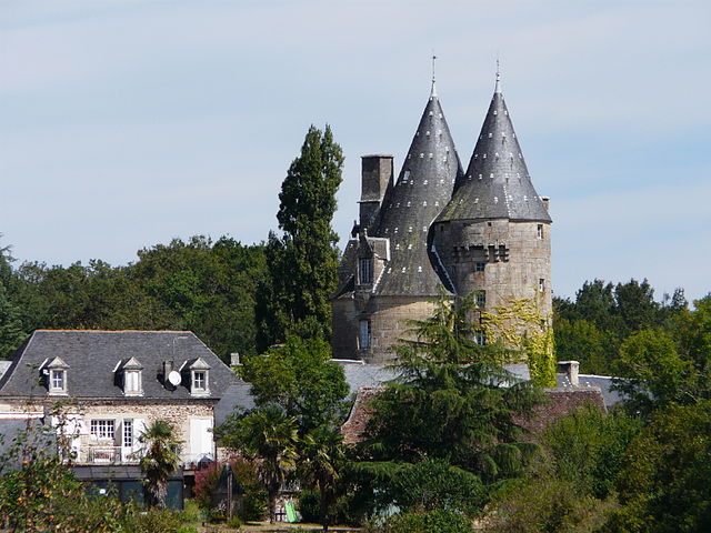
Le Lardin-Saint-Lazare (Le Lardin-Saint-Lazare)

- commune in Dordogne, France
- Country:

- Postal Code: 24570
- Coordinates: 45° 7' 47" N, 1° 13' 37" E


- GPS tracks (wikiloc): [Link]
- AboveSeaLevel: 86 м m
- Area: 10.85 sq km
- Population: 1808
- Web site: http://www.le-lardin.fr
- Wikipedia en: wiki(en)
- Wikipedia: wiki(fr)
- Wikidata storage: Wikidata: Q579445
- Wikipedia Commons Category: [Link]
- Freebase ID: [/m/03mg6pf]
- Freebase ID: [/m/03mg6pf]
- GeoNames ID: Alt: [3003724]
- GeoNames ID: Alt: [3003724]
- SIREN number: [212402291]
- SIREN number: [212402291]
- BnF ID: [15251876x]
- BnF ID: [15251876x]
- VIAF ID: Alt: [123183179]
- VIAF ID: Alt: [123183179]
- PACTOLS thesaurus ID: [pcrtylNXm6u5QO]
- PACTOLS thesaurus ID: [pcrtylNXm6u5QO]
- SUDOC authorities ID: [050171836]
- SUDOC authorities ID: [050171836]
- INSEE municipality code: 24229
- INSEE municipality code: 24229
Shares border with regions:


Condat-sur-Vézère
- commune in Dordogne, France
- Country:
- Postal Code: 24570
- Coordinates: 45° 7' 2" N, 1° 13' 49" E
- GPS tracks (wikiloc): [Link]
- Area: 16.64 sq km
- Population: 904
- Web site: [Link]


Beauregard-de-Terrasson
- commune in Dordogne, France
- Country:
- Postal Code: 24120
- Coordinates: 45° 8' 54" N, 1° 13' 57" E
- GPS tracks (wikiloc): [Link]
- Area: 7.97 sq km
- Population: 729
- Web site: [Link]


La Bachellerie
- commune in Dordogne, France
- Country:
- Postal Code: 24210
- Coordinates: 45° 8' 45" N, 1° 9' 13" E
- GPS tracks (wikiloc): [Link]
- AboveSeaLevel: 121 м m
- Area: 17.34 sq km
- Population: 908
- Web site: [Link]


Les Farges
- commune in Dordogne, France
- Country:
- Postal Code: 24290
- Coordinates: 45° 6' 55" N, 1° 11' 13" E
- GPS tracks (wikiloc): [Link]
- AboveSeaLevel: 250 м m
- Area: 8.14 sq km
- Population: 317
- Web site: [Link]

Peyrignac
- commune in Dordogne, France
- Country:
- Postal Code: 24210
- Coordinates: 45° 9' 21" N, 1° 11' 29" E
- GPS tracks (wikiloc): [Link]
- Area: 6.3 sq km
- Population: 583
- Web site: [Link]