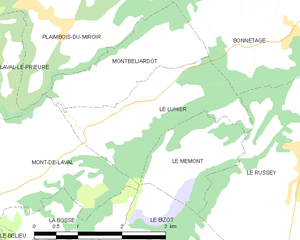
Le Mémont (Le Mémont)

- commune in Doubs, France
 Hiking in Le Mémont
Le Mémont is a scenic hiking destination located in the Vosges region of France. Known for its beautiful landscapes, lush forests, and panoramic views, it offers a variety of trails suitable for different skill levels.
Hiking Highlights:
-
Scenic Views: The summit of Le Mémont provides breathtaking views of the surrounding mountains and valleys, making it an ideal spot for photography and relaxation.
-
Varied Trails: There are several marked hiking trails of varying lengths and difficulties. Whether you're looking for a short stroll or a more challenging trek, there's something for everyone.
-
Flora and Fauna: The area is rich in biodiversity, and hikers may encounter a variety of wildlife as well as impressive plant life, particularly in the spring and summer months.
-
Accessibility: The starting points for many trails are often accessible by car, and some trails may also be suitable for mountain biking.
-
Seasonal Activities: Depending on the season, you may also find opportunities for cross-country skiing or snowshoeing in the winter months.
Tips for Hiking at Le Mémont:
- Footwear: Wear sturdy hiking boots to handle varied terrain.
- Weather Preparedness: Check the weather before your hike; conditions can change rapidly in the mountains.
- Hydration and Snacks: Carry enough water and snacks, especially for longer hikes.
- Navigation: Familiarize yourself with the trail maps available at the trailheads or consider using a hiking app for guidance.
Before you head out, it's always a good idea to check local resources for any updates on trail conditions or safety recommendations. Happy hiking!
- Country:

- Postal Code: 25210
- Coordinates: 47° 9' 22" N, 6° 40' 54" E


- GPS tracks (wikiloc): [Link]
- AboveSeaLevel: 1000 м m
- Area: 3.16 sq km
- Population: 41
- Wikipedia en: wiki(en)
- Wikipedia: wiki(fr)
- Wikidata storage: Wikidata: Q768963
- Wikipedia Commons Category: [Link]
- Freebase ID: [/m/03mhbb4]
- Freebase ID: [/m/03mhbb4]
- GeoNames ID: Alt: [6429872]
- GeoNames ID: Alt: [6429872]
- SIREN number: [212503734]
- SIREN number: [212503734]
- INSEE municipality code: 25373
- INSEE municipality code: 25373
Shares border with regions:

Le Luhier
- commune in Doubs, France
Hiking in Le Luhier
Le Luhier is a picturesque region that offers a variety of hiking trails for both beginners and experienced hikers. Nestled in nature, this area features stunning landscapes, including dense forests, rolling hills, and picturesque streams. While I don’t have specific details on Le Luhier itself, I can give you some general tips and advice for hiking in such areas....
- Country:
- Postal Code: 25210
- Coordinates: 47° 10' 6" N, 6° 39' 34" E
- GPS tracks (wikiloc): [Link]
- Area: 5.21 sq km
- Population: 212


Le Russey
- commune in Doubs, France
Hiking in Le Russey
Le Russey is a charming commune located in the Doubs department in the Bourgogne-Franche-Comté region of eastern France. It's nestled in a picturesque part of the Jura Mountains, which offers a variety of scenic hiking opportunities. Here are some points to consider when hiking in and around Le Russey:...
- Country:
- Postal Code: 25210
- Coordinates: 47° 9' 46" N, 6° 43' 48" E
- GPS tracks (wikiloc): [Link]
- Area: 24.17 sq km
- Population: 2282
- Web site: [Link]