Le Mesnil-Adelée (Le Mesnil-Adelée)

- commune in Manche, France
- Country:

- Postal Code: 50520
- Coordinates: 48° 42' 2" N, 1° 4' 33" E


- GPS tracks (wikiloc): [Link]
- Area: 6.82 sq km
- Population: 170
- Wikipedia en: wiki(en)
- Wikipedia: wiki(fr)
- Wikidata storage: Wikidata: Q769622
- Wikipedia Commons Category: [Link]
- Freebase ID: [/m/03nx9d0]
- Freebase ID: [/m/03nx9d0]
- GeoNames ID: Alt: [6456129]
- GeoNames ID: Alt: [6456129]
- SIREN number: [215003005]
- SIREN number: [215003005]
- BnF ID: [15262275c]
- BnF ID: [15262275c]
- INSEE municipality code: 50300
- INSEE municipality code: 50300
Shares border with regions:


Cuves
- commune in Manche, France
- Country:
- Postal Code: 50670
- Coordinates: 48° 43' 8" N, 1° 6' 19" E
- GPS tracks (wikiloc): [Link]
- Area: 9.69 sq km
- Population: 286


Les Cresnays
- commune in Manche, France
- Country:
- Postal Code: 50370
- Coordinates: 48° 43' 8" N, 1° 7' 19" E
- GPS tracks (wikiloc): [Link]
- Area: 9.78 sq km
- Population: 236


Reffuveille
- commune in Manche, France
- Country:
- Postal Code: 50520
- Coordinates: 48° 40' 6" N, 1° 6' 55" E
- GPS tracks (wikiloc): [Link]
- Area: 23.34 sq km
- Population: 501


Le Mesnil-Gilbert
- commune in Manche, France
- Country:
- Postal Code: 50670
- Coordinates: 48° 42' 53" N, 1° 3' 52" E
- GPS tracks (wikiloc): [Link]
- Area: 7.85 sq km
- Population: 141


Juvigny-le-Tertre
- former commune in Manche, France
- Country:
- Postal Code: 50520
- Coordinates: 48° 40' 37" N, 1° 1' 16" E
- GPS tracks (wikiloc): [Link]
- Area: 7.5 sq km
- Population: 576

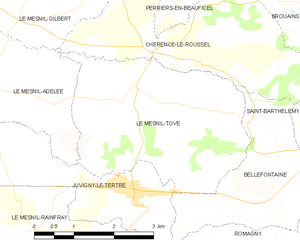
Le Mesnil-Tôve
- former commune in Manche, France
- Country:
- Postal Code: 50520
- Coordinates: 48° 42' 3" N, 1° 1' 21" E
- GPS tracks (wikiloc): [Link]
- Area: 11.74 sq km
- Population: 237