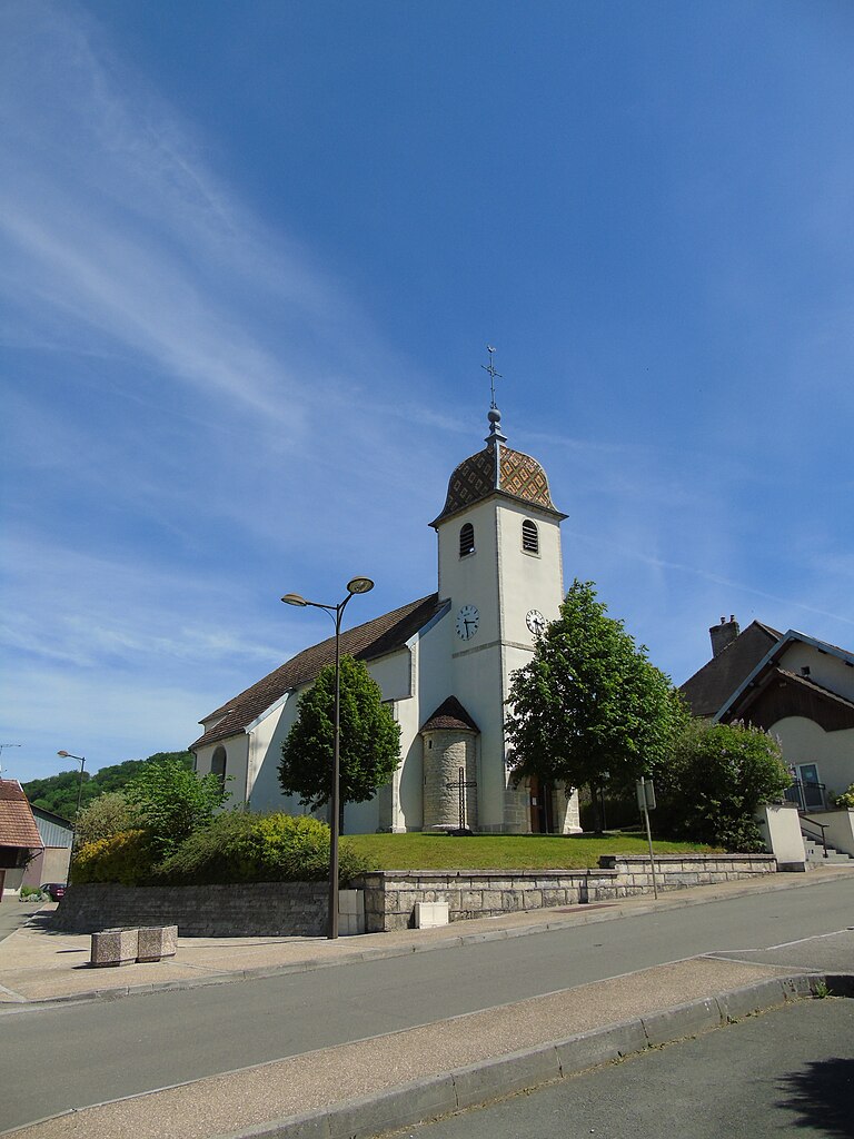
Le Puy (Le Puy)

- commune in Doubs, France
 Hiking in Le Puy
Le Puy in Doubs, located in the Bourgogne-Franche-Comté region of France, is a fantastic spot for hiking, with its beautiful natural landscapes, varied terrain, and rich cultural history. Here’s a brief overview of what you can expect when hiking in the area:
Scenic Views and Terrain
Le Puy and the surrounding Doubs region is characterized by rolling hills, dense forests, rivers, and expansive meadows. Hikers can encounter a diverse range of landscapes, including rocky outcrops and serene lakes, offering excellent opportunities for photography and enjoying nature.
Popular Hiking Trails
-
Les Sentiers de Grande Randonnée (GR Trails): The region is part of the Grande Randonnée network, with numerous trails that cover both long-distance routes and shorter day hikes. The GR 59 is particularly notable, offering stunning views over the Jura Mountains and the Doubs Valley.
-
Local Nature Reserves: There are several nature reserves in the vicinity, such as the Réserve Naturelle de la Haute Chaîne du Jura, which comprises a network of trails showcasing the local flora and fauna. These areas can be ideal for both leisurely walks and more strenuous hikes.
-
Waterfall Hikes: Many trails lead to beautiful waterfalls, such as the Saut du Doubs, which is a breathtaking site worth visiting. The trails to these natural wonders often provide a combination of hiking and sightseeing.
Tips for Hiking in Le Puy
- Proper Gear: Ensure you have appropriate footwear, weather-appropriate clothing, and enough water. The terrain can be challenging, so comfortable and sturdy hiking boots are essential.
- Trail Maps: It’s advisable to carry a trail map or a reliable hiking app, as some trails may not be well-marked.
- Local Guides: Consider hiring a local guide if you want to learn more about the natural history or cultural aspects of the area.
- Wildlife Watching: The Doubs region is rich in wildlife, so take some time to enjoy birdwatching and spotting other animals in their natural habitats.
Best Time to Hike
The best time for hiking in Le Puy is typically from late spring to early autumn (May to October), when the weather is more favorable and the trails are fully accessible. Spring offers blooming flowers, while autumn provides stunning foliage.
Additional Activities
In addition to hiking, the region offers opportunities for cycling, horseback riding, and water-related activities on local rivers and lakes, making it an excellent destination for outdoor enthusiasts.
Le Puy and the Doubs region provide a beautiful escape for hikers seeking nature, adventure, and tranquility. Regardless of your experience level, you’ll find trails that suit your interests and abilities.
- Country:

- Postal Code: 25640
- Coordinates: 47° 20' 43" N, 6° 13' 41" E


- GPS tracks (wikiloc): [Link]
- Area: 3.42 sq km
- Population: 110
- Wikipedia en: wiki(en)
- Wikipedia: wiki(fr)
- Wikidata storage: Wikidata: Q905764
- Wikipedia Commons Category: [Link]
- Freebase ID: [/m/078pp1]
- Freebase ID: [/m/078pp1]
- GeoNames ID: Alt: [6455728]
- GeoNames ID: Alt: [6455728]
- SIREN number: [212504740]
- SIREN number: [212504740]
- BnF ID: [15252700n]
- BnF ID: [15252700n]
- INSEE municipality code: 25474
- INSEE municipality code: 25474
Shares border with regions:


Val-de-Roulans
- commune in Doubs, France
Hiking in Val-de-Roulans
Val-de-Roulans, located in the Doubs department of France, offers a variety of hiking opportunities amidst beautiful natural landscapes. The region is characterized by its rolling hills, lush forests, and scenic views, making it an excellent destination for both novice and experienced hikers....
- Country:
- Postal Code: 25640
- Coordinates: 47° 21' 42" N, 6° 15' 52" E
- GPS tracks (wikiloc): [Link]
- Area: 2.99 sq km
- Population: 189


Saint-Hilaire
- commune in Doubs, France
Hiking in Saint-Hilaire
Saint-Hilaire in the Doubs department of France is known for its beautiful landscapes and outdoor recreational opportunities, including hiking. The region is characterized by its rolling hills, lush forests, and picturesque countryside, making it a great destination for both casual walkers and experienced hikers....
- Country:
- Postal Code: 25640
- Coordinates: 47° 20' 6" N, 6° 14' 30" E
- GPS tracks (wikiloc): [Link]
- Area: 2.64 sq km
- Population: 160
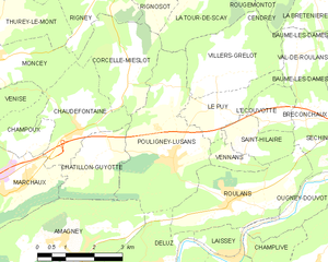
Pouligney-Lusans
- commune in Doubs, France
Hiking in Pouligney-Lusans
Pouligney-Lusans is a small commune located in the Doubs department of the Bourgogne-Franche-Comté region in eastern France. While it may not be a widely recognized hiking destination, the surrounding area does offer opportunities for nature walks and hiking experiences....
- Country:
- Postal Code: 25640
- Coordinates: 47° 19' 43" N, 6° 12' 14" E
- GPS tracks (wikiloc): [Link]
- Area: 11.6 sq km
- Population: 835


Vennans
- commune in Doubs, France
Hiking in Vennans
It seems like there may be a typo in your question, as "Vennans" doesn't correspond to a well-known hiking destination. However, if you meant a specific area or region, such as Vennans in a certain country or context (like perhaps a mountain range, national park, or hiking trail), please clarify so I can provide you with the best information. Alternatively, if you were referring to a popular hiking destination nearby or a different name, just let me know, and I can give you detailed insights about hiking in that location!...
- Country:
- Postal Code: 25640
- Coordinates: 47° 19' 45" N, 6° 14' 12" E
- GPS tracks (wikiloc): [Link]
- Area: 1.36 sq km
- Population: 258

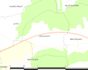
L'Écouvotte
- commune in Doubs, France
Hiking in L'Écouvotte
L'Écouvotte is a beautiful hiking destination located in the Jura Mountains of France, known for its stunning landscapes, varied terrains, and rich biodiversity. Here are some highlights and tips for hiking in this area:...
- Country:
- Postal Code: 25640
- Coordinates: 47° 20' 26" N, 6° 15' 4" E
- GPS tracks (wikiloc): [Link]
- Area: 2.16 sq km
- Population: 93

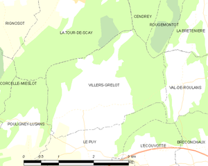
Villers-Grélot
- commune in Doubs, France
Hiking in Villers-Grélot
Villers-Grélot is a charming and lesser-known destination for hiking enthusiasts, situated in Belgium. Given its rural landscape and natural beauty, it offers a variety of trails that cater to different skill levels....
- Country:
- Postal Code: 25640
- Coordinates: 47° 21' 24" N, 6° 13' 36" E
- GPS tracks (wikiloc): [Link]
- Area: 7.02 sq km
- Population: 157