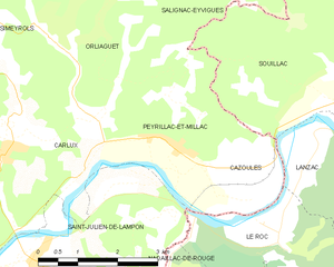
Le Roc (Le Roc)
- commune in Lot, France
- Country:

- Postal Code: 46200
- Coordinates: 44° 51' 58" N, 1° 26' 28" E


- GPS tracks (wikiloc): [Link]
- Area: 6.95 sq km
- Population: 213
- Wikipedia en: wiki(en)
- Wikipedia: wiki(fr)
- Wikidata storage: Wikidata: Q1157253
- Wikipedia Commons Category: [Link]
- Freebase ID: [/m/03nwnxl]
- GeoNames ID: Alt: [6456042]
- SIREN number: [214602393]
- BnF ID: [15260980d]
- VIAF ID: Alt: [248707370]
- INSEE municipality code: 46239
Shares border with regions:


Cazoulès
- commune in Dordogne, France
- Country:

- Postal Code: 24370
- Coordinates: 44° 52' 59" N, 1° 26' 2" E


- GPS tracks (wikiloc): [Link]
- AboveSeaLevel: 101 м m
- Area: 3.52 sq km
- Population: 469


Peyrillac-et-Millac
- commune in Dordogne, France
- Country:

- Postal Code: 24370
- Coordinates: 44° 53' 16" N, 1° 24' 27" E


- GPS tracks (wikiloc): [Link]
- Area: 6.94 sq km
- Population: 223
- Web site: [Link]


Nadaillac-de-Rouge
- commune in Lot, France
- Country:

- Postal Code: 46350
- Coordinates: 44° 50' 57" N, 1° 25' 44" E


- GPS tracks (wikiloc): [Link]
- Area: 7.73 sq km
- Population: 161
Lanzac
- commune in Lot, France
- Country:

- Postal Code: 46200
- Coordinates: 44° 52' 27" N, 1° 28' 58" E


- GPS tracks (wikiloc): [Link]
- Area: 14.62 sq km
- Population: 603


Saint-Julien-de-Lampon
- commune in Dordogne, France
- Country:

- Postal Code: 24370
- Coordinates: 44° 51' 40" N, 1° 21' 47" E


- GPS tracks (wikiloc): [Link]
- Area: 13.24 sq km
- Population: 619
