Le Soler (Le Soler)

- commune in Pyrénées-Orientales, France
- Country:

- Postal Code: 66270
- Coordinates: 42° 40' 55" N, 2° 47' 36" E


- GPS tracks (wikiloc): [Link]
- Area: 10.35 sq km
- Population: 7624
- Wikipedia en: wiki(en)
- Wikipedia: wiki(fr)
- Wikidata storage: Wikidata: Q1163139
- Wikipedia Commons Category: [Link]
- Freebase ID: [/m/03qlr6m]
- Freebase ID: [/m/03qlr6m]
- GeoNames ID: Alt: [3000139]
- GeoNames ID: Alt: [3000139]
- SIREN number: [216601955]
- SIREN number: [216601955]
- BnF ID: [15271104j]
- BnF ID: [15271104j]
- OSM relation ID: [18311]
- OSM relation ID: [18311]
- INSEE municipality code: 66195
- INSEE municipality code: 66195
Shares border with regions:


Baho
- commune in Pyrénées-Orientales, France
- Country:
- Postal Code: 66540
- Coordinates: 42° 42' 1" N, 2° 49' 21" E
- GPS tracks (wikiloc): [Link]
- Area: 7.9 sq km
- Population: 3203


Toulouges
- commune in Pyrénées-Orientales, France
- Country:
- Postal Code: 66350
- Coordinates: 42° 40' 14" N, 2° 49' 55" E
- GPS tracks (wikiloc): [Link]
- Area: 8.04 sq km
- Population: 6686

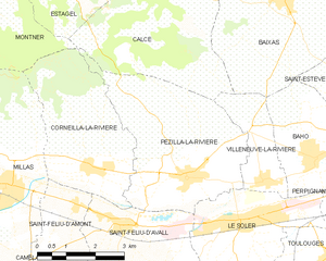
Pézilla-la-Rivière
- commune in Pyrénées-Orientales, France
- Country:
- Postal Code: 66370
- Coordinates: 42° 41' 43" N, 2° 46' 14" E
- GPS tracks (wikiloc): [Link]
- Area: 15.62 sq km
- Population: 3529
- Web site: [Link]


Villeneuve-la-Rivière
- commune in Pyrénées-Orientales, France
- Country:
- Postal Code: 66610
- Coordinates: 42° 41' 37" N, 2° 48' 13" E
- GPS tracks (wikiloc): [Link]
- Area: 4.38 sq km
- Population: 1285

Saint-Féliu-d'Avall
- commune in Pyrénées-Orientales, France
- Country:
- Postal Code: 66170
- Coordinates: 42° 40' 53" N, 2° 44' 19" E
- GPS tracks (wikiloc): [Link]
- Area: 10.79 sq km
- Population: 2732


Thuir
- commune in Pyrénées-Orientales, France
- Country:
- Postal Code: 66300
- Coordinates: 42° 37' 55" N, 2° 45' 23" E
- GPS tracks (wikiloc): [Link]
- Area: 19.9 sq km
- Population: 7401
- Web site: [Link]
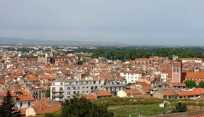

Perpignan
- commune in Pyrénées-Orientales, France
- Country:
- Postal Code: 66100; 66000
- Local Dialing Code: 468
- Coordinates: 42° 41' 51" N, 2° 53' 41" E
- GPS tracks (wikiloc): [Link]
- AboveSeaLevel: 100 м m
- Area: 68.07 sq km
- Population: 121934
- Web site: [Link]