Le Temple (Le Temple)

- commune in Gironde, France
- Country:

- Postal Code: 33680
- Coordinates: 44° 52' 44" N, 0° 59' 27" E


- GPS tracks (wikiloc): [Link]
- Area: 71.83 sq km
- Population: 589
- Wikipedia en: wiki(en)
- Wikipedia: wiki(fr)
- Wikidata storage: Wikidata: Q717567
- Wikipedia Commons Category: [Link]
- Freebase ID: [/m/03ns2n7]
- GeoNames ID: Alt: [6455877]
- SIREN number: [213305287]
- BnF ID: [15256574m]
- INSEE municipality code: 33528
Shares border with regions:


Saint-Jean-d'Illac
- commune in Gironde, France
- Country:
- Postal Code: 33127
- Coordinates: 44° 48' 35" N, 0° 47' 1" E
- GPS tracks (wikiloc): [Link]
- Area: 120.58 sq km
- Population: 7610
- Web site: [Link]


Saint-Médard-en-Jalles
- commune in Gironde, France
- Country:
- Postal Code: 33160
- Coordinates: 44° 53' 49" N, 0° 43' 17" E
- GPS tracks (wikiloc): [Link]
- AboveSeaLevel: 27 м m
- Area: 85.28 sq km
- Population: 30547
- Web site: [Link]


Arès
- commune in Gironde, France
- Country:
- Postal Code: 33740
- Coordinates: 44° 45' 54" N, 1° 8' 12" E
- GPS tracks (wikiloc): [Link]
- Area: 48.25 sq km
- Population: 6126
- Web site: [Link]


Lanton
- commune in Gironde, France
- Country:
- Postal Code: 33138
- Coordinates: 44° 42' 14" N, 1° 2' 7" E
- GPS tracks (wikiloc): [Link]
- Area: 136.19 sq km
- Population: 6771

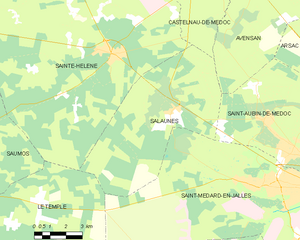
Salaunes
- commune in Gironde, France
- Country:
- Postal Code: 33160
- Coordinates: 44° 56' 11" N, 0° 49' 49" E
- GPS tracks (wikiloc): [Link]
- Area: 42.64 sq km
- Population: 925
- Web site: [Link]


Saumos
- commune in Gironde, France
- Country:
- Postal Code: 33680
- Coordinates: 44° 55' 9" N, 0° 59' 21" E
- GPS tracks (wikiloc): [Link]
- Area: 57.65 sq km
- Population: 544

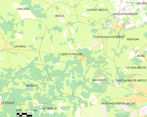
Sainte-Hélène
- commune in Gironde, France
- Country:
- Postal Code: 33480
- Coordinates: 44° 57' 56" N, 0° 53' 3" E
- GPS tracks (wikiloc): [Link]
- AboveSeaLevel: 43 м m
- Area: 127.87 sq km
- Population: 2732
- Web site: [Link]

Le Porge
- commune in Gironde, France
- Country:
- Postal Code: 33680
- Coordinates: 44° 52' 22" N, 1° 5' 31" E
- GPS tracks (wikiloc): [Link]
- Area: 149.03 sq km
- Population: 2875
- Web site: [Link]