Sainte-Hélène (Sainte-Hélène)

- commune in Gironde, France
- Country:

- Postal Code: 33480
- Coordinates: 44° 57' 56" N, 0° 53' 3" E


- GPS tracks (wikiloc): [Link]
- AboveSeaLevel: 43 м m
- Area: 127.87 sq km
- Population: 2732
- Web site: http://www.ville-sainte-helene.fr
- Wikipedia en: wiki(en)
- Wikipedia: wiki(fr)
- Wikidata storage: Wikidata: Q720177
- Wikipedia Commons Category: [Link]
- Freebase ID: [/m/03ns144]
- GeoNames ID: Alt: [6432404]
- SIREN number: [213304173]
- BnF ID: [15256466q]
- INSEE municipality code: 33417
Shares border with regions:

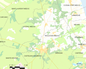
Moulis-en-Médoc
- commune in Gironde, France
- Country:
- Postal Code: 33480
- Coordinates: 45° 3' 34" N, 0° 46' 13" E
- GPS tracks (wikiloc): [Link]
- Area: 20.56 sq km
- Population: 1806
- Web site: [Link]


Castelnau-de-Médoc
- commune in Gironde, France
- Country:
- Postal Code: 33480
- Coordinates: 45° 1' 37" N, 0° 47' 57" E
- GPS tracks (wikiloc): [Link]
- Area: 23.92 sq km
- Population: 4560
- Web site: [Link]


Listrac-Médoc
- commune in Gironde, France
- Country:
- Postal Code: 33480
- Coordinates: 45° 4' 26" N, 0° 47' 29" E
- GPS tracks (wikiloc): [Link]
- Area: 61.9 sq km
- Population: 2689
- Web site: [Link]


Lacanau
- commune in Gironde, France
- Country:
- Postal Code: 33680
- Coordinates: 44° 58' 45" N, 1° 4' 46" E
- GPS tracks (wikiloc): [Link]
- Area: 214.02 sq km
- Population: 4577
- Web site: [Link]


Brach
- commune in Gironde, France
- Country:
- Postal Code: 33480
- Coordinates: 45° 2' 28" N, 0° 56' 16" E
- GPS tracks (wikiloc): [Link]
- Area: 28.61 sq km
- Population: 614
- Web site: [Link]


Le Temple
- commune in Gironde, France
- Country:
- Postal Code: 33680
- Coordinates: 44° 52' 44" N, 0° 59' 27" E
- GPS tracks (wikiloc): [Link]
- Area: 71.83 sq km
- Population: 589

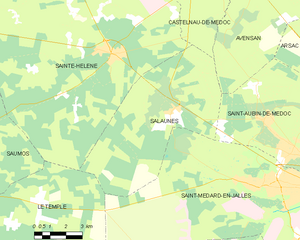
Salaunes
- commune in Gironde, France
- Country:
- Postal Code: 33160
- Coordinates: 44° 56' 11" N, 0° 49' 49" E
- GPS tracks (wikiloc): [Link]
- Area: 42.64 sq km
- Population: 925
- Web site: [Link]


Saumos
- commune in Gironde, France
- Country:
- Postal Code: 33680
- Coordinates: 44° 55' 9" N, 0° 59' 21" E
- GPS tracks (wikiloc): [Link]
- Area: 57.65 sq km
- Population: 544