
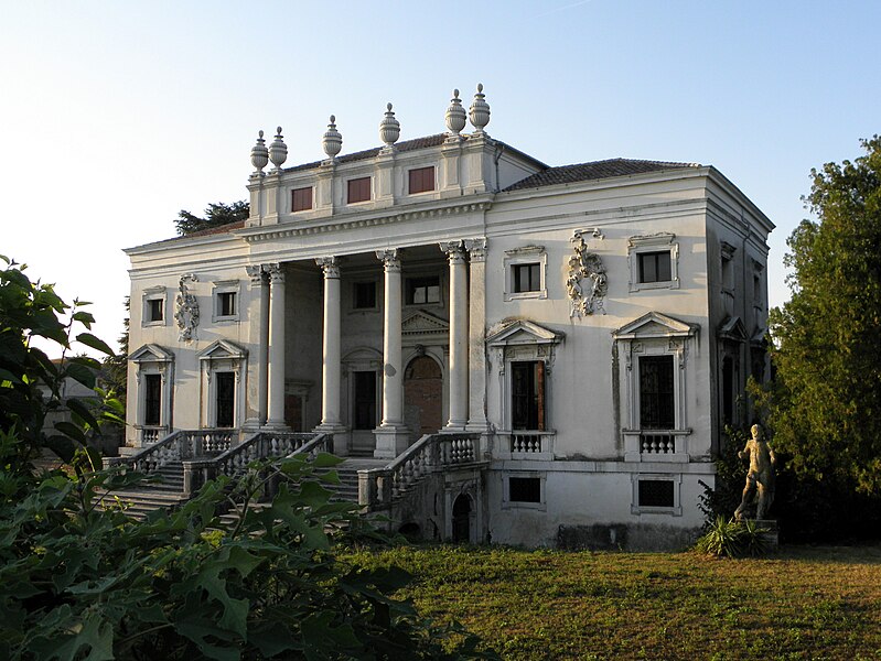
Lendinara (Lendinara)
.svg)
- Italian comune
 Hiking in Lendinara
Lendinara, a charming town in the Veneto region of Italy, is not widely recognized as a primary hiking destination. However, the surrounding area offers lovely opportunities for nature walks and hiking for those who enjoy exploring off the beaten path. Here are some tips and insights for hiking in and around Lendinara:
Local Terrain
Lendinara is situated in the Po Valley, characterized by flat lands, rice fields, and river landscapes. While the region may lack dramatic elevation changes, it offers scenic routes along the banks of the Po River and through agricultural landscapes.
Hiking Options
-
Po Delta Regional Park: A short drive from Lendinara, this park is known for its diverse ecosystems, including wetlands, marshes, and coastal areas. It features various trails ideal for birdwatching and nature walks.
-
Local Countryside Trails: In the immediate vicinity of Lendinara, you can explore paths that lead through the picturesque countryside, including farmland, vineyards, and orchards. These trails can be more suitable for leisurely walks rather than strenuous hikes.
-
Cycle Paths: Many of the roads and paths in the area are also bike-friendly, allowing for a combination of hiking and cycling.
Best Time for Hiking
Spring (April to June) and fall (September to October) are ideal times for hiking in this region, as the weather is mild and the landscapes are especially beautiful during these seasons.
Preparation Tips
-
Footwear: Since the terrain is mostly flat, comfortable walking shoes should suffice, though waterproof options may be beneficial if you encounter muddy areas.
-
Water and Snacks: Ensure you carry enough water and snacks, especially if you’re venturing into less populated areas.
-
Maps and Navigation: It's advisable to have a map or a GPS device, as some trails may not be well-marked.
Conclusion
While Lendinara may not be a traditional hiking hub, it offers unique opportunities to connect with nature and experience the serene beauty of the Veneto countryside. You can enjoy leisurely walks and discover the local flora and fauna, making it a nice complement to your exploration of this beautiful Italian region.
- Country:

- Postal Code: 45026
- Local Dialing Code: 0425
- Licence Plate Code: RO
- Coordinates: 45° 5' 6" N, 11° 36' 2" E


- GPS tracks (wikiloc): [Link]
- AboveSeaLevel: 9 м m
- Area: 55.06 sq km
- Population: 11694
- Web site: http://www.comune.lendinara.ro.it/
- Wikipedia en: wiki(en)
- Wikipedia: wiki(it)
- Wikidata storage: Wikidata: Q34390
- Wikipedia Commons Category: [Link]
- Freebase ID: [/m/0dzqdg]
- GeoNames ID: Alt: [6538353]
- VIAF ID: Alt: [150160303]
- OSM relation ID: [44077]
- WOEID: [717183]
- Quora topic ID: [Lendinara]
- UN/LOCODE: [ITLDN]
- Gran Enciclopèdia Catalana ID: [0265754]
- ISTAT ID: 029029
- Italian cadastre code: E522
Shares border with regions:


Villanova del Ghebbo
- Italian comune
Hiking in Villanova del Ghebbo
Villanova del Ghebbo is a small town located in the Veneto region of Italy, and while it's known for its agricultural landscape and proximity to the Po River, there are certainly hiking opportunities in the surrounding areas. Here are some points to consider for hiking in and around Villanova del Ghebbo:...
- Country:
- Postal Code: 45020
- Local Dialing Code: 0425
- Licence Plate Code: RO
- Coordinates: 45° 4' 0" N, 11° 39' 0" E
- GPS tracks (wikiloc): [Link]
- AboveSeaLevel: 11 м m
- Area: 11.73 sq km
- Population: 2008
- Web site: [Link]


Lusia
- Italian comune
Hiking in Lusia
Lusia, located in the Dolomites of northern Italy, is a stunning destination for hiking enthusiasts. The area is known for its breathtaking landscapes, diverse flora and fauna, and a variety of trails that cater to different skill levels. Here are some key points to consider when hiking in Lusia:...
- Country:
- Postal Code: 45020
- Local Dialing Code: 0425
- Licence Plate Code: RO
- Coordinates: 45° 6' 0" N, 11° 40' 0" E
- GPS tracks (wikiloc): [Link]
- AboveSeaLevel: 10 м m
- Area: 17.68 sq km
- Population: 3429
- Web site: [Link]

Piacenza d'Adige
- Italian comune
Hiking in Piacenza d'Adige
Piacenza d'Adige is a charming village located in the province of Padua, in the Veneto region of Italy. The area around Piacenza d'Adige is characterized by beautiful landscapes, rolling hills, vineyards, and the scenic Adige River, making it an appealing destination for hiking enthusiasts....
- Country:
- Postal Code: 35040
- Local Dialing Code: 0425
- Licence Plate Code: PD
- Coordinates: 45° 8' 0" N, 11° 33' 0" E
- GPS tracks (wikiloc): [Link]
- AboveSeaLevel: 10 м m
- Area: 18.49 sq km
- Population: 1293
- Web site: [Link]

Canda
- Italian comune
Hiking in Canda
Canada is a hiker's paradise, offering a diverse range of landscapes, trails, and ecosystems across its vast expanse. Whether you’re looking for leisurely day hikes or challenging multi-day backpacking adventures, here are some key highlights and regions for hiking in Canada:...
- Country:
- Postal Code: 45020
- Local Dialing Code: 0425
- Licence Plate Code: RO
- Coordinates: 45° 2' 0" N, 11° 31' 0" E
- GPS tracks (wikiloc): [Link]
- AboveSeaLevel: 9 м m
- Area: 14.37 sq km
- Population: 895
- Web site: [Link]


Badia Polesine
- Italian comune
Hiking in Badia Polesine
Badia Polesine, located in the province of Rovigo in the Veneto region of Italy, is not primarily known as a hiking destination compared to other parts of Italy, like the Dolomites or the Apennines. However, it offers some charming landscapes and countryside suitable for leisurely hikes and outdoor activities....
- Country:
- Postal Code: 45021
- Local Dialing Code: 0425
- Licence Plate Code: RO
- Coordinates: 45° 5' 39" N, 11° 29' 36" E
- GPS tracks (wikiloc): [Link]
- AboveSeaLevel: 11 м m
- Area: 44.53 sq km
- Population: 10348
- Web site: [Link]


Castelguglielmo
- Italian comune
Hiking in Castelguglielmo
Castelguglielmo is a small village in the province of Rovigo, in the Veneto region of Italy. While it may not be the most famous hiking destination compared to other Italian regions, its surroundings offer a unique experience for nature lovers and hikers....
- Country:
- Postal Code: 45020
- Local Dialing Code: 0425
- Licence Plate Code: RO
- Coordinates: 45° 1' 0" N, 11° 32' 0" E
- GPS tracks (wikiloc): [Link]
- AboveSeaLevel: 9 м m
- Area: 22.13 sq km
- Population: 1565
- Web site: [Link]


Fratta Polesine
- Italian comune
Hiking in Fratta Polesine
Fratta Polesine, located in the Veneto region of Italy, is a charming town known for its picturesque landscapes, rich history, and proximity to natural reserves. While it might not be universally recognized as a hiking hotspot, there are still opportunities for outdoor activities and exploration in and around the area....
- Country:
- Postal Code: 45025
- Local Dialing Code: 0425
- Licence Plate Code: RO
- Coordinates: 45° 2' 0" N, 11° 39' 0" E
- GPS tracks (wikiloc): [Link]
- AboveSeaLevel: 11 м m
- Area: 20.97 sq km
- Population: 2615
- Web site: [Link]

Sant'Urbano
- Italian comune
Hiking in Sant'Urbano
Sant'Urbano, a charming area located in the Veneto region of Italy, offers a range of hiking opportunities that cater to various skill levels. Surrounded by beautiful landscapes, including vineyards, rolling hills, and lush forests, hiking here can be a rewarding experience for nature lovers....
- Country:
- Postal Code: 35040
- Local Dialing Code: 0429
- Licence Plate Code: PD
- Coordinates: 45° 8' 0" N, 11° 39' 0" E
- GPS tracks (wikiloc): [Link]
- AboveSeaLevel: 9 м m
- Area: 31.92 sq km
- Population: 2008
- Web site: [Link]


San Bellino
- Italian comune
Hiking in San Bellino
San Bellino, located in the province of Rovigo in the Veneto region of Italy, may not be as well-known for hiking as some other areas in the region, but it offers a unique experience for those looking to explore the countryside and local nature....
- Country:
- Postal Code: 45020
- Local Dialing Code: 0425
- Licence Plate Code: RO
- Coordinates: 45° 2' 0" N, 11° 35' 0" E
- GPS tracks (wikiloc): [Link]
- AboveSeaLevel: 7 м m
- Area: 15.83 sq km
- Population: 1087
- Web site: [Link]