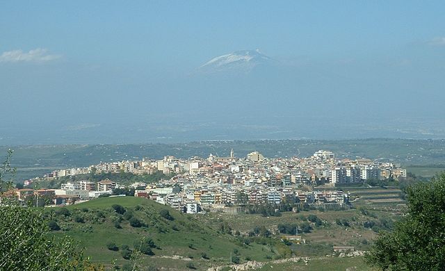
Lentini (Lentini)
.svg)
- Italian comune
 Hiking in Lentini
Lentini is a town in Sicily, Italy, known for its rich history and beautiful natural surroundings. While it's not famous as a hiking destination, there are plenty of opportunities for outdoor enthusiasts to explore the area. Here are some highlights and recommendations for hiking in and around Lentini:
Local Trails
-
Natural Reserves: The nearby Simeto River Natural Reserve offers some beautiful trails where you can hike and enjoy the diverse flora and fauna. This region is great for birdwatching, as it attracts various migratory birds.
-
Lentini Hills: The hills surrounding Lentini provide various paths and tracks that can be explored. These trails often offer panoramic views of the countryside and the coast.
Historical Sites
- Ancient Ruins: As you hike, you might come across historical sites such as ancient ruins or archaeological areas, which add a cultural element to your outdoor adventures.
Preparation
- Weather: Sicily has a Mediterranean climate, so be sure to check the weather before heading out. Spring and fall are typically the best times for hiking due to milder temperatures.
- Footwear: Wear sturdy, comfortable hiking shoes; some paths may be rocky or uneven.
- Water and Snacks: Always carry plenty of water and some snacks, especially if you plan to hike for several hours.
Local Guidance
- Consulting with local hiking groups or guides can enhance your experience. They can provide insights into the best trails, safety tips, and possibly arrange guided hikes.
Nearby Hiking Options
If you're willing to travel a bit further, consider venturing into the following areas:
- Mount Etna: One of the most popular hiking destinations in Sicily, offering trails that lead you around the volcano and even to the summit.
- Nebrodi National Park: A bit farther away but known for its stunning landscapes, abundant wildlife, and well-marked trails.
Conclusion
Though Lentini may not be a well-known hiking hub, it offers opportunities for exploration and connecting with nature. Combining hiking with a bit of local culture and history can make for a memorable experience. Always remember to respect nature and local regulations while hiking!
- Country:

- Postal Code: 96016
- Local Dialing Code: 095
- Licence Plate Code: SR
- Coordinates: 37° 17' 0" N, 15° 0' 0" E


- GPS tracks (wikiloc): [Link]
- AboveSeaLevel: 53 м m
- Area: 216.78 sq km
- Population: 23526
- Web site: http://www.comune.lentini.sr.it
- Wikipedia en: wiki(en)
- Wikipedia: wiki(it)
- Wikidata storage: Wikidata: Q488240
- Wikipedia Commons Gallery: [Link]
- Wikipedia Commons Category: [Link]
- Freebase ID: [/m/0cx1rv]
- GeoNames ID: Alt: [6539211]
- VIAF ID: Alt: [242578902]
- OSM relation ID: [39210]
- GND ID: Alt: [4111258-1]
- archINFORM location ID: [8419]
- Library of Congress authority ID: Alt: [n84059060]
- MusicBrainz area ID: [66944794-9f4b-4e24-86cf-7c438204ac1f]
- UN/LOCODE: [ITENT]
- Nomisma ID: [leontini]
- ISTAT ID: 089011
- Italian cadastre code: E532
Shares border with regions:

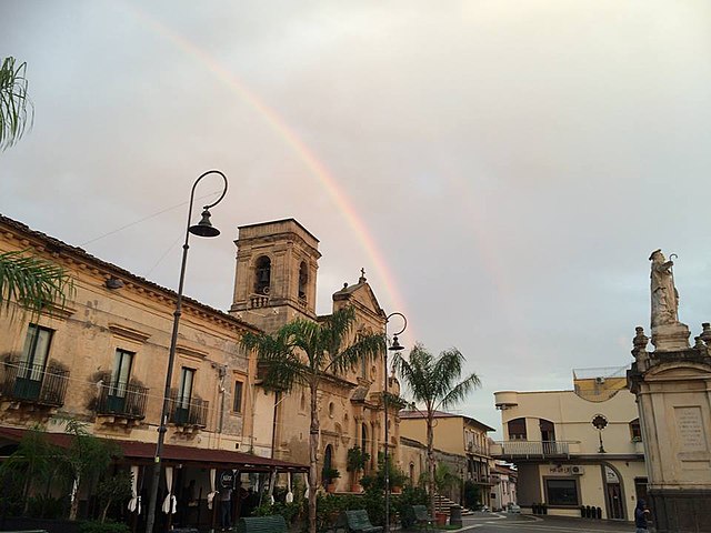
Carlentini
- Italian comune
Hiking in Carlentini
Carlentini is a charming town located in Sicily, Italy, known for its beautiful landscapes and rich cultural heritage. While it may not be the first destination that comes to mind for hiking, there are some wonderful opportunities for outdoor enthusiasts in and around the area. Here are some key points to consider when planning a hiking trip to Carlentini:...
- Country:
- Postal Code: 96013
- Local Dialing Code: 095
- Licence Plate Code: SR
- Coordinates: 37° 17' 0" N, 15° 1' 0" E
- GPS tracks (wikiloc): [Link]
- AboveSeaLevel: 190 м m
- Area: 158.91 sq km
- Population: 17741
- Web site: [Link]

Catania
- Italian city on the east coast of Sicily
Hiking in Catania
Catania, located on the eastern coast of Sicily, offers a variety of hiking opportunities that showcase the region's stunning natural beauty, historical sites, and diverse ecosystems. Here are some highlights for those interested in hiking in and around Catania:...
- Country:
- Postal Code: 95121–95131
- Local Dialing Code: 095
- Licence Plate Code: CT
- Coordinates: 37° 30' 10" N, 15° 5' 14" E
- GPS tracks (wikiloc): [Link]
- AboveSeaLevel: 7 м m
- Area: 180.88 sq km
- Population: 313396
- Web site: [Link]
Belpasso
- Italian comune
Hiking in Belpasso
Belpasso, located on the eastern slope of Mount Etna in Sicily, Italy, offers a variety of hiking opportunities that combine stunning natural landscapes, fascinating geological features, and rich local history. Here are some key aspects to consider for a hiking experience in Belpasso:...
- Country:
- Postal Code: 95032
- Local Dialing Code: 095
- Licence Plate Code: CT
- Coordinates: 37° 35' 0" N, 14° 59' 0" E
- GPS tracks (wikiloc): [Link]
- AboveSeaLevel: 551 м m
- Area: 166.33 sq km
- Population: 28126
- Web site: [Link]

Militello in Val di Catania
- Italian comune
Hiking in Militello in Val di Catania
Militello in Val di Catania, located in Sicily, Italy, is surrounded by beautiful landscapes and offers several hiking opportunities that showcase the natural beauty and cultural heritage of the region. Here are some highlights for hiking in and around Militello:...
- Country:
- Postal Code: 95043
- Local Dialing Code: 095
- Licence Plate Code: CT
- Coordinates: 37° 17' 0" N, 14° 47' 0" E
- GPS tracks (wikiloc): [Link]
- AboveSeaLevel: 413 м m
- Area: 162.48 sq km
- Population: 7262
- Web site: [Link]

Palagonia
- Italian comune
Hiking in Palagonia
Palagonia is a town located in the province of Catania, Sicily, Italy. While it may not be the most well-known hiking destination, the surrounding Sicilian landscape offers some opportunities for outdoor enthusiasts to explore the natural beauty of the region....
- Country:
- Postal Code: 95046
- Local Dialing Code: 095
- Licence Plate Code: CT
- Coordinates: 37° 20' 0" N, 14° 45' 0" E
- GPS tracks (wikiloc): [Link]
- AboveSeaLevel: 200 м m
- Area: 57.79 sq km
- Population: 16654
- Web site: [Link]

Ramacca
- Italian comune
Hiking in Ramacca
Ramacca, located in the province of Catania in Sicily, Italy, is a lesser-known gem for hiking enthusiasts. While the area may not be as famous for hiking as some other regions in Sicily, it offers scenic landscapes and opportunities for outdoor activities. Here are some key points about hiking in and around Ramacca:...
- Country:
- Postal Code: 95040
- Local Dialing Code: 095
- Licence Plate Code: CT
- Coordinates: 37° 23' 0" N, 14° 42' 0" E
- GPS tracks (wikiloc): [Link]
- AboveSeaLevel: 270 м m
- Area: 306.44 sq km
- Population: 10866
- Web site: [Link]
Scordia
- Italian comune
Hiking in Scordia
Scordia is located in Sicily, Italy, and while it may not be as well-known as some of the larger hiking destinations in the region, it still offers unique opportunities for outdoor enthusiasts. Here’s what you should know about hiking in and around Scordia:...
- Country:
- Postal Code: 95048
- Local Dialing Code: 095
- Licence Plate Code: CT
- Coordinates: 37° 18' 0" N, 14° 51' 0" E
- GPS tracks (wikiloc): [Link]
- AboveSeaLevel: 150 м m
- Area: 24.31 sq km
- Population: 16919
- Web site: [Link]


Francofonte
- Italian comune
Hiking in Francofonte
Francofonte, located in the province of Syracuse in Sicily, Italy, offers several hiking opportunities surrounded by beautiful natural landscapes, rich history, and unique flora and fauna. Here are some highlights of hiking in the area:...
- Country:
- Postal Code: 96015
- Local Dialing Code: 095
- Licence Plate Code: SR
- Coordinates: 37° 14' 0" N, 14° 53' 0" E
- GPS tracks (wikiloc): [Link]
- AboveSeaLevel: 281 м m
- Area: 74.2 sq km
- Population: 12661
- Web site: [Link]