Jonquerets-de-Livet (Jonquerets-de-Livet)

- former commune in Eure, France
- Country:

- Postal Code: 27410
- Coordinates: 49° 1' 17" N, 0° 36' 29" E


- GPS tracks (wikiloc): [Link]
- Area: 10.28 sq km
- Population: 316
- Wikipedia en: wiki(en)
- Wikipedia: wiki(fr)
- Wikidata storage: Wikidata: Q673119
- Wikipedia Commons Category: [Link]
- Freebase ID: [/m/03mhrd9]
- Freebase ID: [/m/03mhrd9]
- GeoNames ID: Alt: [6430454]
- GeoNames ID: Alt: [6430454]
- BnF ID: [15253592t]
- BnF ID: [15253592t]
- INSEE municipality code: 27356
- INSEE municipality code: 27356
Shares border with regions:


Chamblac
- commune in Eure, France
- Country:
- Postal Code: 27270
- Coordinates: 48° 59' 18" N, 0° 32' 40" E
- GPS tracks (wikiloc): [Link]
- Area: 20.9 sq km
- Population: 390


Granchain
- former commune in Eure, France
- Country:
- Postal Code: 27410
- Coordinates: 49° 2' 26" N, 0° 39' 31" E
- GPS tracks (wikiloc): [Link]
- Area: 8.12 sq km
- Population: 222

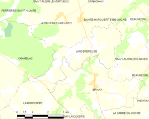
Landepéreuse
- former commune in Eure, France
- Country:
- Postal Code: 27410
- Coordinates: 49° 0' 16" N, 0° 38' 18" E
- GPS tracks (wikiloc): [Link]
- Area: 8.92 sq km
- Population: 383


Ferrières-Saint-Hilaire
- commune in Eure, France
- Country:
- Postal Code: 27270
- Coordinates: 49° 1' 58" N, 0° 34' 3" E
- GPS tracks (wikiloc): [Link]
- Area: 9.84 sq km
- Population: 416