Les Mées (Les Mées)

- commune in Sarthe, France
- Country:

- Postal Code: 72260
- Coordinates: 48° 18' 51" N, 0° 13' 54" E


- GPS tracks (wikiloc): [Link]
- Area: 6.8 sq km
- Population: 104
- Wikipedia en: wiki(en)
- Wikipedia: wiki(fr)
- Wikidata storage: Wikidata: Q1224111
- Wikipedia Commons Category: [Link]
- Freebase ID: [/m/03qk2kr]
- GeoNames ID: Alt: [6615065]
- SIREN number: [217201920]
- INSEE municipality code: 72192
Shares border with regions:


Courgains
- commune in Sarthe, France
- Country:
- Postal Code: 72260
- Coordinates: 48° 17' 24" N, 0° 16' 44" E
- GPS tracks (wikiloc): [Link]
- Area: 14.66 sq km
- Population: 588


René
- commune in Sarthe, France
- Country:
- Postal Code: 72260
- Coordinates: 48° 16' 43" N, 0° 13' 15" E
- GPS tracks (wikiloc): [Link]
- Area: 12.52 sq km
- Population: 375
Louvigny
- commune in Sarthe, France
- Country:
- Postal Code: 72600
- Coordinates: 48° 20' 19" N, 0° 12' 5" E
- GPS tracks (wikiloc): [Link]
- Area: 8.71 sq km
- Population: 189

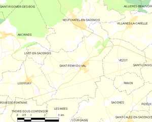
Saint-Rémy-du-Val
- commune in Sarthe, France
- Country:
- Postal Code: 72600
- Coordinates: 48° 20' 59" N, 0° 15' 17" E
- GPS tracks (wikiloc): [Link]
- AboveSeaLevel: 160 м m
- Area: 16.54 sq km
- Population: 531
Thoigné
- commune in Sarthe, France
- Country:
- Postal Code: 72260
- Coordinates: 48° 17' 21" N, 0° 15' 10" E
- GPS tracks (wikiloc): [Link]
- Area: 7.31 sq km
- Population: 164
Thoiré-sous-Contensor
- commune in Sarthe, France
- Country:
- Postal Code: 72610
- Coordinates: 48° 18' 41" N, 0° 12' 2" E
- GPS tracks (wikiloc): [Link]
- Area: 5.99 sq km
- Population: 87


Saosnes
- commune in Sarthe, France
- Country:
- Postal Code: 72600
- Coordinates: 48° 19' 33" N, 0° 16' 45" E
- GPS tracks (wikiloc): [Link]
- Area: 11.25 sq km
- Population: 216