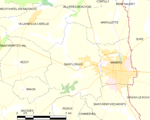
canton of Mamers (canton de Mamers)

- canton of France
- Country:

- Capital: Mamers
- Coordinates: 48° 20' 3" N, 0° 19' 49" E


- GPS tracks (wikiloc): [Link]
- Population: 27067
- Wikipedia en: wiki(en)
- Wikipedia: wiki(fr)
- Wikidata storage: Wikidata: Q1726051
- INSEE canton code: [7209]
Includes regions:
Les Mées
- commune in Sarthe, France
- Country:
- Postal Code: 72260
- Coordinates: 48° 18' 51" N, 0° 13' 54" E
- GPS tracks (wikiloc): [Link]
- Area: 6.8 sq km
- Population: 104


Villaines-la-Carelle
- commune in Sarthe, France
- Country:
- Postal Code: 72600
- Coordinates: 48° 22' 36" N, 0° 17' 57" E
- GPS tracks (wikiloc): [Link]
- Area: 14.7 sq km
- Population: 159

Pizieux
- commune in Sarthe, France
- Country:
- Postal Code: 72600
- Coordinates: 48° 19' 20" N, 0° 19' 52" E
- GPS tracks (wikiloc): [Link]
- Area: 4.51 sq km
- Population: 80


Vezot
- commune in Sarthe, France
- Country:
- Postal Code: 72600
- Coordinates: 48° 21' 10" N, 0° 17' 28" E
- GPS tracks (wikiloc): [Link]
- Area: 6.35 sq km
- Population: 72

Saint-Cosme-en-Vairais
- commune in Sarthe, France
- Country:
- Postal Code: 72110
- Coordinates: 48° 16' 26" N, 0° 27' 36" E
- GPS tracks (wikiloc): [Link]
- Area: 32.63 sq km
- Population: 1997
- Web site: [Link]


Saint-Rémy-des-Monts
- commune in Sarthe, France
- Country:
- Postal Code: 72600
- Coordinates: 48° 18' 31" N, 0° 24' 2" E
- GPS tracks (wikiloc): [Link]
- Area: 10.12 sq km
- Population: 685
Louvigny
- commune in Sarthe, France
- Country:
- Postal Code: 72600
- Coordinates: 48° 20' 19" N, 0° 12' 5" E
- GPS tracks (wikiloc): [Link]
- Area: 8.71 sq km
- Population: 189


Commerveil
- commune in Sarthe, France
- Country:
- Postal Code: 72600
- Coordinates: 48° 19' 1" N, 0° 21' 28" E
- GPS tracks (wikiloc): [Link]
- Area: 5.64 sq km
- Population: 132

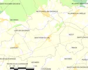
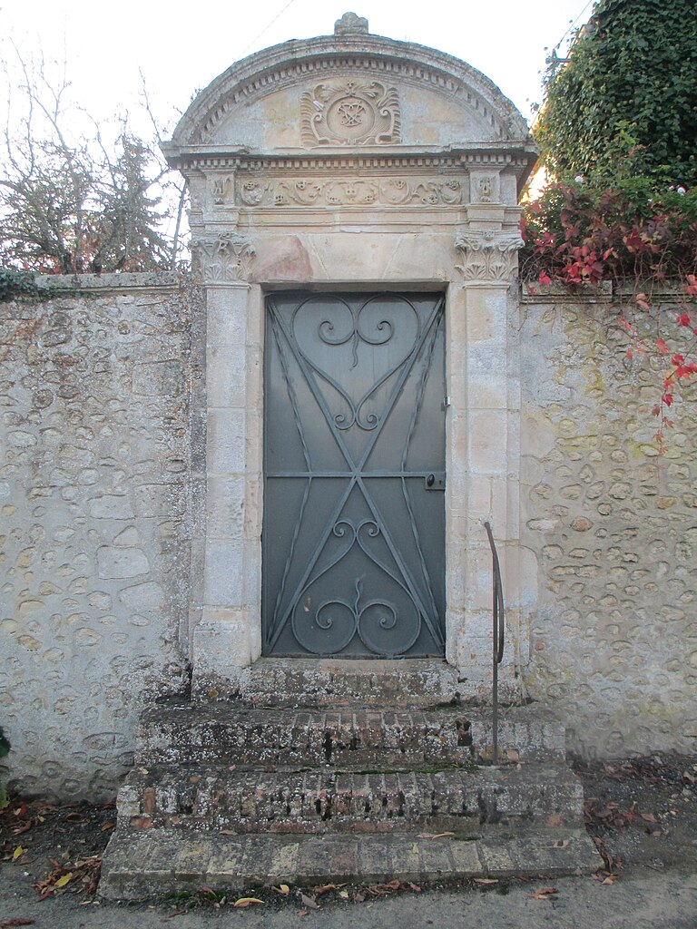
Saint-Rémy-du-Val
- commune in Sarthe, France
- Country:
- Postal Code: 72600
- Coordinates: 48° 20' 59" N, 0° 15' 17" E
- GPS tracks (wikiloc): [Link]
- AboveSeaLevel: 160 м m
- Area: 16.54 sq km
- Population: 531


Contilly
- commune in Sarthe, France
- Country:
- Postal Code: 72600
- Coordinates: 48° 24' 3" N, 0° 22' 9" E
- GPS tracks (wikiloc): [Link]
- Area: 12.48 sq km
- Population: 141


Saint-Calez-en-Saosnois
- commune in Sarthe, France
- Country:
- Postal Code: 72600
- Coordinates: 48° 18' 47" N, 0° 18' 16" E
- GPS tracks (wikiloc): [Link]
- Area: 7.19 sq km
- Population: 169


Saint-Vincent-des-Prés, Sarthe
- commune in Sarthe, France
- Country:
- Postal Code: 72600
- Coordinates: 48° 17' 44" N, 0° 23' 8" E
- GPS tracks (wikiloc): [Link]
- Area: 10.51 sq km
- Population: 522


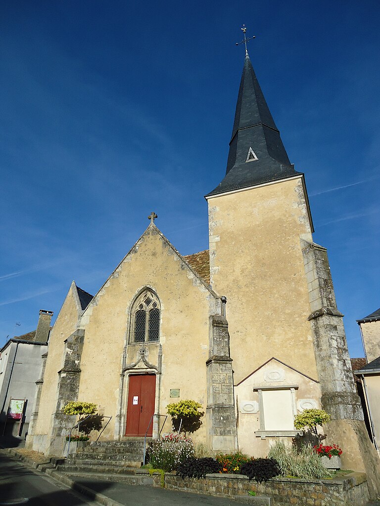
Mamers
- commune in Sarthe, France
- Country:
- Postal Code: 72600
- Coordinates: 48° 20' 58" N, 0° 22' 10" E
- GPS tracks (wikiloc): [Link]
- Area: 5.05 sq km
- Population: 5304
- Web site: [Link]

Saint-Longis
- commune in Sarthe, France
- Country:
- Postal Code: 72600
- Coordinates: 48° 21' 19" N, 0° 20' 45" E
- GPS tracks (wikiloc): [Link]
- Area: 11.22 sq km
- Population: 511


Saint-Pierre-des-Ormes
- commune in Sarthe, France
- Country:
- Postal Code: 72600
- Coordinates: 48° 18' 23" N, 0° 25' 17" E
- GPS tracks (wikiloc): [Link]
- Area: 10.12 sq km
- Population: 227


Marollette
- commune in Sarthe, France
- Country:
- Postal Code: 72600
- Coordinates: 48° 22' 11" N, 0° 21' 4" E
- GPS tracks (wikiloc): [Link]
- AboveSeaLevel: 175 м m
- Area: 5.7 sq km
- Population: 148


Saosnes
- commune in Sarthe, France
- Country:
- Postal Code: 72600
- Coordinates: 48° 19' 33" N, 0° 16' 45" E
- GPS tracks (wikiloc): [Link]
- Area: 11.25 sq km
- Population: 216
Panon
- commune in Sarthe, France
- Country:
- Postal Code: 72600
- Coordinates: 48° 20' 19" N, 0° 17' 41" E
- GPS tracks (wikiloc): [Link]
- Area: 2.37 sq km
- Population: 41