Les Montils (Les Montils)

- commune in Loir-et-Cher, France
- Country:

- Postal Code: 41120
- Coordinates: 47° 29' 43" N, 1° 17' 49" E


- GPS tracks (wikiloc): [Link]
- Area: 9.27 sq km
- Population: 1992
- Web site: http://www.lesmontils.com
- Wikipedia en: wiki(en)
- Wikipedia: wiki(fr)
- Wikidata storage: Wikidata: Q1383860
- Wikipedia Commons Category: [Link]
- Freebase ID: [/m/03nw0qc]
- GeoNames ID: Alt: [3000246]
- SIREN number: [214101479]
- BnF ID: [15259421g]
- INSEE municipality code: 41147
Shares border with regions:


Candé-sur-Beuvron
- commune in Loir-et-Cher, France
- Country:
- Postal Code: 41120
- Coordinates: 47° 29' 42" N, 1° 15' 38" E
- GPS tracks (wikiloc): [Link]
- Area: 15.49 sq km
- Population: 1532
Monthou-sur-Bièvre
- commune in Loir-et-Cher, France
- Country:
- Postal Code: 41120
- Coordinates: 47° 28' 34" N, 1° 17' 42" E
- GPS tracks (wikiloc): [Link]
- Area: 16.62 sq km
- Population: 823
- Web site: [Link]
Valaire
- commune in Loir-et-Cher, France
- Country:
- Postal Code: 41120
- Coordinates: 47° 28' 11" N, 1° 16' 6" E
- GPS tracks (wikiloc): [Link]
- Area: 6.68 sq km
- Population: 84
Seur
- commune in Loir-et-Cher, France
- Country:
- Postal Code: 41120
- Coordinates: 47° 30' 10" N, 1° 20' 2" E
- GPS tracks (wikiloc): [Link]
- AboveSeaLevel: 86 м m
- Area: 3.85 sq km
- Population: 481
Ouchamps
- commune in Loir-et-Cher, France
- Country:
- Postal Code: 41120
- Coordinates: 47° 28' 21" N, 1° 18' 29" E
- GPS tracks (wikiloc): [Link]
- Area: 13.08 sq km
- Population: 743

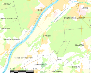
Chailles
- commune in Loir-et-Cher, France
- Country:
- Postal Code: 41120
- Coordinates: 47° 32' 30" N, 1° 18' 37" E
- GPS tracks (wikiloc): [Link]
- Area: 18.54 sq km
- Population: 2673