
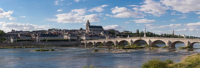
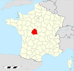
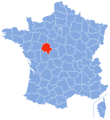
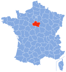
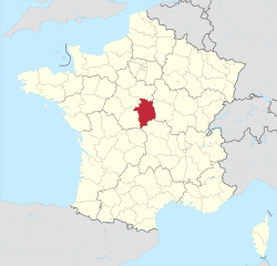
Loir-et-Cher (Loir-et-Cher)


- French department
- Country:

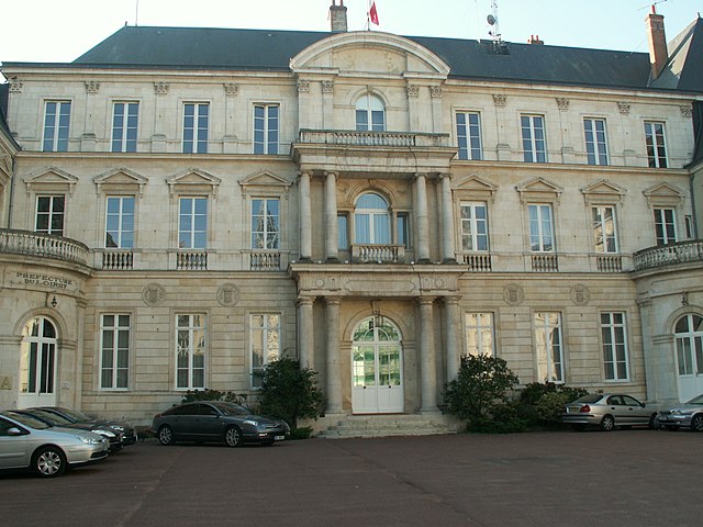
- Capital: Blois
- Coordinates: 47° 16' 0" N, 0° 40' 0" E


- GPS tracks (wikiloc): [Link]
- Area: 6343 sq km
- Population: 333050
- Web site: http://www.loir-et-cher.gouv.fr/
- Wikipedia en: wiki(en)
- Wikipedia: wiki(fr)
- Wikidata storage: Wikidata: Q12564
- Wikipedia Commons Gallery: [Link]
- Wikipedia Commons Category: [Link]
- Wikipedia Commons Maps Category: [Link]
- Freebase ID: [/m/0m7vy]
- GeoNames ID: Alt: [2997856]
- SIREN number: [224100016]
- BnF ID: [11947686k]
- VIAF ID: Alt: [124325187]
- OSM relation ID: [7399]
- GND ID: Alt: [4111364-0]
- archINFORM location ID: [35]
- Library of Congress authority ID: Alt: [n79116204]
- PACTOLS thesaurus ID: [pcrtdP5QQvB1PO]
- MusicBrainz area ID: [cc8bf355-cd9d-45ac-8eb7-c56a4419f534]
- TGN ID: [7002929]
- SUDOC authorities ID: [026588722]
- Encyclopædia Britannica Online ID: [place/Loir-et-Cher]
- Gran Enciclopèdia Catalana ID: [0038361]
- Twitter username: Alt: [Departement41]
- data.gouv.fr org ID: [conseil-general-de-loir-et-cher]
- NUTS code: [FR245]
- INSEE department code: [41]
- ISO 3166-2 code: FR-41
Includes regions:


arrondissement of Romorantin-Lanthenay
- arrondissement of France
- Country:
- Capital: Romorantin-Lanthenay
- Coordinates: 47° 25' 0" N, 1° 50' 0" E
- GPS tracks (wikiloc): [Link]
- Area: 2059 sq km
- Population: 111726

arrondissement of Blois
- arrondissement of France
- Country:
- Capital: Blois
- Coordinates: 47° 35' 0" N, 1° 20' 0" E
- GPS tracks (wikiloc): [Link]
- Area: 2565 sq km
- Population: 151292


arrondissement of Vendôme
- arrondissement of France
- Country:
- Capital: Vendôme
- Coordinates: 47° 50' 0" N, 1° 0' 0" E
- GPS tracks (wikiloc): [Link]
- Area: 1719 sq km
- Population: 70032
Shares border with regions:

Indre
- French department
- Country:
- Capital: Châteauroux
- Coordinates: 46° 46' 0" N, 1° 36' 0" E
- GPS tracks (wikiloc): [Link]
- Area: 6791 sq km
- Population: 224200
- Web site: [Link]
Indre-et-Loire
- French department
- Country:
- Capital: Tours
- Coordinates: 47° 15' 0" N, 0° 40' 0" E
- GPS tracks (wikiloc): [Link]
- Area: 6127 sq km
- Population: 604966
- Web site: [Link]
Loiret
- French department
- Country:
- Capital: Orléans
- Coordinates: 47° 55' 0" N, 2° 10' 0" E
- GPS tracks (wikiloc): [Link]
- Area: 6775 sq km
- Population: 673349
- Web site: [Link]


Sarthe
- French department
- Country:
- Capital: Le Mans
- Coordinates: 48° 17' 0" N, 0° 13' 0" E
- GPS tracks (wikiloc): [Link]
- Area: 6206 sq km
- Population: 568445
- Web site: [Link]

Cher
- French department
- Country:
- Capital: Bourges
- Coordinates: 47° 4' 52" N, 2° 26' 40" E
- GPS tracks (wikiloc): [Link]
- Area: 7235 sq km
- Population: 308992
- Web site: [Link]


Eure-et-Loir
- French department
- Country:
- Capital: Chartres
- Coordinates: 48° 20' 0" N, 1° 25' 0" E
- GPS tracks (wikiloc): [Link]
- Area: 5880 sq km
- Population: 434035
- Web site: [Link]