Les Plans (Les Plans)

- commune in Hérault, France
- Country:

- Postal Code: 34700
- Coordinates: 43° 45' 12" N, 3° 16' 34" E


- GPS tracks (wikiloc): [Link]
- Area: 18.12 sq km
- Population: 286
- Wikipedia en: wiki(en)
- Wikipedia: wiki(fr)
- Wikidata storage: Wikidata: Q943334
- Wikipedia Commons Category: [Link]
- Freebase ID: [/m/03nw453]
- Freebase ID: [/m/03nw453]
- GeoNames ID: Alt: [6615088]
- GeoNames ID: Alt: [6615088]
- SIREN number: [213402050]
- SIREN number: [213402050]
- BnF ID: [15256806z]
- BnF ID: [15256806z]
- INSEE municipality code: 34205
- INSEE municipality code: 34205
Shares border with regions:


Lauroux
- commune in Hérault, France
- Country:
- Postal Code: 34700
- Coordinates: 43° 46' 40" N, 3° 17' 21" E
- GPS tracks (wikiloc): [Link]
- Area: 26.42 sq km
- Population: 190

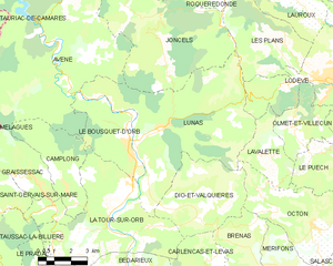
Lunas
- commune in Hérault, France
- Country:
- Postal Code: 34650
- Coordinates: 43° 42' 27" N, 3° 11' 39" E
- GPS tracks (wikiloc): [Link]
- Area: 44.89 sq km
- Population: 663


Joncels
- commune in Hérault, France
- Country:
- Postal Code: 34650
- Coordinates: 43° 44' 15" N, 3° 11' 41" E
- GPS tracks (wikiloc): [Link]
- Area: 46.24 sq km
- Population: 311


Lodève
- commune in Hérault, France
- Country:
- Postal Code: 34700
- Coordinates: 43° 43' 54" N, 3° 19' 10" E
- GPS tracks (wikiloc): [Link]
- Area: 23.17 sq km
- Population: 7409
- Web site: [Link]


Roqueredonde
- commune in Hérault, France
- Country:
- Postal Code: 34650
- Coordinates: 43° 48' 1" N, 3° 12' 44" E
- GPS tracks (wikiloc): [Link]
- Area: 22.71 sq km
- Population: 212