Les Thuiles (Les Thuiles)
- commune in Alpes-de-Haute-Provence, France
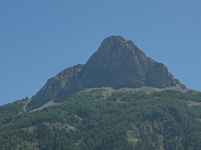
 Hiking in Les Thuiles
Les Thuiles is a picturesque village located in the French region of Provence-Alpes-Côte d'Azur, specifically in the Alpes-de-Haute-Provence department. Hiking in this area offers a wonderful experience, as it is surrounded by stunning natural landscapes, including mountains, valleys, and forests.
Popular Hiking Trails
-
The Val d'Allos: This area offers several hiking trails that vary in difficulty. You can explore the beautiful alpine scenery, with opportunities to see diverse flora and fauna. The trails around the Val d'Allos often lead to beautiful lakes such as Lac d'Allos, which is the highest natural lake in Europe.
-
The Chemin des Parquets: This trail is suitable for families and provides a great introduction to the natural beauty of the region. The well-marked paths allow hikers to enjoy a leisurely exploration of the local environment.
-
Col de la Cayolle: This mountain pass offers breathtaking views and is a starting point for various hikes. The trails here can lead you to higher altitudes with stunning panoramic views of the surrounding peaks.
Hiking Tips
-
Best Time to Hike: The best months for hiking in Les Thuiles are typically from late spring (May) to early autumn (September), when the weather is mild and the trails are more accessible.
-
Safety Precautions: Always check weather conditions before you head out, as mountain weather can change rapidly. Make sure to carry enough water, snacks, and proper gear, including sturdy hiking boots, a map, and navigation tools.
-
Guided Tours: If you're unfamiliar with the area, consider joining a guided hiking tour. Local guides can provide valuable insights into the region’s history, flora, and fauna.
-
Respect Nature: As in all hiking areas, it's essential to follow Leave No Trace principles. Stay on marked trails, pack out what you bring in, and respect local wildlife.
By exploring the beautiful trails around Les Thuiles, hikers can enjoy the serene environment and breathtaking scenery that this part of the French Alps has to offer.
- Country:

- Postal Code: 04400
- Coordinates: 44° 23' 35" N, 6° 34' 16" E


- GPS tracks (wikiloc): [Link]
- Area: 32.8 sq km
- Population: 398
- Wikipedia en: wiki(en)
- Wikipedia: wiki(fr)
- Wikidata storage: Wikidata: Q1016870
- Wikipedia Commons Category: [Link]
- Freebase ID: [/m/03m7xs5]
- Freebase ID: [/m/03m7xs5]
- GeoNames ID: Alt: [2999499]
- GeoNames ID: Alt: [2999499]
- SIREN number: [210402202]
- SIREN number: [210402202]
- INSEE municipality code: 04220
- INSEE municipality code: 04220
Shares border with regions:
Uvernet-Fours
- commune in Alpes-de-Haute-Provence, France
Hiking in Uvernet-Fours
Uvernet-Fours is a charming destination in the French Alpes-de-Haute-Provence region, known for its beautiful landscapes and outdoor recreational opportunities, including hiking. Here are some details to help you plan your hiking experience in this area:...
- Country:
- Postal Code: 04400
- Coordinates: 44° 21' 40" N, 6° 37' 34" E
- GPS tracks (wikiloc): [Link]
- Area: 135.44 sq km
- Population: 583

Saint-Pons
- commune in Alpes-de-Haute-Provence, France
Hiking in Saint-Pons
Saint-Pons, located in the Alpes-de-Haute-Provence region of France, is a fantastic destination for hiking enthusiasts. Known for its stunning natural scenery, diverse landscapes, and relatively mild climate, it offers a variety of trails suitable for different skill levels. Here are some key features and tips for hiking in this area:...
- Country:
- Postal Code: 04400
- Coordinates: 44° 23' 32" N, 6° 37' 40" E
- GPS tracks (wikiloc): [Link]
- Area: 32.06 sq km
- Population: 647
- Web site: [Link]

Méolans-Revel
- commune in Alpes-de-Haute-Provence, France
Hiking in Méolans-Revel
Méolans-Revel is a charming commune located in the Alpes-de-Haute-Provence region of southeastern France, known for its beautiful landscapes and outdoor recreational opportunities. Here’s an overview of hiking in this area:...
- Country:
- Postal Code: 04340
- Coordinates: 44° 24' 5" N, 6° 30' 42" E
- GPS tracks (wikiloc): [Link]
- AboveSeaLevel: 1040 м m
- Area: 127.74 sq km
- Population: 337

Les Orres
- commune in Hautes-Alpes, France
Hiking in Les Orres
Les Orres, located in the French Alps, is a fantastic destination for hiking enthusiasts. This charming mountain resort offers a variety of trails suitable for all levels, from beginners to experienced hikers. Here’s an overview to help you plan your hiking experience in Les Orres:...
- Country:
- Postal Code: 05200
- Coordinates: 44° 30' 50" N, 6° 33' 3" E
- GPS tracks (wikiloc): [Link]
- AboveSeaLevel: 1460 м m
- Area: 74.79 sq km
- Population: 569
- Web site: [Link]