Lieusaint (Lieusaint)

- commune in Seine-et-Marne, France
- Country:

- Postal Code: 77127
- Coordinates: 48° 37' 56" N, 2° 32' 55" E


- GPS tracks (wikiloc): [Link]
- Area: 11.97 sq km
- Population: 13242
- Web site: http://www.ville-lieusaint.fr
- Wikipedia en: wiki(en)
- Wikipedia: wiki(fr)
- Wikidata storage: Wikidata: Q1441028
- Wikipedia Commons Category: [Link]
- Freebase ID: [/m/02qwh21]
- Freebase ID: [/m/02qwh21]
- GeoNames ID: Alt: [6455406]
- GeoNames ID: Alt: [6455406]
- SIREN number: [217702513]
- SIREN number: [217702513]
- BnF ID: [15275591c]
- BnF ID: [15275591c]
- PACTOLS thesaurus ID: [pcrtc7zdyBjByf]
- PACTOLS thesaurus ID: [pcrtc7zdyBjByf]
- MusicBrainz area ID: [910d9f81-8309-44e4-bada-df20061eb883]
- MusicBrainz area ID: [910d9f81-8309-44e4-bada-df20061eb883]
- INSEE municipality code: 77251
- INSEE municipality code: 77251
Shares border with regions:

Tigery
- commune in Essonne, France
- Country:
- Postal Code: 91250
- Coordinates: 48° 38' 25" N, 2° 30' 31" E
- GPS tracks (wikiloc): [Link]
- Area: 8.64 sq km
- Population: 3449
- Web site: [Link]


Combs-la-Ville
- commune in Seine-et-Marne, France
- Country:
- Postal Code: 77380
- Coordinates: 48° 39' 43" N, 2° 33' 47" E
- GPS tracks (wikiloc): [Link]
- Area: 14.48 sq km
- Population: 22154
- Web site: [Link]


Savigny-le-Temple
- commune in Seine-et-Marne, France
- Country:
- Postal Code: 77176
- Coordinates: 48° 35' 45" N, 2° 34' 50" E
- GPS tracks (wikiloc): [Link]
- AboveSeaLevel: 77 м m
- Area: 11.97 sq km
- Population: 30260
- Web site: [Link]

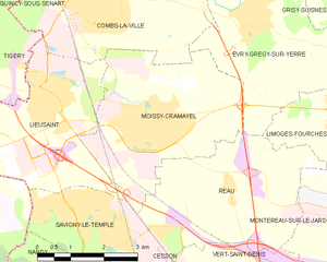
Moissy-Cramayel
- commune in Seine-et-Marne, France
- Country:
- Postal Code: 77550
- Coordinates: 48° 37' 34" N, 2° 35' 32" E
- GPS tracks (wikiloc): [Link]
- Area: 14.28 sq km
- Population: 17630

Saint-Pierre-du-Perray
- commune in Essonne, France
- Country:
- Postal Code: 91280
- Coordinates: 48° 36' 47" N, 2° 29' 43" E
- GPS tracks (wikiloc): [Link]
- Area: 11.59 sq km
- Population: 10501
- Web site: [Link]