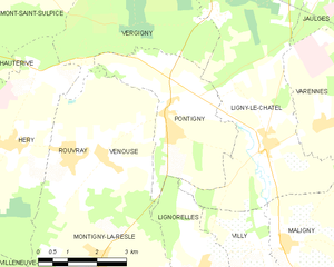
Ligny-le-Châtel (Ligny-le-Châtel)
- commune in Yonne, France
- Country:

- Postal Code: 89144
- Coordinates: 47° 54' 3" N, 3° 45' 24" E


- GPS tracks (wikiloc): [Link]
- Area: 27.48 sq km
- Population: 1289
- Wikipedia en: wiki(en)
- Wikipedia: wiki(fr)
- Wikidata storage: Wikidata: Q305444
- Wikipedia Commons Category: [Link]
- Freebase ID: [/m/03npcsj]
- Freebase ID: [/m/03npcsj]
- GeoNames ID: Alt: [6445905]
- GeoNames ID: Alt: [6445905]
- SIREN number: [218902278]
- SIREN number: [218902278]
- BnF ID: [15279684b]
- BnF ID: [15279684b]
- VIAF ID: Alt: [147892655]
- VIAF ID: Alt: [147892655]
- Library of Congress authority ID: Alt: [n92098425]
- Library of Congress authority ID: Alt: [n92098425]
- INSEE municipality code: 89227
- INSEE municipality code: 89227
Shares border with regions:


Jaulges
- commune in Yonne, France
- Country:

- Postal Code: 89360
- Coordinates: 47° 57' 45" N, 3° 47' 25" E


- GPS tracks (wikiloc): [Link]
- Area: 12.35 sq km
- Population: 484
Maligny
- commune in Yonne, France
- Country:

- Postal Code: 89800
- Coordinates: 47° 52' 12" N, 3° 45' 53" E


- GPS tracks (wikiloc): [Link]
- Area: 22.28 sq km
- Population: 800
Varennes
- commune in Yonne, France
- Country:

- Postal Code: 89144
- Coordinates: 47° 54' 20" N, 3° 46' 59" E


- GPS tracks (wikiloc): [Link]
- Area: 10.06 sq km
- Population: 319
Villy
- commune in Yonne, France
- Country:

- Postal Code: 89800
- Coordinates: 47° 52' 4" N, 3° 45' 4" E


- GPS tracks (wikiloc): [Link]
- Area: 5.84 sq km
- Population: 105
Lignorelles
- commune in Yonne, France
- Country:

- Postal Code: 89800
- Coordinates: 47° 51' 47" N, 3° 43' 39" E


- GPS tracks (wikiloc): [Link]
- Area: 11.55 sq km
- Population: 187
- Web site: [Link]
Méré
- commune in Yonne, France
- Country:

- Postal Code: 89144
- Coordinates: 47° 53' 56" N, 3° 49' 22" E


- GPS tracks (wikiloc): [Link]
- Area: 11.86 sq km
- Population: 188
Chéu
- commune in Yonne, France
- Country:

- Postal Code: 89600
- Coordinates: 47° 57' 56" N, 3° 45' 56" E


- GPS tracks (wikiloc): [Link]
- AboveSeaLevel: 107 м m
- Area: 7.61 sq km
- Population: 546


Vergigny
- commune in Yonne, France
- Country:

- Postal Code: 89600
- Coordinates: 47° 58' 13" N, 3° 43' 9" E


- GPS tracks (wikiloc): [Link]
- Area: 38.01 sq km
- Population: 1560


Pontigny
- commune in Yonne, France
- Country:

- Postal Code: 89230
- Coordinates: 47° 54' 25" N, 3° 42' 39" E


- GPS tracks (wikiloc): [Link]
- Area: 11.92 sq km
- Population: 759
