Lilly (Lilly)

- commune in Eure, France
- Country:

- Postal Code: 27480
- Coordinates: 49° 24' 24" N, 1° 34' 1" E


- GPS tracks (wikiloc): [Link]
- Area: 6.03 sq km
- Population: 82
- Wikipedia en: wiki(en)
- Wikipedia: wiki(fr)
- Wikidata storage: Wikidata: Q1073913
- Wikipedia Commons Category: [Link]
- Freebase ID: [/m/03mhrjs]
- Freebase ID: [/m/03mhrjs]
- GeoNames ID: Alt: [6430462]
- GeoNames ID: Alt: [6430462]
- SIREN number: [212703698]
- SIREN number: [212703698]
- BnF ID: [152536040]
- BnF ID: [152536040]
- INSEE municipality code: 27369
- INSEE municipality code: 27369
Shares border with regions:
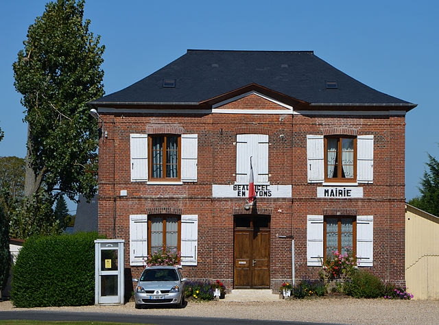

Beauficel-en-Lyons
- commune in Eure, France
- Country:
- Postal Code: 27480
- Coordinates: 49° 24' 27" N, 1° 31' 22" E
- GPS tracks (wikiloc): [Link]
- Area: 7.2 sq km
- Population: 192

Bosquentin
- commune in Eure, France
- Country:
- Postal Code: 27480
- Coordinates: 49° 24' 49" N, 1° 35' 11" E
- GPS tracks (wikiloc): [Link]
- Area: 6.9 sq km
- Population: 133

Morgny
- commune in Eure, France
- Country:
- Postal Code: 27150
- Coordinates: 49° 22' 58" N, 1° 35' 26" E
- GPS tracks (wikiloc): [Link]
- Area: 17.37 sq km
- Population: 644


Fleury-la-Forêt
- commune in Eure, France
- Country:
- Postal Code: 27480
- Coordinates: 49° 25' 10" N, 1° 33' 17" E
- GPS tracks (wikiloc): [Link]
- Area: 7.85 sq km
- Population: 271