Linz-Land District (Bezirk Linz-Land)

- district of Austria
 Hiking in Linz-Land District
Linz-Land District, located in the Upper Austria region, is a fantastic destination for hiking enthusiasts. It offers a variety of trails that cater to both beginners and experienced hikers, showcasing the beautiful landscapes, forests, and scenic views of the area.
Key Highlights for Hiking in Linz-Land District:
-
Diverse Terrain: The district features a mix of terrains, including wooded areas, hills, and valleys, making it ideal for various hiking experiences. Whether you prefer gentle walks or challenging hikes, there's something for everyone.
-
Scenic Trails: Trails like the "Mühlviertler Panoramaweg" offer breathtaking views and a chance to explore the natural beauty of the region. Many paths follow rivers or lead to vantage points overlooking the Danube and surrounding areas.
-
Nature Reserves: The area is home to several nature reserves, such as the "Waldhaus" and the "Mitterkirchen" nature reserve, which provide well-marked hiking paths and opportunities for wildlife observation.
-
Cultural Sites: As you hike, you can also encounter historical and cultural landmarks, including small villages, churches, and remnants of old fortifications, enriching your hiking experience.
-
Accessibility: Many trails are easily accessible from Linz, making them convenient options for day trips or weekend outings. Public transport options will often take you close to popular hiking starting points.
-
Seasonal Hiking: Each season offers a unique experience; spring and summer feature lush greenery, while autumn showcases beautiful foliage. Winter hiking can also be appealing, with some trails maintained for snowshoeing or winter walks.
-
Local Recommendations: It's often helpful to check with local tourist offices or hiking clubs for updated trail information, guided hikes, or tips on the best routes for your skill level.
Practical Tips:
- Appropriate Gear: Ensure you have suitable hiking footwear and weather-appropriate clothing, as conditions can change quickly.
- Trail Maps: Always carry a map or have a GPS device with you, as some trails may not be well-marked.
- Hydration and Snacks: Bring adequate water and snacks to keep your energy up during your hikes.
- Respect Nature: Follow Leave No Trace principles to preserve the natural beauty of the area.
Overall, Linz-Land District provides a perfect combination of nature and culture for those looking to explore the great outdoors. Happy hiking!
- Country:

- Capital: Linz
- Licence Plate Code: LL
- Coordinates: 48° 12' 29" N, 14° 14' 24" E


- GPS tracks (wikiloc): [Link]
- AboveSeaLevel: 297 м m
- Area: 460.25 sq km
- Web site: http://www.bh-linz-land.gv.at/
- Wikipedia en: wiki(en)
- Wikipedia: wiki(de)
- Wikidata storage: Wikidata: Q265632
- Wikipedia Commons Category: [Link]
- Freebase ID: [/m/07f1f7]
- GeoNames ID: Alt: [2772396]
- GND ID: Alt: [4289512-1]
- archINFORM location ID: [14674]
Includes regions:

Ansfelden
- municipality in Austria
Hiking in Ansfelden
Ansfelden, located in Austria near Linz, offers a variety of hiking trails suitable for different skill levels. The region features picturesque landscapes, including lush forests, rolling hills, and scenic views of the surrounding areas, making it an excellent destination for nature enthusiasts....
- Country:
- Licence Plate Code: LL
- Coordinates: 48° 12' 30" N, 14° 17' 20" E
- GPS tracks (wikiloc): [Link]
- AboveSeaLevel: 289 м m
- Area: 31.33 sq km
- Population: 16194
- Web site: [Link]

Enns
- municipality in Austria
Hiking in Enns
Enns, a town in Austria, is situated in the stunning region of Upper Austria and is known for its rich history and beautiful landscapes. While it may not be as prominent as some larger tourist destinations, it offers a fantastic opportunity for hiking and enjoying nature in a more tranquil setting. Here are some aspects to consider if you're interested in hiking around Enns:...
- Country:
- Postal Code: 4470
- Local Dialing Code: 07223
- Licence Plate Code: LL
- Coordinates: 48° 13' 0" N, 14° 28' 30" E
- GPS tracks (wikiloc): [Link]
- AboveSeaLevel: 281 м m
- Area: 33.27 sq km
- Population: 11523
- Web site: [Link]

Traun
- municipality in Austria
Hiking in Traun
Traun is a beautiful area located in Austria, particularly known for its stunning natural landscapes, including mountains, lakes, and rivers. The region is popular among hikers due to its diverse trails that cater to various skill levels, from beginners to experienced hikers. Here are some key points about hiking in the Traun area:...
- Country:
- Postal Code: 4050
- Local Dialing Code: 07229
- Licence Plate Code: LL
- Coordinates: 48° 13' 18" N, 14° 14' 23" E
- GPS tracks (wikiloc): [Link]
- AboveSeaLevel: 273 м m
- Area: 15.49 sq km
- Population: 24477
- Web site: [Link]

Hofkirchen im Traunkreis
- municipality in Austria
Hiking in Hofkirchen im Traunkreis
Hofkirchen im Traunkreis is a picturesque village in Austria that offers a variety of hiking opportunities for outdoor enthusiasts. Nestled in the scenic Traunviertel region, this area is characterized by rolling hills, lush forests, and stunning landscapes....
- Country:
- Postal Code: 4492
- Local Dialing Code: 07225
- Licence Plate Code: LL
- Coordinates: 48° 8' 31" N, 14° 22' 49" E
- GPS tracks (wikiloc): [Link]
- AboveSeaLevel: 342 м m
- Area: 14 sq km
- Population: 1899
- Web site: [Link]

Oftering
- municipality in Austria
Hiking in Oftering
Oftering, located in the Upper Austria region, offers beautiful landscapes and a variety of hiking opportunities for outdoor enthusiasts. The area is characterized by rolling hills, lush forests, and scenic views, making it a perfect destination for both casual hikers and those looking for more challenging routes....
- Country:
- Postal Code: 4064
- Local Dialing Code: 07221
- Licence Plate Code: LL
- Coordinates: 48° 14' 1" N, 14° 8' 0" E
- GPS tracks (wikiloc): [Link]
- AboveSeaLevel: 316 м m
- Area: 13.50 sq km
- Population: 2076
- Web site: [Link]

Leonding
- municipality in Austria
Hiking in Leonding
Leonding, located in Upper Austria near the city of Linz, is a charming area with several hiking opportunities that can be enjoyed by both beginners and experienced hikers. The region features lush landscapes, rolling hills, and beautiful forests, making it a delightful destination for outdoor enthusiasts....
- Country:
- Local Dialing Code: 0732
- Licence Plate Code: LL
- Coordinates: 48° 16' 45" N, 14° 15' 10" E
- GPS tracks (wikiloc): [Link]
- AboveSeaLevel: 287 м m
- Area: 24.05 sq km
- Population: 28698
- Web site: [Link]

Sankt Florian
- municipality in Austria
Hiking in Sankt Florian
Sankt Florian is a picturesque municipality located in Upper Austria, known for its beautiful landscapes, rich history, and opportunities for outdoor activities including hiking. While Sankt Florian might not be as famous as some other hiking destinations in Austria, it offers a variety of trails that allow you to immerse yourself in nature....
- Country:
- Postal Code: 4490
- Licence Plate Code: LL
- Coordinates: 48° 12' 32" N, 14° 22' 46" E
- GPS tracks (wikiloc): [Link]
- AboveSeaLevel: 296 м m
- Area: 44 sq km
- Population: 6176
- Web site: [Link]
Pasching
- municipality in Austria
Hiking in Pasching
Pasching is a small town located near Linz in Upper Austria, known for its scenic landscapes and proximity to the Danube River. While Pasching itself may not be a major hiking destination, it offers access to several hiking routes in the surrounding areas....
- Country:
- Postal Code: 4061
- Licence Plate Code: LL
- Coordinates: 48° 15' 32" N, 14° 12' 10" E
- GPS tracks (wikiloc): [Link]
- AboveSeaLevel: 295 м m
- Area: 12.48 sq km
- Population: 7552
- Web site: [Link]

Hargelsberg
- municipality in Austria
Hiking in Hargelsberg
Hargelsberg, located in Austria, is a charming destination for hiking enthusiasts. Nestled in the picturesque landscape of the Upper Austria region, it offers a variety of trails that cater to different skill levels, from leisurely walks to more challenging hikes....
- Country:
- Postal Code: 4483
- Local Dialing Code: 07225
- Licence Plate Code: LL
- Coordinates: 48° 9' 0" N, 14° 25' 32" E
- GPS tracks (wikiloc): [Link]
- AboveSeaLevel: 324 м m
- Area: 18 sq km
- Population: 1371
- Web site: [Link]

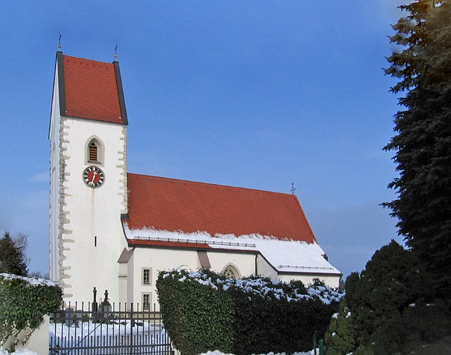
Niederneukirchen
- municipality in Austria
Hiking in Niederneukirchen
Niederneukirchen, located in Austria, offers a variety of hiking opportunities suitable for different skill levels. Nestled in the scenic landscape of Upper Austria, this area is characterized by rolling hills, lush forests, and picturesque countryside....
- Country:
- Postal Code: 4491
- Local Dialing Code: 07224
- Licence Plate Code: LL
- Coordinates: 48° 9' 39" N, 14° 20' 27" E
- GPS tracks (wikiloc): [Link]
- AboveSeaLevel: 336 м m
- Area: 21 sq km
- Population: 2073
- Web site: [Link]
Piberbach
- municipality in Austria
Hiking in Piberbach
Piberbach is a beautiful hiking area located in Austria, particularly known for its scenic landscapes and lush natural surroundings. The region offers a variety of hiking trails that cater to different skill levels, making it an ideal destination for both novice and experienced hikers....
- Country:
- Postal Code: 4533
- Local Dialing Code: 07228
- Licence Plate Code: LL
- Coordinates: 48° 6' 55" N, 14° 13' 36" E
- GPS tracks (wikiloc): [Link]
- AboveSeaLevel: 320 м m
- Area: 17 sq km
- Population: 1902
- Web site: [Link]

Hörsching
- municipality in Austria
Hiking in Hörsching
Hörsching, located in Upper Austria near Linz, offers various opportunities for hiking enthusiasts. While Hörsching itself may not have extensive hiking trails within its immediate vicinity, its location provides easy access to beautiful surrounding areas....
- Country:
- Postal Code: 4063
- Local Dialing Code: 07221
- Licence Plate Code: LL
- Coordinates: 48° 13' 36" N, 14° 10' 46" E
- GPS tracks (wikiloc): [Link]
- AboveSeaLevel: 294 м m
- Area: 20 sq km
- Population: 6062
- Web site: [Link]

Kirchberg-Thening
- municipality in Austria
Hiking in Kirchberg-Thening
Kirchberg-Thening, located in Austria, is a charming area that offers several hiking opportunities amidst picturesque landscapes. Nestled in the Upper Austrian region, it is surrounded by beautiful countryside and features a mix of wooded areas, rolling hills, and scenic views....
- Country:
- Postal Code: 4062
- Local Dialing Code: 07221
- Licence Plate Code: LL
- Coordinates: 48° 15' 53" N, 14° 9' 34" E
- GPS tracks (wikiloc): [Link]
- AboveSeaLevel: 322 м m
- Area: 16 sq km
- Population: 2364
- Web site: [Link]

Eggendorf im Traunkreis
- municipality in Austria
Hiking in Eggendorf im Traunkreis
Eggendorf im Traunkreis is a charming village located in the Traunviertel region of Austria, surrounded by beautiful landscapes that make it ideal for hiking enthusiasts. The area features a mix of gently rolling hills, lush forests, and scenic views of the surrounding mountains, providing a variety of trails suitable for different skill levels....
- Country:
- Postal Code: 4622
- Local Dialing Code: 07228
- Licence Plate Code: LL
- Coordinates: 48° 7' 54" N, 14° 8' 46" E
- GPS tracks (wikiloc): [Link]
- AboveSeaLevel: 364 м m
- Area: 9 sq km
- Population: 944
- Web site: [Link]

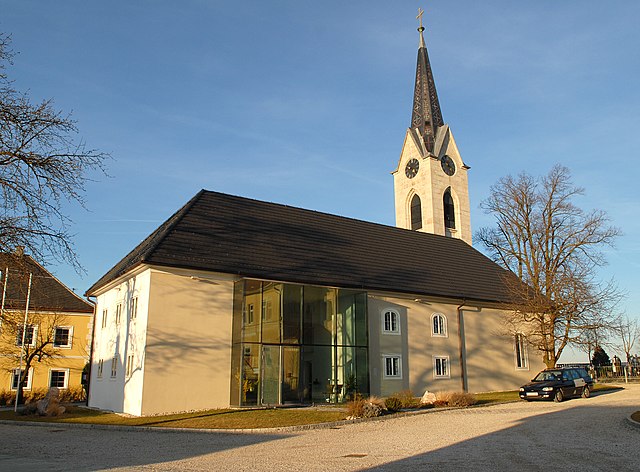
Sankt Marien
- municipality in Austria
Hiking in Sankt Marien
Sankt Marien is a picturesque area, often associated with beautiful natural landscapes suitable for hiking. While there may not be extensive information available specifically for a location named Sankt Marien (given there are several places with similar names across Europe), if we consider it to be a town or region in areas like Germany or Austria, it generally offers a variety of hiking opportunities....
- Country:
- Postal Code: 4502
- Local Dialing Code: 07227
- Licence Plate Code: LL
- Coordinates: 48° 8' 47" N, 14° 16' 32" E
- GPS tracks (wikiloc): [Link]
- AboveSeaLevel: 338 м m
- Area: 38 sq km
- Population: 4769
- Web site: [Link]

Asten
- municipality in Austria
Hiking in Asten
Asten, located in Upper Austria, is surrounded by beautiful landscapes that are ideal for hiking. The region features rolling hills, lush forests, and picturesque views of the nearby mountains, making it a great destination for outdoor enthusiasts....
- Country:
- Postal Code: 4481
- Local Dialing Code: 07224
- Licence Plate Code: LL
- Coordinates: 48° 13' 0" N, 14° 25' 0" E
- GPS tracks (wikiloc): [Link]
- AboveSeaLevel: 255 м m
- Area: 8.48 sq km
- Population: 6613
- Web site: [Link]

Kronstorf
- municipality in Austria
Hiking in Kronstorf
Kronstorf, a charming municipality in Austria's Upper Austria region, offers several picturesque hiking opportunities for outdoor enthusiasts. Nestled near the Danube River and surrounded by lush landscapes, Kronstorf serves as an excellent base for various hiking trails....
- Country:
- Postal Code: 4484
- Local Dialing Code: 07225
- Licence Plate Code: LL
- Coordinates: 48° 8' 34" N, 14° 28' 0" E
- GPS tracks (wikiloc): [Link]
- AboveSeaLevel: 277 м m
- Area: 21 sq km
- Population: 3389
- Web site: [Link]


Pucking
- municipality in Austria
Hiking in Pucking
Pucking is a small municipality in Austria, located in the upper Austrian region of Pucking. While it may not be universally recognized as a hiking hotspot, it is surrounded by beautiful landscapes that can provide opportunities for outdoor enthusiasts....
- Country:
- Postal Code: 4055
- Local Dialing Code: 07229
- Licence Plate Code: LL
- Coordinates: 48° 11' 21" N, 14° 11' 1" E
- GPS tracks (wikiloc): [Link]
- AboveSeaLevel: 286 м m
- Area: 19.81 sq km
- Population: 3904
- Web site: [Link]

Allhaming
- municipality in Austria
Hiking in Allhaming
Allhaming is a small municipality located in Austria, specifically in the state of Upper Austria. While it may not be as well-known as larger cities or national parks, the surrounding region offers opportunities for hiking that can be quite enjoyable....
- Country:
- Postal Code: 4511
- Local Dialing Code: 07227
- Licence Plate Code: LL
- Coordinates: 48° 9' 1" N, 14° 10' 2" E
- GPS tracks (wikiloc): [Link]
- AboveSeaLevel: 341 м m
- Area: 14 sq km
- Population: 1174
- Web site: [Link]

Neuhofen an der Krems
- municipality in Austria
Hiking in Neuhofen an der Krems
Neuhofen an der Krems, located in Upper Austria within the district of Linz-Land, offers a picturesque setting for hiking enthusiasts. The area is characterized by rolling hills, lush forests, and peaceful landscapes, making it an ideal destination for both casual walkers and more experienced hikers....
- Country:
- Postal Code: 4501
- Local Dialing Code: 07227
- Licence Plate Code: LL
- Coordinates: 48° 8' 1" N, 14° 14' 0" E
- GPS tracks (wikiloc): [Link]
- AboveSeaLevel: 303 м m
- Area: 18.2 sq km
- Population: 6269
- Web site: [Link]

Kematen an der Krems
- municipality in Austria
Hiking in Kematen an der Krems
Kematen an der Krems is a charming municipality located in Upper Austria, surrounded by beautiful landscapes that make it an excellent destination for hiking enthusiasts. The region features a variety of trails suited for different skill levels, including leisurely walks and more challenging hikes....
- Country:
- Postal Code: 4531
- Local Dialing Code: 07228
- Licence Plate Code: LL
- Coordinates: 48° 6' 41" N, 14° 11' 32" E
- GPS tracks (wikiloc): [Link]
- AboveSeaLevel: 327 м m
- Area: 21 sq km
- Population: 2790
- Web site: [Link]

Wilhering
- municipality in Austria
Hiking in Wilhering
Wilhering is a picturesque area located in Austria, near the city of Linz, and offers a range of hiking opportunities that combine natural beauty with cultural experiences. Here are some highlights for hiking in and around Wilhering:...
- Country:
- Postal Code: 4073
- Licence Plate Code: LL
- Coordinates: 48° 19' 26" N, 14° 11' 26" E
- GPS tracks (wikiloc): [Link]
- AboveSeaLevel: 270 м m
- Area: 30 sq km
- Population: 5911
- Web site: [Link]