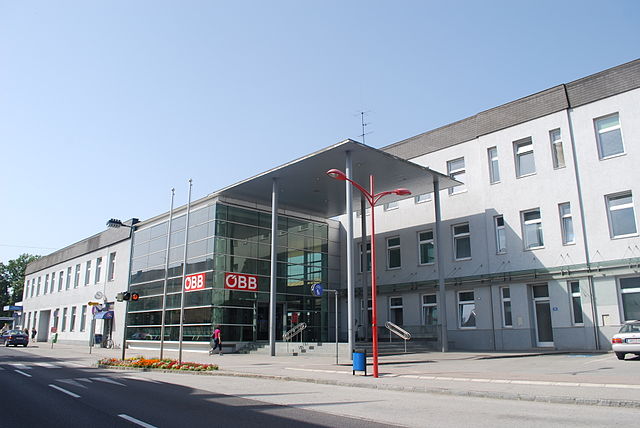
Kronstorf (Kronstorf)
- municipality in Austria
Kronstorf, a charming municipality in Austria's Upper Austria region, offers several picturesque hiking opportunities for outdoor enthusiasts. Nestled near the Danube River and surrounded by lush landscapes, Kronstorf serves as an excellent base for various hiking trails.
Hiking Trails
-
Kronstorf to the Danube: This trail leads you to the stunning banks of the Danube River. It’s relatively easy and suitable for families, allowing you to enjoy scenic views and possibly spot local wildlife.
-
Trails through the Forest: The area around Kronstorf is rich in forested areas. Trails can be found that wind through beautiful woodlands, perfect for birdwatching and enjoying the tranquility of nature.
-
Local Hills: The nearby hills provide a mix of moderate to challenging hikes, rewarding you with breathtaking panoramic views of the surrounding landscapes, including the Danube Valley.
Tips for Hiking in Kronstorf
- Weather Awareness: Always check the weather prior to your hike, as conditions can change quickly, especially in wooded or mountainous areas.
- Trail Maps: Carry a local map or use a hiking app to navigate. Some trails may not be well-marked.
- Proper Gear: Wear sturdy hiking boots and appropriate clothing, and bring plenty of water and snacks.
- Respect Nature: Follow the Leave No Trace principles to preserve the beauty of the natural environment.
Accessibility
Kronstorf is accessible by public transport, making it convenient for day trips. The region is also known for its bike-friendly paths, so consider exploring both on foot and by bike for a fuller experience.
Nearby Attractions
After hiking, you might want to explore local attractions such as historic sites and cultural landmarks in the town itself or venture a bit further to nearby towns along the Danube.
Overall, Kronstorf is a wonderful spot for hikers of all skill levels, offering a mix of nature and accessibility that can lead to a rewarding outdoor experience.
- Country:

- Postal Code: 4484
- Local Dialing Code: 07225
- Licence Plate Code: LL
- Coordinates: 48° 8' 34" N, 14° 28' 0" E


- GPS tracks (wikiloc): [Link]
- AboveSeaLevel: 277 м m
- Area: 21 sq km
- Population: 3389
- Web site: http://www.kronstorf.at/
- Wikipedia en: wiki(en)
- Wikipedia: wiki(de)
- Wikidata storage: Wikidata: Q680424
- Wikipedia Commons Category: [Link]
- Freebase ID: [/m/03gv6k4]
- GeoNames ID: Alt: [7872054]
- VIAF ID: Alt: [240101435]
- GND ID: Alt: [4682086-3]
- archINFORM location ID: [10334]
- WOEID: [545697]
- Austrian municipality key: [41011]
Shares border with regions:

Enns
- municipality in Austria
Enns, a town in Austria, is situated in the stunning region of Upper Austria and is known for its rich history and beautiful landscapes. While it may not be as prominent as some larger tourist destinations, it offers a fantastic opportunity for hiking and enjoying nature in a more tranquil setting. Here are some aspects to consider if you're interested in hiking around Enns:...
- Country:

- Postal Code: 4470
- Local Dialing Code: 07223
- Licence Plate Code: LL
- Coordinates: 48° 13' 0" N, 14° 28' 30" E


- GPS tracks (wikiloc): [Link]
- AboveSeaLevel: 281 м m
- Area: 33.27 sq km
- Population: 11523
- Web site: [Link]

St. Valentin
- municipality in Austria
St. Valentin, located in the province of South Tyrol in northern Italy, offers a variety of hiking opportunities that cater to different skill levels and preferences. Nestled in the scenic Val d’Isarco, St. Valentin is surrounded by lush landscapes and beautiful mountain scenery. Here are some key points about hiking in the area:...
- Country:

- Local Dialing Code: 07435
- Licence Plate Code: AM
- Coordinates: 48° 10' 29" N, 14° 32' 0" E


- GPS tracks (wikiloc): [Link]
- AboveSeaLevel: 272 м m
- Area: 45.64 sq km
- Population: 9340
- Web site: [Link]

Hargelsberg
- municipality in Austria
Hargelsberg, located in Austria, is a charming destination for hiking enthusiasts. Nestled in the picturesque landscape of the Upper Austria region, it offers a variety of trails that cater to different skill levels, from leisurely walks to more challenging hikes....
- Country:

- Postal Code: 4483
- Local Dialing Code: 07225
- Licence Plate Code: LL
- Coordinates: 48° 9' 0" N, 14° 25' 32" E


- GPS tracks (wikiloc): [Link]
- AboveSeaLevel: 324 м m
- Area: 18 sq km
- Population: 1371
- Web site: [Link]
Ernsthofen
- municipality in Austria
Ernsthofen is a small village located in Austria, specifically in the Lower Austria region. While it may not be as well-known as some of the larger hiking destinations in the country, it offers some beautiful surrounding landscapes and can be a peaceful spot for hiking enthusiasts....
- Country:

- Local Dialing Code: 07435
- Licence Plate Code: AM
- Coordinates: 48° 7' 40" N, 14° 28' 57" E


- GPS tracks (wikiloc): [Link]
- AboveSeaLevel: 284 м m
- Area: 19.20 sq km
- Population: 2230
- Web site: [Link]
Haidershofen
- municipality in Austria
Haidershofen, a small village located in Austria, is surrounded by beautiful natural landscapes that make it an excellent destination for hiking enthusiasts. Here are some aspects you might consider when planning a hike in Haidershofen:...
- Country:

- Postal Code: 4431
- Licence Plate Code: AM
- Coordinates: 48° 4' 36" N, 14° 27' 35" E


- GPS tracks (wikiloc): [Link]
- AboveSeaLevel: 285 м m
- Area: 32.04 sq km
- Population: 3670
- Web site: [Link]

Dietach
- municipality in Austria
Dietach is a small town located in Upper Austria, near the city of Steyr. It's surrounded by beautiful landscapes and various hiking opportunities, making it a great spot for outdoor enthusiasts....
- Country:

- Postal Code: 4407
- Local Dialing Code: 07252
- Licence Plate Code: SE
- Coordinates: 48° 5' 31" N, 14° 24' 58" E


- GPS tracks (wikiloc): [Link]
- AboveSeaLevel: 313 м m
- Area: 2062 sq km
- Population: 3126
- Web site: [Link]
