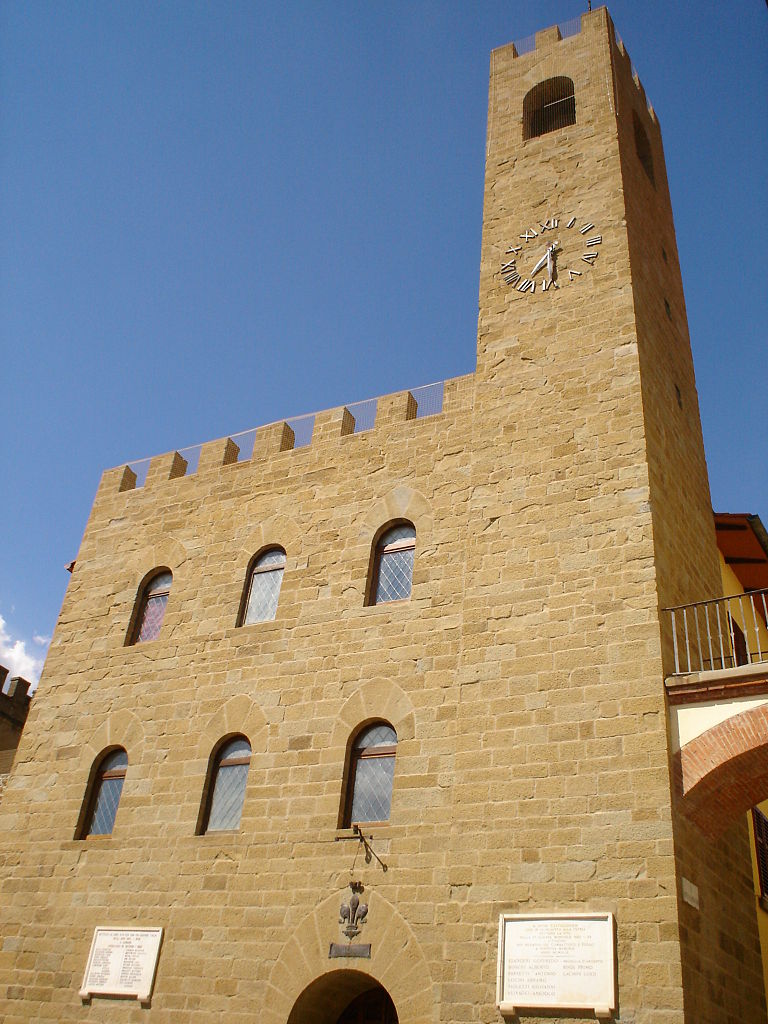
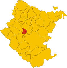
Loro Ciuffenna (Loro Ciuffenna)
.svg)
- Italian comune
 Hiking in Loro Ciuffenna
Loro Ciuffenna, a picturesque village located in the Tuscany region of Italy, offers a range of beautiful hiking opportunities for outdoor enthusiasts. Nestled in the Chianti area, it provides stunning views of the surrounding hills, lush landscapes, and historical landmarks. Here are some highlights for hiking in Loro Ciuffenna:
Trails and Scenic Routes:
-
The Aretina Trail:
- This trail connects Loro Ciuffenna to nearby areas and offers a mix of panoramic views and woodland paths. It’s a great option for both beginners and experienced hikers.
-
Vallombrosa Forest:
- Not far from Loro Ciuffenna, the Vallombrosa area features trails that weave through dense forests and showcase the beauty of the Tuscan landscape. The area is famous for its abbey and rich biodiversity.
-
Pratomagno:
- The nearby Pratomagno mountain range offers various hiking routes that lead to stunning viewpoints. The elevation gain may be challenging, but the vistas are well worth the effort.
-
Historical Paths:
- Explore ancient paths used by locals, featuring charming stone bridges and medieval architecture. These routes not only provide a connection to nature but also a glimpse into the region's history.
Tips for Hiking in Loro Ciuffenna:
-
Best Time to Hike: Spring (April to June) and fall (September to October) are ideal for hiking due to milder temperatures and beautiful scenery.
-
Gear: Wear sturdy hiking boots, dress in layers, and carry a backpack with water, snacks, and a first-aid kit. Trekking poles can be helpful on uneven terrain.
-
Local Guidance: Consider hiring a local guide or joining a hiking group for insights into the area’s flora, fauna, and history.
-
Respect Nature: Follow Leave No Trace principles. Stay on marked trails and be mindful of wildlife and local regulations.
-
Cultural Spots: Don’t miss the chance to explore the village of Loro Ciuffenna itself, which features charming architecture, local eateries, and the historic Pieve di San Giovanni Battista.
Overall, hiking in Loro Ciuffenna can be a rewarding experience surrounded by the natural beauty and rich culture of Tuscany. Enjoy your hike!
- Country:

- Postal Code: 52024
- Local Dialing Code: 055
- Licence Plate Code: AR
- Coordinates: 43° 35' 12" N, 11° 37' 43" E


- GPS tracks (wikiloc): [Link]
- AboveSeaLevel: 330 м m
- Area: 86.52 sq km
- Population: 5862
- Web site: http://www.comune.loro-ciuffenna.ar.it
- Wikipedia en: wiki(en)
- Wikipedia: wiki(it)
- Wikidata storage: Wikidata: Q52083
- Wikipedia Commons Gallery: [Link]
- Wikipedia Commons Category: [Link]
- Freebase ID: [/m/0gm06d]
- GeoNames ID: Alt: [6538589]
- VIAF ID: Alt: [245413911]
- OSM relation ID: [42514]
- GND ID: Alt: [4622096-3]
- UN/LOCODE: [ITLC4]
- ISTAT ID: 051020
- Italian cadastre code: E693
Shares border with regions:


Castel Focognano
- Italian comune
Hiking in Castel Focognano
Castel Focognano is a charming area located in the Tuscany region of Italy, known for its beautiful landscapes and hiking opportunities. Nestled in the Casentino Valley, this location is surrounded by nature, with trails that lead through picturesque forests, rolling hills, and offer stunning views of the surrounding countryside....
- Country:
- Postal Code: 52016
- Local Dialing Code: 0575
- Licence Plate Code: AR
- Coordinates: 43° 39' 12" N, 11° 47' 17" E
- GPS tracks (wikiloc): [Link]
- AboveSeaLevel: 310 м m
- Area: 56.63 sq km
- Population: 3093
- Web site: [Link]


Castel San Niccolò
- Italian comune
Hiking in Castel San Niccolò
Castel San Niccolò is a charming town located in the Casentino Valley in Tuscany, Italy. It's surrounded by picturesque landscapes and offers a variety of hiking opportunities, appealing to both seasoned hikers and casual walkers. Here are some key points to consider if you're planning a hike in the area:...
- Country:
- Postal Code: 52010; 52018
- Local Dialing Code: 0575
- Licence Plate Code: AR
- Coordinates: 43° 44' 43" N, 11° 42' 36" E
- GPS tracks (wikiloc): [Link]
- AboveSeaLevel: 380 м m
- Area: 83.27 sq km
- Population: 2667
- Web site: [Link]
Castiglion Fibocchi
- Italian comune
Hiking in Castiglion Fibocchi
Castiglion Fibocchi is a charming hillside village located in the province of Arezzo, in the Tuscany region of Italy. This area is characterized by picturesque landscapes, rolling hills, olive groves, and vineyards, making it an excellent destination for hiking enthusiasts....
- Country:
- Postal Code: 52029
- Local Dialing Code: 0575
- Licence Plate Code: AR
- Coordinates: 43° 31' 44" N, 11° 45' 49" E
- GPS tracks (wikiloc): [Link]
- AboveSeaLevel: 300 м m
- Area: 25.68 sq km
- Population: 2147
- Web site: [Link]


Ortignano Raggiolo
- Italian comune
Hiking in Ortignano Raggiolo
Ortignano Raggiolo is a charming village located in the Tuscany region of Italy, nestled in the Casentino Forests area. It offers a variety of hiking opportunities amid stunning landscapes characterized by picturesque hills, dense forests, and beautiful vistas. Here are some highlights and tips for hiking in and around Ortignano Raggiolo:...
- Country:
- Postal Code: 52010
- Local Dialing Code: 0575
- Licence Plate Code: AR
- Coordinates: 43° 40' 51" N, 11° 44' 59" E
- GPS tracks (wikiloc): [Link]
- AboveSeaLevel: 483 м m
- Area: 36.3 sq km
- Population: 881
- Web site: [Link]


Talla
- Italian comune
Hiking in Talla
Talla is a beautiful area located in the Scottish Borders, known for its stunning landscapes and diverse hiking opportunities. It features rolling hills, scenic moorlands, and picturesque reservoirs, making it ideal for outdoor enthusiasts. Here are some key points to consider if you're planning a hike in Talla:...
- Country:
- Postal Code: 52010
- Local Dialing Code: 0575
- Licence Plate Code: AR
- Coordinates: 43° 36' 10" N, 11° 47' 17" E
- GPS tracks (wikiloc): [Link]
- AboveSeaLevel: 348 м m
- Area: 59.89 sq km
- Population: 1026
- Web site: [Link]


Terranuova Bracciolini
- Italian comune
Hiking in Terranuova Bracciolini
Terranuova Bracciolini, located in the Tuscany region of Italy, offers a beautiful and diverse landscape for hiking enthusiasts. Nestled inside the Valdarno valley and surrounded by hills, it provides a range of trails ideal for various skill levels, from gentle walks to more challenging hikes....
- Country:
- Postal Code: 52028
- Local Dialing Code: 055
- Licence Plate Code: AR
- Coordinates: 43° 33' 11" N, 11° 35' 22" E
- GPS tracks (wikiloc): [Link]
- AboveSeaLevel: 156 м m
- Area: 85.88 sq km
- Population: 12292
- Web site: [Link]