Louit (Louit)

- commune in Hautes-Pyrénées, France
- Country:

- Postal Code: 65350
- Coordinates: 43° 18' 10" N, 0° 9' 21" E


- GPS tracks (wikiloc): [Link]
- Area: 5.04 sq km
- Population: 200
- Wikipedia en: wiki(en)
- Wikipedia: wiki(fr)
- Wikidata storage: Wikidata: Q1599868
- Wikipedia Commons Category: [Link]
- Freebase ID: [/m/03nv60s]
- Freebase ID: [/m/03nv60s]
- GeoNames ID: Alt: [6440812]
- GeoNames ID: Alt: [6440812]
- SIREN number: [216502856]
- SIREN number: [216502856]
- BnF ID: [15270665w]
- BnF ID: [15270665w]
- INSEE municipality code: 65285
- INSEE municipality code: 65285
Shares border with regions:


Bouilh-Péreuilh
- commune in Hautes-Pyrénées, France
- Country:
- Postal Code: 65350
- Coordinates: 43° 18' 25" N, 0° 11' 15" E
- GPS tracks (wikiloc): [Link]
- Area: 7.85 sq km
- Population: 87


Collongues
- commune in Hautes-Pyrénées, France
- Country:
- Postal Code: 65350
- Coordinates: 43° 17' 16" N, 0° 9' 44" E
- GPS tracks (wikiloc): [Link]
- Area: 2.14 sq km
- Population: 151


Soréac
- commune in Hautes-Pyrénées, France
- Country:
- Postal Code: 65350
- Coordinates: 43° 18' 48" N, 0° 9' 31" E
- GPS tracks (wikiloc): [Link]
- Area: 2.31 sq km
- Population: 56

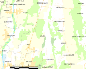
Dours
- commune in Hautes-Pyrénées, France
- Country:
- Postal Code: 65350
- Coordinates: 43° 17' 45" N, 0° 8' 19" E
- GPS tracks (wikiloc): [Link]
- Area: 4.99 sq km
- Population: 230


Sabalos
- commune in Hautes-Pyrénées, France
- Country:
- Postal Code: 65350
- Coordinates: 43° 17' 7" N, 0° 8' 22" E
- GPS tracks (wikiloc): [Link]
- Area: 2.2 sq km
- Population: 150