Louvigné-de-Bais (Louvigné-de-Bais)

- commune in Ille-et-Vilaine, France
- Country:

- Postal Code: 35680
- Coordinates: 48° 2' 55" N, 1° 19' 50" E


- GPS tracks (wikiloc): [Link]
- Area: 15.37 sq km
- Population: 1845
- Web site: http://www.louvignedebais.com
- Wikipedia en: wiki(en)
- Wikipedia: wiki(fr)
- Wikidata storage: Wikidata: Q549380
- Wikipedia Commons Category: [Link]
- Freebase ID: [/m/03m9x2k]
- Freebase ID: [/m/03m9x2k]
- Freebase ID: [/m/03m9x2k]
- GeoNames ID: Alt: [6432738]
- GeoNames ID: Alt: [6432738]
- GeoNames ID: Alt: [6432738]
- SIREN number: [213501612]
- SIREN number: [213501612]
- SIREN number: [213501612]
- BnF ID: [15257105x]
- BnF ID: [15257105x]
- BnF ID: [15257105x]
- OSM relation ID: [134315]
- OSM relation ID: [134315]
- OSM relation ID: [134315]
- INSEE municipality code: 35161
- INSEE municipality code: 35161
- INSEE municipality code: 35161
- GNS Unique Feature ID: -1448078
- GNS Unique Feature ID: -1448078
- GNS Unique Feature ID: -1448078
Shares border with regions:

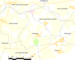
Cornillé
- commune in Ille-et-Vilaine, France
- Country:
- Postal Code: 35500
- Coordinates: 48° 4' 49" N, 1° 18' 25" E
- GPS tracks (wikiloc): [Link]
- AboveSeaLevel: 85 м m
- Area: 12.47 sq km
- Population: 969


Domagné
- commune in Ille-et-Vilaine, France
- Country:
- Postal Code: 35113
- Coordinates: 48° 4' 13" N, 1° 23' 29" E
- GPS tracks (wikiloc): [Link]
- Area: 29 sq km
- Population: 2290
- Web site: [Link]


Torcé
- commune in Ille-et-Vilaine, France
- Country:
- Postal Code: 35370
- Coordinates: 48° 3' 42" N, 1° 15' 57" E
- GPS tracks (wikiloc): [Link]
- Area: 14.03 sq km
- Population: 1190
- Web site: [Link]


Bais
- commune in Ille-et-Vilaine, France
- Country:
- Postal Code: 35680
- Coordinates: 48° 0' 38" N, 1° 17' 26" E
- GPS tracks (wikiloc): [Link]
- Area: 35.18 sq km
- Population: 2354


Saint-Didier
- commune in Ille-et-Vilaine, France
- Country:
- Postal Code: 35220
- Coordinates: 48° 5' 41" N, 1° 22' 18" E
- GPS tracks (wikiloc): [Link]
- Area: 14.14 sq km
- Population: 1990
- Web site: [Link]