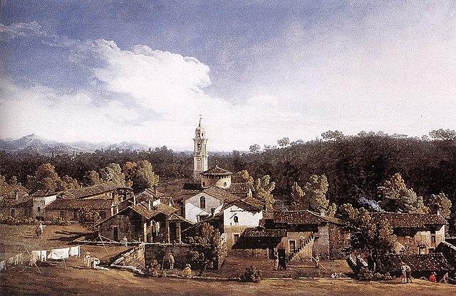
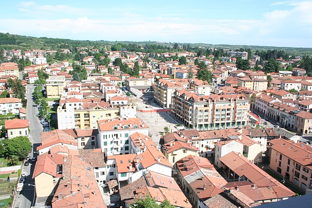
Lozza (Lozza)
- Italian comune
Lozza is a small town located in the province of Como in northern Italy, close to the scenic Lake Como. While it may not be a widely recognized hiking destination, the surrounding region offers plenty of beautiful trails and outdoor opportunities.
Hiking Opportunities Near Lozza:
-
Monte Barro Regional Park: Just a short drive from Lozza, this park offers various trails suitable for different skill levels. The views from the top are stunning, overlooking Lake Como and the surrounding mountains.
-
The Greenway of Lake Como: This is a more leisurely hike that runs along the western shore of Lake Como. It provides stunning views of the lake and surrounding hillside villas. The trail connects several charming towns and is perfect for a half-day outing.
-
Sentiero del Viandante: A historic trail that runs along the eastern side of Lake Como. It stretches for about 45 kilometers and has sections that pass through Lozza, providing hikers with a mix of scenic views, historical landmarks, and local culture.
-
Valle Intelvi: Located a bit further from Lozza, this valley is known for its trails that lead through lush landscapes and offer both easy and challenging hikes. This area provides a great opportunity to explore local flora and fauna.
Hiking Tips:
-
Best Time to Hike: The best seasons for hiking in this region are spring (April to June) and fall (September to October), when the weather is generally mild and the landscapes are vibrant.
-
Equipment: Make sure to wear good hiking shoes, carry plenty of water, and pack some snacks. A hiking pole can also be helpful, especially on steep trails.
-
Navigation: While many trails are well-marked, carrying a map or using a hiking app can help keep you oriented, especially if you plan to venture off the more popular paths.
-
Local Regulations: Always check for any local regulations or trail conditions before heading out, especially during wet weather or in the winter months when some paths may be closed.
Overall, although Lozza itself may not be the primary hiking destination, it serves as a great base for accessing numerous beautiful hiking trails in the surrounding areas of Lake Como and the northern Italian Alps. Happy hiking!
- Country:

- Postal Code: 21040
- Local Dialing Code: 0332
- Licence Plate Code: VA
- Coordinates: 45° 47' 0" N, 8° 51' 0" E


- GPS tracks (wikiloc): [Link]
- AboveSeaLevel: 350 м m
- Area: 1.71 sq km
- Population: 1246
- Web site: http://www.comune.lozza.va.it/
- Wikipedia en: wiki(en)
- Wikipedia: wiki(it)
- Wikidata storage: Wikidata: Q39522
- Wikipedia Commons Category: [Link]
- Freebase ID: [/m/0ghz8x]
- GeoNames ID: Alt: [6542466]
- OSM relation ID: [46077]
- UN/LOCODE: [ITLOZ]
- ISTAT ID: 012091
- Italian cadastre code: E707
Shares border with regions:
Vedano Olona
- Italian comune
Vedano Olona is a charming town located in the Lombardy region of Italy, and it is surrounded by beautiful natural landscapes that can provide hikers with a variety of trails and outdoor experiences. Here’s what you need to know about hiking in and around Vedano Olona:...
- Country:

- Postal Code: 21040
- Local Dialing Code: 0332
- Licence Plate Code: VA
- Coordinates: 45° 46' 37" N, 8° 53' 13" E


- GPS tracks (wikiloc): [Link]
- AboveSeaLevel: 360 м m
- Area: 7.08 sq km
- Population: 7425
- Web site: [Link]


Castiglione Olona
- Italian comune
Castiglione Olona, located in the Lombardy region of Italy, is a small but charming municipality known for its rich history and picturesque landscapes. While it may not be as widely recognized for hiking as some other Italian destinations, it offers beautiful trails and opportunities to enjoy nature, local culture, and scenic views....
- Country:

- Postal Code: 21043
- Local Dialing Code: 0331
- Licence Plate Code: VA
- Coordinates: 45° 45' 11" N, 8° 52' 28" E


- GPS tracks (wikiloc): [Link]
- AboveSeaLevel: 307 м m
- Area: 6.9 sq km
- Population: 7669
- Web site: [Link]


Morazzone
- Italian comune
Morazzone, located in the Lombardy region of Italy, is surrounded by beautiful landscapes and offers various hiking opportunities. Nestled between the provinces of Varese and Como, it features scenic trails that appeal to hikers of all levels, from beginners to more experienced adventurers. Here are some aspects to consider if you're planning to hike in Morazzone:...
- Country:

- Postal Code: 21040
- Local Dialing Code: 0332
- Licence Plate Code: VA
- Coordinates: 45° 46' 0" N, 8° 50' 0" E


- GPS tracks (wikiloc): [Link]
- AboveSeaLevel: 432 м m
- Area: 5.6 sq km
- Population: 4287
- Web site: [Link]


Gazzada Schianno
- Italian comune
Gazzada Schianno is located in the Lombardy region of Italy, nestled within the beautiful Varese province. This area is known for its picturesque landscapes, charming villages, and access to nature, making it a fantastic spot for hiking enthusiasts....
- Country:

- Postal Code: 21045
- Local Dialing Code: 0332
- Licence Plate Code: VA
- Coordinates: 45° 47' 0" N, 8° 49' 0" E


- GPS tracks (wikiloc): [Link]
- AboveSeaLevel: 368 м m
- Area: 4.84 sq km
- Population: 4632
- Web site: [Link]


Malnate
- Italian comune
Malnate is a charming town in the Lombardy region of Italy, close to the Swiss border. While the town itself may not be known for extensive hiking trails, its location near the Prealps and the surrounding natural scenery offers some beautiful hiking opportunities in the nearby areas....
- Country:

- Postal Code: 21046
- Local Dialing Code: 0332
- Licence Plate Code: VA
- Coordinates: 45° 48' 0" N, 8° 53' 0" E


- GPS tracks (wikiloc): [Link]
- AboveSeaLevel: 355 м m
- Area: 9 sq km
- Population: 16784
- Web site: [Link]


Varese
- Italian comune
Varese, located in the Lombardy region of northern Italy, is a beautiful area for hiking enthusiasts. Nestled near the foothills of the Alps and surrounded by picturesque landscapes, Varese offers a variety of trails that cater to all skill levels. Here are some key highlights about hiking in Varese:...
- Country:

- Postal Code: 21100
- Local Dialing Code: 0332
- Licence Plate Code: VA
- Coordinates: 45° 49' 0" N, 8° 50' 0" E


- GPS tracks (wikiloc): [Link]
- AboveSeaLevel: 382 м m
- Area: 54.84 sq km
- Population: 80629
- Web site: [Link]

