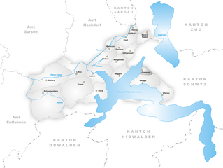
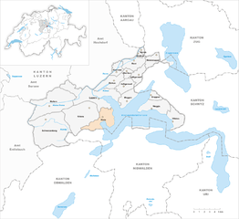
Luzern-Land Constituency (Wahlkreis Luzern-Land)
- district in Switzerland
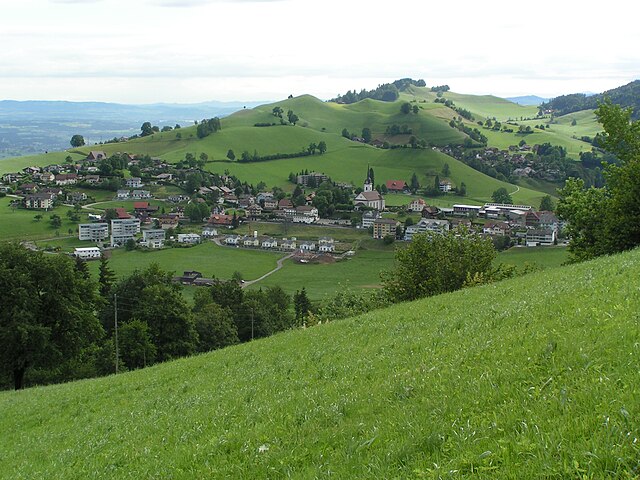
 Hiking in Luzern-Land Constituency
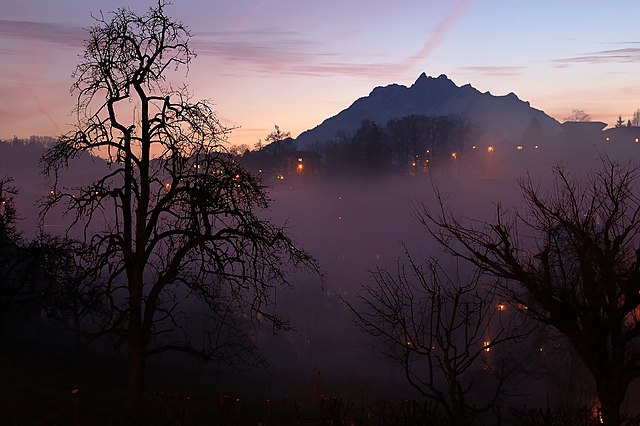
The Lucerne-Land District, located in the beautiful region surrounding the city of Lucerne in Switzerland, offers a range of stunning hiking trails that cater to various skill levels and preferences. The area is blessed with breathtaking landscapes, lush forests, serene lakes, and picturesque villages, making it an ideal destination for hiking enthusiasts.
Popular Hiking Trails
-
Rigi: Dubbed the "Queen of the Mountains," Rigi offers numerous hiking trails with panoramic views of the Swiss Alps and surrounding lakes. The Rigi Summit trail is a must-do for its stunning vistas.
-
Pilatus: Known for its steep terrain and dramatic landscapes, Pilatus has a variety of trails, including easier paths suitable for families. The hike up to the summit rewards you with incredible views of Lake Lucerne and the surrounding mountains.
-
Mt. Bürgenstock: This area offers several well-marked hiking trails that provide stunning views of Lake Lucerne and the surrounding Alps. The trails vary in difficulty, making it accessible to both experienced hikers and novices.
-
Hiking around Lake Lucerne: The lakeside paths are perfect for leisurely walks, offering gentle slopes and beautiful scenery. The route from Lucerne to Weggis is especially popular and provides picturesque views of the lake and mountains.
Tips for Hiking in Lucerne-Land District
-
Weather Preparedness: Weather can change rapidly in the mountains, so always check the forecast before heading out and be prepared with appropriate clothing and gear.
-
Trail Difficulty: Familiarize yourself with the trail ratings (easy, moderate, difficult) and choose hikes that match your experience level.
-
Stay Hydrated and Nourished: Carry enough water and snacks to keep your energy levels up during longer hikes.
-
Respect Nature: Stay on marked trails, take your litter with you, and respect wildlife to preserve the beauty of the area.
-
Local Maps and Resources: Utilize local maps and guides, or consider visiting a tourist information center in Lucerne for trail recommendations and resources.
Accessibility
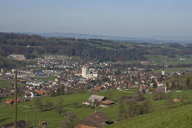
The Lucerne-Land District is easily accessible by public transport, allowing hikers to reach starting points for various trails without a car. The local transport system is well-connected, with buses and trains that lead to popular hiking areas.
Conclusion
Hiking in the Lucerne-Land District combines stunning natural beauty with a rich cultural experience. Whether you’re looking for challenging trails or peaceful lakeside walks, this region offers something for every hiker. Don't forget to enjoy the views and take plenty of photographs to capture the memories!
- Country:

- Licence Plate Code: LU
- Coordinates: 47° 10' 0" N, 8° 10' 0" E


- GPS tracks (wikiloc): [Link]
- AboveSeaLevel: 523 м m
- Area: 230.86 sq km
- Wikipedia en: wiki(en)
- Wikipedia: wiki(de)
- Wikidata storage: Wikidata: Q2540080
- GeoNames ID: Alt: [8718162]
Includes regions:

Adligenswil
- municipality in the canton of Lucerne, Switzerland
Hiking in Adligenswil
Adligenswil is a charming municipality located near Lucerne, Switzerland, and offers a variety of hiking opportunities that cater to different skill levels. The region is characterized by its stunning natural landscapes, including rolling hills, forests, and views of Lake Lucerne and the surrounding mountains....
- Country:
- Postal Code: 6043
- Local Dialing Code: 041
- Licence Plate Code: LU
- Coordinates: 47° 4' 20" N, 8° 22' 6" E
- GPS tracks (wikiloc): [Link]
- AboveSeaLevel: 569 м m
- Area: 6.99 sq km
- Population: 5343
- Web site: [Link]


Dierikon
- municipality in the canton of Lucerne, Switzerland
Hiking in Dierikon
Dierikon is a small community located in the canton of Lucerne in Switzerland, surrounded by beautiful natural scenery, making it an excellent destination for hiking enthusiasts. Here are some things you can expect when hiking in and around Dierikon:...
- Country:
- Postal Code: 6036
- Local Dialing Code: 041
- Licence Plate Code: LU
- Coordinates: 47° 5' 49" N, 8° 22' 17" E
- GPS tracks (wikiloc): [Link]
- AboveSeaLevel: 429 м m
- Area: 2.78 sq km
- Population: 1503
- Web site: [Link]


Ebikon
- municipality in the canton of Lucerne, Switzerland
Hiking in Ebikon
Ebikon is a picturesque town located in the canton of Lucerne in Switzerland, nestled alongside Lake Lucerne and surrounded by stunning mountains, making it an excellent destination for hiking enthusiasts. Here are some highlights of hiking in and around Ebikon:...
- Country:
- Postal Code: 6030
- Local Dialing Code: 041
- Licence Plate Code: LU
- Coordinates: 47° 4' 42" N, 8° 19' 53" E
- GPS tracks (wikiloc): [Link]
- AboveSeaLevel: 418 м m
- Area: 9.68 sq km
- Population: 13531
- Web site: [Link]


Gisikon
- municipality in the canton of Lucerne, Switzerland
Hiking in Gisikon
Gisikon is a charming village located in Switzerland, known for its beautiful landscapes and proximity to both nature and urban areas. Hiking in and around Gisikon offers a unique blend of scenic views, diverse trails, and opportunities to experience the local Swiss culture....
- Country:
- Postal Code: 6038
- Local Dialing Code: 041
- Licence Plate Code: LU
- Coordinates: 47° 7' 26" N, 8° 23' 53" E
- GPS tracks (wikiloc): [Link]
- AboveSeaLevel: 418 м m
- Area: 1.08 sq km
- Population: 1331
- Web site: [Link]

Greppen
- municipality in the canton of Lucerne, Switzerland
Hiking in Greppen
Greppen is a picturesque village located in the Canton of Lucerne, Switzerland, nestled along the shores of Lake Zug and surrounded by stunning natural landscapes. It's an excellent destination for hiking enthusiasts of all skill levels, offering a variety of trails that showcase the area's breathtaking views, lush forests, and charming countryside....
- Country:
- Postal Code: 6404
- Local Dialing Code: 041
- Licence Plate Code: LU
- Coordinates: 47° 3' 18" N, 8° 25' 46" E
- GPS tracks (wikiloc): [Link]
- AboveSeaLevel: 449 м m
- Area: 5.25 sq km
- Population: 1075
- Web site: [Link]
Honau
- municipality in the canton of Lucerne, Switzerland
Hiking in Honau
Honau, Switzerland, is a charming village nestled in the beautiful landscape of the Swiss Alps. While it might not be as widely known as some of the larger Swiss hiking destinations, it offers a variety of scenic trails and outdoor activities that cater to various skill levels....
- Country:
- Postal Code: 6038
- Local Dialing Code: 041
- Licence Plate Code: LU
- Coordinates: 47° 7' 59" N, 8° 24' 22" E
- GPS tracks (wikiloc): [Link]
- AboveSeaLevel: 445 м m
- Area: 1.25 sq km
- Population: 391
- Web site: [Link]

Horw
- municipality in the canton of Lucerne, Switzerland
Hiking in Horw
Horw is a picturesque municipality located in the canton of Lucerne, Switzerland, known for its stunning natural landscapes and proximity to the Swiss Alps. Hiking in and around Horw offers a variety of trails suited for different skill levels, making it an excellent destination for both novice and experienced hikers....
- Country:
- Postal Code: 6048
- Local Dialing Code: 041
- Licence Plate Code: LU
- Coordinates: 47° 0' 48" N, 8° 18' 39" E
- GPS tracks (wikiloc): [Link]
- AboveSeaLevel: 438 м m
- Area: 20.43 sq km
- Population: 13915
- Web site: [Link]


Kriens
- municipality in the canton of Lucerne, Switzerland
Hiking in Kriens
Kriens is a charming municipality located in the canton of Lucerne in Switzerland, nestled at the foot of the majestic Pilatus mountain range. It offers a variety of hiking opportunities suitable for different skill levels. Here are some highlights and recommendations for hiking in and around Kriens:...
- Country:
- Postal Code: 6010
- Local Dialing Code: 041
- Licence Plate Code: LU
- Coordinates: 47° 1' 15" N, 8° 15' 32" E
- GPS tracks (wikiloc): [Link]
- AboveSeaLevel: 843 м m
- Area: 27.31 sq km
- Population: 26997
- Web site: [Link]

Malters
- municipality in the canton of Lucerne, Switzerland
Hiking in Malters
Malters is a charming municipality located in the canton of Lucerne, Switzerland. It’s nestled in the foothills of the Swiss Alps and offers a variety of hiking opportunities that cater to different skill levels....
- Country:
- Postal Code: 6102
- Local Dialing Code: 041
- Licence Plate Code: LU
- Coordinates: 47° 2' 34" N, 8° 11' 24" E
- GPS tracks (wikiloc): [Link]
- AboveSeaLevel: 490 м m
- Area: 28.57 sq km
- Population: 7231
- Web site: [Link]


Meggen
- municipality in the canton of Lucerne, Switzerland
Hiking in Meggen
Meggen is a picturesque village located in the Canton of Lucerne in Switzerland, offering stunning views over Lake Lucerne and the surrounding mountains. Here are some aspects of hiking in and around Meggen that you might find interesting:...
- Country:
- Postal Code: 6045
- Local Dialing Code: 041
- Licence Plate Code: LU
- Coordinates: 47° 2' 47" N, 8° 22' 28" E
- GPS tracks (wikiloc): [Link]
- AboveSeaLevel: 479 м m
- Area: 13.93 sq km
- Population: 7138
- Web site: [Link]


Meierskappel
- municipality in the canton of Lucerne, Switzerland
Hiking in Meierskappel
Meierskappel is a picturesque village located in the canton of Lucerne, Switzerland, which offers a variety of hiking opportunities amidst beautiful landscapes. The area is characterized by its rolling hills, lush forests, and stunning views of the surrounding mountains and the nearby Lake Lucerne....
- Country:
- Postal Code: 6344
- Local Dialing Code: 041
- Licence Plate Code: LU
- Coordinates: 47° 7' 32" N, 8° 26' 39" E
- GPS tracks (wikiloc): [Link]
- AboveSeaLevel: 487 м m
- Area: 9.23 sq km
- Population: 1369
- Web site: [Link]


Root
- municipality in the canton of Lucerne, Switzerland
Hiking in Root
Root, Switzerland, is located in the canton of Luzern and offers beautiful hiking opportunities, characterized by scenic views, lush landscapes, and a variety of trails suitable for different skill levels. Here are some highlights for hiking in and around Root:...
- Country:
- Postal Code: 6037
- Local Dialing Code: 041
- Licence Plate Code: LU
- Coordinates: 47° 6' 57" N, 8° 23' 29" E
- GPS tracks (wikiloc): [Link]
- AboveSeaLevel: 422 м m
- Area: 8.65 sq km
- Population: 4995
- Web site: [Link]

Schwarzenberg
- municipality in the canton of Lucerne, Switzerland
Hiking in Schwarzenberg
Schwarzenberg, nestled in the beautiful Lucerne region of Switzerland, offers a variety of hiking opportunities that cater to different skill levels and preferences. The area is known for its stunning landscapes, characterized by rolling hills, lush forests, and picturesque views of the surrounding mountains....
- Country:
- Postal Code: 6103
- Local Dialing Code: 041
- Licence Plate Code: LU
- Coordinates: 47° 0' 51" N, 8° 10' 24" E
- GPS tracks (wikiloc): [Link]
- AboveSeaLevel: 838 м m
- Area: 39.31 sq km
- Population: 1690
- Web site: [Link]


Udligenswil
- municipality in the canton of Lucerne, Switzerland
Hiking in Udligenswil
Udligenswil is a charming municipality located in the canton of Lucerne, Switzerland, surrounded by beautiful landscapes and scenic views. Hiking in this region can be a delightful experience, as it offers a mix of easy walks and more challenging trails suitable for various skill levels....
- Country:
- Postal Code: 6044
- Local Dialing Code: 041
- Licence Plate Code: LU
- Coordinates: 47° 5' 28" N, 8° 23' 59" E
- GPS tracks (wikiloc): [Link]
- AboveSeaLevel: 624 м m
- Area: 6.25 sq km
- Population: 2279
- Web site: [Link]


Vitznau
- municipality in the canton of Lucerne, Switzerland
Hiking in Vitznau
Vitznau is a picturesque village situated on the shores of Lake Lucerne in Switzerland, surrounded by stunning mountains, making it an excellent destination for hiking enthusiasts. Here are some highlights for hiking in the Vitznau area:...
- Country:
- Postal Code: 6354
- Local Dialing Code: 041
- Licence Plate Code: LU
- Coordinates: 47° 1' 1" N, 8° 29' 30" E
- GPS tracks (wikiloc): [Link]
- AboveSeaLevel: 917 м m
- Area: 11.76 sq km
- Population: 1381
- Web site: [Link]


Weggis
- municipality in the canton of Lucerne, Switzerland
Hiking in Weggis
Weggis is a charming lakeside village located in the Canton of Lucerne in Switzerland, nestled along the shores of Lake Lucerne and surrounded by stunning mountains. It is an excellent starting point for hiking enthusiasts due to its diverse range of trails and breathtaking scenery. Here are some highlights of hiking in Weggis:...
- Country:
- Postal Code: 6353
- Local Dialing Code: 041
- Licence Plate Code: LU
- Coordinates: 47° 2' 14" N, 8° 26' 34" E
- GPS tracks (wikiloc): [Link]
- AboveSeaLevel: 582 м m
- Area: 25.29 sq km
- Population: 4404
- Web site: [Link]
Buchrain
- municipality in the canton of Lucerne, Switzerland
Hiking in Buchrain
Buchrain, located in the Canton of Lucerne in Switzerland, offers a variety of hiking opportunities set against the backdrop of beautiful Swiss landscapes. The area is characterized by picturesque hills, lush forests, and stunning views of surrounding mountains and Lake Lucerne. Here are some key points to consider if you're planning to hike in Buchrain:...
- Country:
- Postal Code: 6033
- Local Dialing Code: 041
- Licence Plate Code: LU
- Coordinates: 47° 5' 43" N, 8° 20' 51" E
- GPS tracks (wikiloc): [Link]
- AboveSeaLevel: 458 м m
- Area: 4.80 sq km
- Population: 6116
- Web site: [Link]