Meggen (Meggen)
- municipality in the canton of Lucerne, Switzerland
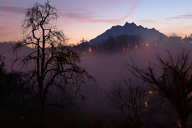
Meggen is a picturesque village located in the Canton of Lucerne in Switzerland, offering stunning views over Lake Lucerne and the surrounding mountains. Here are some aspects of hiking in and around Meggen that you might find interesting:
Trails and Routes
-
Local Trails: Meggen has several well-marked hiking paths that cater to various skill levels. You can enjoy short walks with beautiful lake views or more challenging trails that ascend into the nearby mountains.
-
Klausen Pass: If you're looking for more challenging hikes, the trails that lead to Klausen Pass offer breathtaking scenery and a chance to explore the Swiss Alps.
-
Lake Lucerne Circuit: A popular route is the hike along the shores of Lake Lucerne, which offers a blend of natural beauty and access to local attractions.
-
Hiking to Mount Pilatus: Access to Mount Pilatus, which provides stunning panoramic views, is possible from Meggen. You can hike part of the way and then take the cable car or cogwheel train to reach the summit.
-
Meggerwald: The forested area surrounding Meggen, known as Meggerwald, offers several trails where you can enjoy the tranquility of nature while observing local flora and fauna.
Wildlife and Scenery
-
Flora and Fauna: The area is rich in biodiversity, making it a great spot for nature lovers. You might see various wildflowers, birds, and, if you're lucky, wildlife such as deer or foxes.
-
Scenic Views: The landscape around Meggen is characterized by lush hills, the shimmering waters of Lake Lucerne, and the majestic peaks of the Swiss Alps, offering plenty of photo opportunities along the way.
Accessibility
- Public Transport: Meggen is accessible via public transport, with trains and buses connecting it to Lucerne and other parts of Switzerland. This makes it easy to start your hiking adventure without the need for a car.
Hiking Tips
-
Weather Preparedness: The weather can change quickly in the mountains, so be prepared for varying conditions. Bring layers, rain gear, and plenty of water.
-
Trail Etiquette: Always stay on marked paths, yield to other hikers, and respect local wildlife and plants.
-
Seasonal Considerations: Some trails may be covered in snow during the winter months, so plan your hike according to the season and check trail conditions beforehand.
Conclusion
Hiking in Meggen offers a wonderful combination of natural beauty, well-maintained trails, and opportunities for outdoor adventure. Whether you're a seasoned hiker or a casual walker, you'll find plenty to explore in this charming Swiss village. Enjoy your hikes and take in the amazing scenery!
- Country:

- Postal Code: 6045
- Local Dialing Code: 041
- Licence Plate Code: LU
- Coordinates: 47° 2' 47" N, 8° 22' 28" E


- GPS tracks (wikiloc): [Link]
- AboveSeaLevel: 479 м m
- Area: 13.93 sq km
- Population: 7138
- Web site: http://www.meggen.ch
- Wikipedia en: wiki(en)
- Wikipedia: wiki(de)
- Wikidata storage: Wikidata: Q14573
- Wikipedia Commons Category: [Link]
- Freebase ID: [/m/0fn6rp]
- GeoNames ID: Alt: [7286468]
- VIAF ID: Alt: [132554313]
- OSM relation ID: [1682896]
- GND ID: Alt: [4100752-9]
- archINFORM location ID: [4147]
- MusicBrainz area ID: [189d5b6c-aff2-4c54-9e2b-d39400095ad6]
- HDS ID: [626]
- Swiss municipality code: [1063]
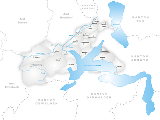
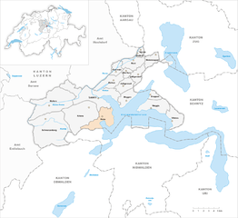
Shares border with regions:


Adligenswil
- municipality in the canton of Lucerne, Switzerland
Adligenswil is a charming municipality located near Lucerne, Switzerland, and offers a variety of hiking opportunities that cater to different skill levels. The region is characterized by its stunning natural landscapes, including rolling hills, forests, and views of Lake Lucerne and the surrounding mountains....
- Country:

- Postal Code: 6043
- Local Dialing Code: 041
- Licence Plate Code: LU
- Coordinates: 47° 4' 20" N, 8° 22' 6" E


- GPS tracks (wikiloc): [Link]
- AboveSeaLevel: 569 м m
- Area: 6.99 sq km
- Population: 5343
- Web site: [Link]


Greppen
- municipality in the canton of Lucerne, Switzerland
Greppen is a picturesque village located in the Canton of Lucerne, Switzerland, nestled along the shores of Lake Zug and surrounded by stunning natural landscapes. It's an excellent destination for hiking enthusiasts of all skill levels, offering a variety of trails that showcase the area's breathtaking views, lush forests, and charming countryside....
- Country:

- Postal Code: 6404
- Local Dialing Code: 041
- Licence Plate Code: LU
- Coordinates: 47° 3' 18" N, 8° 25' 46" E


- GPS tracks (wikiloc): [Link]
- AboveSeaLevel: 449 м m
- Area: 5.25 sq km
- Population: 1075
- Web site: [Link]


Horw
- municipality in the canton of Lucerne, Switzerland
Horw is a picturesque municipality located in the canton of Lucerne, Switzerland, known for its stunning natural landscapes and proximity to the Swiss Alps. Hiking in and around Horw offers a variety of trails suited for different skill levels, making it an excellent destination for both novice and experienced hikers....
- Country:

- Postal Code: 6048
- Local Dialing Code: 041
- Licence Plate Code: LU
- Coordinates: 47° 0' 48" N, 8° 18' 39" E


- GPS tracks (wikiloc): [Link]
- AboveSeaLevel: 438 м m
- Area: 20.43 sq km
- Population: 13915
- Web site: [Link]


Weggis
- municipality in the canton of Lucerne, Switzerland
Weggis is a charming lakeside village located in the Canton of Lucerne in Switzerland, nestled along the shores of Lake Lucerne and surrounded by stunning mountains. It is an excellent starting point for hiking enthusiasts due to its diverse range of trails and breathtaking scenery. Here are some highlights of hiking in Weggis:...
- Country:

- Postal Code: 6353
- Local Dialing Code: 041
- Licence Plate Code: LU
- Coordinates: 47° 2' 14" N, 8° 26' 34" E


- GPS tracks (wikiloc): [Link]
- AboveSeaLevel: 582 м m
- Area: 25.29 sq km
- Population: 4404
- Web site: [Link]


Lucerne
- city on Lake Lucerne, in central Switzerland
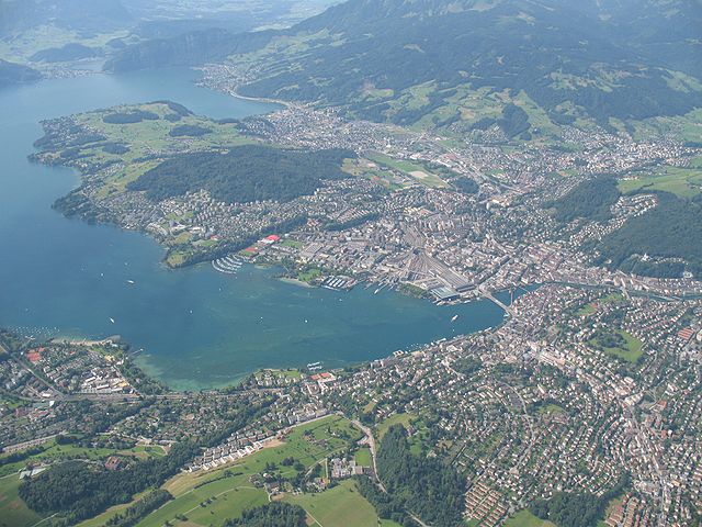
Hiking in Lucerne, Switzerland, offers breathtaking views and a variety of trails that cater to different skill levels. Situated by Lake Lucerne and surrounded by majestic mountains, this region is a paradise for outdoor enthusiasts. Here are some popular hiking areas and trails you might consider:...
- Country:

- Postal Code: 6014; 6000
- Local Dialing Code: 041
- Licence Plate Code: LU
- Coordinates: 47° 3' 8" N, 8° 18' 21" E


- GPS tracks (wikiloc): [Link]
- AboveSeaLevel: 436 м m
- Area: 37.4 sq km
- Population: 81592
- Web site: [Link]


Küssnacht
- municipality in Switzerland
Küssnacht, located in the picturesque Swiss region of Central Switzerland, offers a variety of hiking trails that cater to different skill levels, making it a great destination for hikers. Nestled along the shores of Lake Zug and near Mount Rigi, the area provides stunning views and diverse landscapes. Here are some highlights of hiking in and around Küssnacht:...
- Country:

- Postal Code: 6403
- Local Dialing Code: 041
- Licence Plate Code: SZ
- Coordinates: 47° 4' 58" N, 8° 26' 27" E


- GPS tracks (wikiloc): [Link]
- AboveSeaLevel: 445 м m
- Area: 36.2 sq km
- Population: 12845
- Web site: [Link]


Stansstad
- municipality in Switzerland
Stansstad, located in the canton of Nidwalden in Switzerland, offers a variety of stunning hiking opportunities. Nestled between Lake Lucerne and the surrounding mountains, it's an ideal destination for both casual walkers and experienced hikers....
- Country:

- Postal Code: 6362
- Local Dialing Code: 041
- Licence Plate Code: NW
- Coordinates: 46° 58' 49" N, 8° 20' 20" E


- GPS tracks (wikiloc): [Link]
- AboveSeaLevel: 436 м m
- Area: 17.11 sq km
- Population: 4494
- Web site: [Link]

