Lucinges (Lucinges)

- commune in Haute-Savoie, France
 Hiking in Lucinges
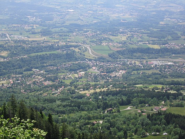
Lucinges is a charming village located in the Haute-Savoie region of France, nestled near the French-Swiss border. It offers stunning views of the surrounding Alpine landscape and is an excellent spot for hiking enthusiasts. Here are some details about hiking in Lucinges:
Hiking Trails
-
Local Trails: Lucinges has several well-marked trails that cater to various skill levels, from easy walks to more challenging hikes. Be sure to check local maps or inquire at the village tourist office for detailed trail information.
-
Scenic Views: Many of the trails provide breathtaking views of the surrounding mountains, valleys, and Lake Geneva in the distance, making for great photo opportunities.
-
Nature and Wildlife: Hiking in the area allows you to enjoy the rich flora and fauna of the Alps. You might encounter local wildlife and various plant species.
Popular Hikes
-
Montagne de Lachat: A popular hike that offers panoramic views from the summit. It's a moderate trail that's rewarding for those who take the time to trek to the top.
-
Les Champs: This area features gentler slopes suitable for more leisurely walks, ideal for families or those looking to enjoy a peaceful nature experience.
Preparation Tips
- Start Early: To make the most of your day and enjoy the cooler temperatures, it’s best to start your hike early in the morning.
- Check Weather Conditions: The weather in the Alps can change quickly, so make sure to check the forecast before heading out.
- Pack Accordingly: Bring sufficient water, snacks, and a first-aid kit. Good hiking shoes are crucial due to the varying terrain.
- Navigation Tools: Use a GPS device or a physical map; while many trails are marked, it's always best to stay prepared.
Local Amenities
Lucinges is a small village, so amenities may be limited compared to larger towns. However, local eateries may provide a warm meal or snack after your hike. It’s a good idea to bring a picnic to enjoy amidst nature.
Accessibility
Lucinges can be accessed by car from nearby cities like Geneva or Annecy, making it a convenient getaway for a day hike or a weekend retreat into nature.
Remember to respect nature by staying on marked trails, taking all litter with you, and following local guidelines for wildlife interaction. Enjoy your hiking adventure in Lucinges!
- Country:

- Postal Code: 74380
- Coordinates: 46° 11' 27" N, 6° 19' 7" E


- GPS tracks (wikiloc): [Link]
- Area: 7.69 sq km
- Population: 1641
- Web site: http://www.lucinges.fr
- Wikipedia en: wiki(en)
- Wikipedia: wiki(fr)
- Wikidata storage: Wikidata: Q644128
- Wikipedia Commons Category: [Link]
- Freebase ID: [/m/03ntzh1]
- GeoNames ID: Alt: [6442972]
- SIREN number: [217401538]
- BnF ID: [15274411c]
- INSEE municipality code: 74153
Shares border with regions:


Cranves-Sales
- commune in Haute-Savoie, France
Hiking in Cranves-Sales
Cranves-Sales, located in the Haute-Savoie region of France, is a scenic destination that offers beautiful landscapes and various hiking opportunities. Nestled near the Alps and close to Lake Geneva, the area is characterized by its rolling hills, forests, and stunning views of the surrounding mountains....
- Country:
- Postal Code: 74380
- Coordinates: 46° 11' 12" N, 6° 17' 29" E
- GPS tracks (wikiloc): [Link]
- Area: 13.61 sq km
- Population: 6562
- Web site: [Link]


Fillinges
- commune in Haute-Savoie, France
Hiking in Fillinges
Fillinges, located in the Haute-Savoie region of France, is a charming area that offers a variety of hiking opportunities amidst beautiful landscapes. Nestled near the French-Chevalier Mountains and close to Lake Geneva, the region provides stunning views and a mix of terrain suitable for different hiking levels....
- Country:
- Postal Code: 74250
- Coordinates: 46° 9' 30" N, 6° 20' 31" E
- GPS tracks (wikiloc): [Link]
- Area: 11.67 sq km
- Population: 3350
- Web site: [Link]

Bonne, Haute-Savoie
- commune in Haute-Savoie, France
Hiking in Bonne, Haute-Savoie
Hiking in Bonne, Haute-Savoie, offers a fantastic experience for outdoor enthusiasts. Situated in the picturesque region of the French Alps, Bonne is known for its stunning mountainous scenery, with a variety of trails suited for different skill levels, from beginners to advanced hikers....
- Country:
- Postal Code: 74380
- Coordinates: 46° 10' 6" N, 6° 19' 14" E
- GPS tracks (wikiloc): [Link]
- Area: 8.58 sq km
- Population: 3245
- Web site: [Link]

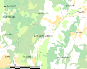
Saint-André-de-Boëge
- commune in Haute-Savoie, France
Hiking in Saint-André-de-Boëge
Saint-André-de-Boëge is a charming commune located in the Haute-Savoie department in the Auvergne-Rhône-Alpes region of southeastern France. It's nestled within the scenic backdrop of the French Alps, making it an appealing destination for outdoor enthusiasts and hikers....
- Country:
- Postal Code: 74420
- Coordinates: 46° 11' 25" N, 6° 23' 37" E
- GPS tracks (wikiloc): [Link]
- Area: 12.6 sq km
- Population: 549