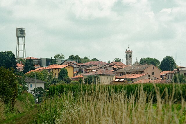
Lurago Marinone (Lurago Marinone)
.svg)
- Italian comune
 Hiking in Lurago Marinone
Lurago Marinone is a picturesque small town located in the province of Como, in the Lombardy region of Italy. While it may not be one of the most prominent hiking destinations, it offers several opportunities for outdoor exploration thanks to its charming surrounding landscapes, particularly the foothills of the Alps.
Hiking Opportunities
-
Natural Landscapes: The area around Lurago Marinone features rolling hills and green valleys, making it suitable for leisurely hikes. You can enjoy views of the landscape and the distant mountains, especially in the late spring and summer when the flora is lush.
-
Local Trails: There are several local trails that you can explore. These trails often connect to wider networks leading to neighboring towns or villages. Maps and trail markings can typically be found at local tourist information centers.
-
Nearby Nature Reserves: Consider taking a short trip to nearby areas like the Spina Verde Regional Park, which has well-marked trails that offer different levels of difficulty, stunning views, and opportunities to observe wildlife.
-
Cultural Integration: While hiking, be sure to also appreciate the local culture. The area is rich with history, and you might come across ancient churches, ruins, and charming architecture in the towns you pass through.
Tips for Hiking
- Preparation: Check the weather forecast before your hike. It’s essential to wear appropriate clothing and footwear.
- Maps and Guides: Obtain local maps or use hiking apps that can guide you through the trails. While marked trails are common, a good map can help you find hidden gems.
- Hydration and Snacks: Bring enough water and some snacks, especially if you're planning a longer hike.
- Respect Nature: Stay on marked paths, and ensure to pack out any trash you bring in to preserve the beautiful environment.
Accessibility
Lurago Marinone can be accessed via public transportation or by car from larger cities like Milan or Como. If you're staying in a nearby urban area, consider setting out for a day hike to enjoy the tranquility and beauty of the surrounding Italian countryside.
Ultimately, while Lurago Marinone may not be a major hiking destination, it offers a great opportunity for a peaceful hike immersed in nature, with the chance to experience the local culture. Enjoy your hike!
- Country:

- Postal Code: 22070
- Local Dialing Code: 031
- Licence Plate Code: CO
- Coordinates: 45° 42' 0" N, 8° 59' 0" E


- GPS tracks (wikiloc): [Link]
- AboveSeaLevel: 294 м m
- Area: 3.89 sq km
- Population: 2585
- Web site: http://www.comune.luragomarinone.co.it
- Wikipedia en: wiki(en)
- Wikipedia: wiki(it)
- Wikidata storage: Wikidata: Q47370
- Wikipedia Commons Category: [Link]
- Freebase ID: [/m/0gj0tj]
- GeoNames ID: Alt: [6540578]
- VIAF ID: Alt: [237042781]
- OSM relation ID: [45807]
- WOEID: [717526]
- UN/LOCODE: [ITLMR]
- ISTAT ID: 013137
- Italian cadastre code: E750
Shares border with regions:
Appiano Gentile
- Italian comune
Hiking in Appiano Gentile
Appiano Gentile is a charming town located in the province of Como, in the Lombardy region of northern Italy. While it might not be as widely known for hiking as some areas near the Alps, there are several beautiful trails and scenic spots in and around Appiano Gentile that can offer a lovely hiking experience....
- Country:
- Postal Code: 22070
- Local Dialing Code: 031
- Licence Plate Code: CO
- Coordinates: 45° 44' 18" N, 8° 58' 47" E
- GPS tracks (wikiloc): [Link]
- AboveSeaLevel: 366 м m
- Area: 12.81 sq km
- Population: 7750
- Web site: [Link]


Carbonate, Lombardy
- Italian comune
Hiking in Carbonate, Lombardy
Carbonate, located in the province of Varese in Lombardy, Italy, is a great area to experience hiking amidst stunning landscapes. While Carbonate itself is a small town with limited hiking trails, it is surrounded by beautiful countryside and is in proximity to various hiking spots in the nearby regions, including the Prealps and the Lake Maggiore area....
- Country:
- Postal Code: 22070
- Local Dialing Code: 0331
- Licence Plate Code: CO
- Coordinates: 45° 41' 9" N, 8° 56' 21" E
- GPS tracks (wikiloc): [Link]
- AboveSeaLevel: 267 м m
- Area: 4.92 sq km
- Population: 2925
- Web site: [Link]

Veniano
- Italian comune
Hiking in Veniano
Veniano is a charming town located in the Lombardy region of Italy, near Lake Como. The surrounding area offers beautiful hiking opportunities, making it an excellent destination for outdoor enthusiasts. Here are some highlights for hiking in and around Veniano:...
- Country:
- Postal Code: 22070
- Local Dialing Code: 031
- Licence Plate Code: CO
- Coordinates: 45° 43' 0" N, 8° 59' 0" E
- GPS tracks (wikiloc): [Link]
- AboveSeaLevel: 316 м m
- Area: 3.15 sq km
- Population: 3041
- Web site: [Link]
Limido Comasco
- Italian comune
Hiking in Limido Comasco
Limido Comasco is a charming town located in the Como province of Italy, nestled in the beautiful region of Lombardy. While it might not be as famous as some other hiking destinations in Italy, it offers several wonderful opportunities for outdoor activities, particularly hiking, thanks to its proximity to the scenic landscape of the Prealps and nearby Lake Como....
- Country:
- Postal Code: 22070
- Local Dialing Code: 031
- Licence Plate Code: CO
- Coordinates: 45° 41' 0" N, 8° 59' 0" E
- GPS tracks (wikiloc): [Link]
- AboveSeaLevel: 276 м m
- Area: 4.56 sq km
- Population: 3828
- Web site: [Link]
Fenegrò
- Italian comune
Hiking in Fenegrò
Fenegrò, located in the province of Como in the Lombardy region of Italy, offers a variety of hiking opportunities for outdoor enthusiasts. The area is characterized by its lush greenery, rolling hills, and proximity to both the natural beauty of the surrounding landscape and cultural attractions....
- Country:
- Postal Code: 22070
- Local Dialing Code: 031
- Licence Plate Code: CO
- Coordinates: 45° 42' 0" N, 9° 0' 0" E
- GPS tracks (wikiloc): [Link]
- AboveSeaLevel: 290 м m
- Area: 5.36 sq km
- Population: 3236
- Web site: [Link]
Mozzate
- Italian comune
Hiking in Mozzate
Mozzate is a small town in the Lombardy region of Italy, not typically known as a hiking hotspot. However, it is well-positioned near various natural and scenic areas that are great for hiking enthusiasts. Here are some key points about hiking in and around Mozzate:...
- Country:
- Postal Code: 22076
- Local Dialing Code: 0331
- Licence Plate Code: CO
- Coordinates: 45° 41' 0" N, 8° 57' 0" E
- GPS tracks (wikiloc): [Link]
- AboveSeaLevel: 246 м m
- Area: 10.68 sq km
- Population: 8971
- Web site: [Link]