Mée (Mée)

- commune in Mayenne, France
- Country:

- Postal Code: 53400
- Coordinates: 47° 47' 50" N, 0° 51' 38" E


- GPS tracks (wikiloc): [Link]
- Area: 8.75 sq km
- Population: 216
- Wikipedia en: wiki(en)
- Wikipedia: wiki(fr)
- Wikidata storage: Wikidata: Q1225649
- Wikipedia Commons Category: [Link]
- Freebase ID: [/m/03nq0ft]
- Freebase ID: [/m/03nq0ft]
- GeoNames ID: Alt: [6424389]
- GeoNames ID: Alt: [6424389]
- SIREN number: [215301482]
- SIREN number: [215301482]
- BnF ID: [152639417]
- BnF ID: [152639417]
- INSEE municipality code: 53148
- INSEE municipality code: 53148
Shares border with regions:


Chérancé
- commune in Mayenne, France
- Country:
- Postal Code: 53400
- Coordinates: 47° 47' 43" N, 0° 56' 8" E
- GPS tracks (wikiloc): [Link]
- AboveSeaLevel: 54 м m
- Area: 8.73 sq km
- Population: 160


Ampoigné
- former commune in Mayenne, France
- Country:
- Postal Code: 53200
- Coordinates: 47° 48' 38" N, 0° 49' 32" E
- GPS tracks (wikiloc): [Link]
- Area: 21.12 sq km
- Population: 563
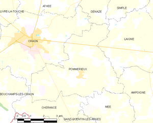
Pommerieux
- commune in Mayenne, France
- Country:
- Postal Code: 53400
- Coordinates: 47° 49' 24" N, 0° 53' 54" E
- GPS tracks (wikiloc): [Link]
- Area: 23.2 sq km
- Population: 671
- Web site: [Link]

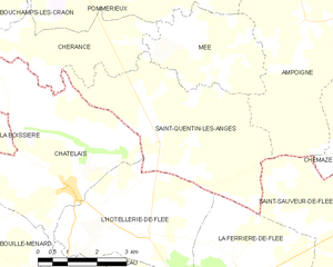
Saint-Quentin-les-Anges
- commune in Mayenne, France
- Country:
- Postal Code: 53400
- Coordinates: 47° 46' 23" N, 0° 53' 10" E
- GPS tracks (wikiloc): [Link]
- Area: 17.81 sq km
- Population: 419
- Web site: [Link]