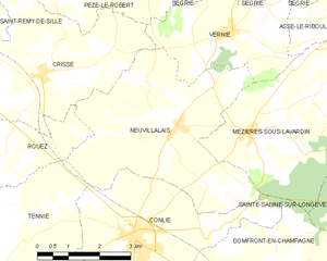
Mézières-sous-Lavardin (Mézières-sous-Lavardin)

- commune in Sarthe, France
- Country:

- Postal Code: 72240
- Coordinates: 48° 9' 16" N, 0° 1' 48" E


- GPS tracks (wikiloc): [Link]
- Area: 15.31 sq km
- Population: 710
- Wikipedia en: wiki(en)
- Wikipedia: wiki(fr)
- Wikidata storage: Wikidata: Q1226734
- Wikipedia Commons Category: [Link]
- Freebase ID: [/m/03qh_ws]
- GeoNames ID: Alt: [2994012]
- SIREN number: [217201979]
- BnF ID: [15273752j]
- INSEE municipality code: 72197
Shares border with regions:

Assé-le-Riboul
- commune in Sarthe, France
- Country:
- Postal Code: 72170
- Coordinates: 48° 11' 38" N, 0° 5' 11" E
- GPS tracks (wikiloc): [Link]
- Area: 16.77 sq km
- Population: 523


Saint-Jean-d'Assé
- commune in Sarthe, France
- Country:
- Postal Code: 72380
- Coordinates: 48° 9' 2" N, 0° 7' 14" E
- GPS tracks (wikiloc): [Link]
- Area: 21.29 sq km
- Population: 1719
- Web site: [Link]
Vernie
- commune in Sarthe, France
- Country:
- Postal Code: 72170
- Coordinates: 48° 11' 0" N, 0° 1' 15" E
- GPS tracks (wikiloc): [Link]
- Area: 9.9 sq km
- Population: 345


Domfront-en-Champagne
- commune in Sarthe, France
- Country:
- Postal Code: 72240
- Coordinates: 48° 6' 17" N, 0° 1' 41" E
- GPS tracks (wikiloc): [Link]
- Area: 20.97 sq km
- Population: 1020

Neuvillalais
- commune in Sarthe, France
- Country:
- Postal Code: 72240
- Coordinates: 48° 9' 24" N, 0° 0' 3" E
- GPS tracks (wikiloc): [Link]
- Area: 18.86 sq km
- Population: 591
- Web site: [Link]


Sainte-Sabine-sur-Longève
- commune in Sarthe, France
- Country:
- Postal Code: 72380
- Coordinates: 48° 8' 28" N, 0° 5' 43" E
- GPS tracks (wikiloc): [Link]
- Area: 11.82 sq km
- Population: 760

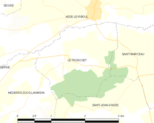
Le Tronchet, Sarthe
- commune in Sarthe, France
- Country:
- Postal Code: 72170
- Coordinates: 48° 10' 53" N, 0° 4' 30" E
- GPS tracks (wikiloc): [Link]
- Area: 3.89 sq km
- Population: 154


Conlie
- commune in Sarthe, France
- Country:
- Postal Code: 72240
- Coordinates: 48° 7' 24" N, 0° 1' 3" E
- GPS tracks (wikiloc): [Link]
- Area: 17.16 sq km
- Population: 1864
- Web site: [Link]