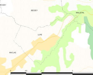
Maclas (Maclas)
- commune in Loire, France
- Country:

- Postal Code: 42520
- Coordinates: 45° 21' 45" N, 4° 41' 5" E


- GPS tracks (wikiloc): [Link]
- Area: 10.15 sq km
- Population: 1817
- Web site: http://www.maclas.fr
- Wikipedia en: wiki(en)
- Wikipedia: wiki(fr)
- Wikidata storage: Wikidata: Q965319
- Wikipedia Commons Category: [Link]
- Freebase ID: [/m/03vv5n]
- Freebase ID: [/m/03vv5n]
- GeoNames ID: Alt: [6434194]
- GeoNames ID: Alt: [6434194]
- SIREN number: [214201295]
- SIREN number: [214201295]
- BnF ID: [152596978]
- BnF ID: [152596978]
- VIAF ID: Alt: [240088328]
- VIAF ID: Alt: [240088328]
- INSEE municipality code: 42129
- INSEE municipality code: 42129
Shares border with regions:


Saint-Appolinard
- commune in Loire, France
- Country:

- Postal Code: 42520
- Coordinates: 45° 20' 31" N, 4° 39' 8" E


- GPS tracks (wikiloc): [Link]
- Area: 9.84 sq km
- Population: 668


Roisey
- commune in Loire, France
- Country:

- Postal Code: 42520
- Coordinates: 45° 23' 15" N, 4° 40' 19" E


- GPS tracks (wikiloc): [Link]
- AboveSeaLevel: 510 м m
- Area: 13.03 sq km
- Population: 903
- Web site: [Link]


Malleval
- commune in Loire, France
- Country:

- Postal Code: 42520
- Coordinates: 45° 23' 2" N, 4° 43' 36" E


- GPS tracks (wikiloc): [Link]
- Area: 5.06 sq km
- Population: 579
- Web site: [Link]

Lupé
- commune in Loire, France
- Country:

- Postal Code: 42520
- Coordinates: 45° 22' 22" N, 4° 42' 16" E


- GPS tracks (wikiloc): [Link]
- Area: 1.47 sq km
- Population: 312
- Web site: [Link]


Bessey
- commune in Loire, France
- Country:

- Postal Code: 42520
- Coordinates: 45° 23' 9" N, 4° 41' 43" E


- GPS tracks (wikiloc): [Link]
- Area: 6.24 sq km
- Population: 448

Saint-Jacques-d'Atticieux
- commune in Ardèche, France
- Country:

- Postal Code: 07340
- Coordinates: 45° 20' 5" N, 4° 40' 4" E


- GPS tracks (wikiloc): [Link]
- Area: 4.97 sq km
- Population: 320

Vinzieux
- commune in Ardèche, France
- Country:

- Postal Code: 07340
- Coordinates: 45° 19' 38" N, 4° 42' 4" E


- GPS tracks (wikiloc): [Link]
- Area: 6.87 sq km
- Population: 452

Charnas
- commune in Ardèche, France
- Country:

- Postal Code: 07340
- Coordinates: 45° 20' 11" N, 4° 44' 37" E


- GPS tracks (wikiloc): [Link]
- Area: 5.39 sq km
- Population: 909

Limony
- commune in Ardèche, France
- Country:

- Postal Code: 07340
- Coordinates: 45° 21' 7" N, 4° 45' 28" E


- GPS tracks (wikiloc): [Link]
- Area: 7.22 sq km
- Population: 736


Véranne
- commune in Loire, France
- Country:

- Postal Code: 42520
- Coordinates: 45° 22' 6" N, 4° 39' 46" E


- GPS tracks (wikiloc): [Link]
- Area: 15.96 sq km
- Population: 829
- Web site: [Link]


Saint-Pierre-de-Bœuf
- commune in Loire, France
- Country:

- Postal Code: 42520
- Coordinates: 45° 22' 58" N, 4° 44' 58" E


- GPS tracks (wikiloc): [Link]
- Area: 5.95 sq km
- Population: 1752
- Web site: [Link]
