Madegney (Madegney)

- commune in Vosges, France
- Country:

- Postal Code: 88450
- Coordinates: 48° 17' 18" N, 6° 17' 17" E


- GPS tracks (wikiloc): [Link]
- Area: 3.05 sq km
- Population: 109
- Wikipedia en: wiki(en)
- Wikipedia: wiki(fr)
- Wikidata storage: Wikidata: Q1455189
- Wikipedia Commons Category: [Link]
- Freebase ID: [/m/03qgv6d]
- Freebase ID: [/m/03qgv6d]
- GeoNames ID: Alt: [6445631]
- GeoNames ID: Alt: [6445631]
- SIREN number: [218802809]
- SIREN number: [218802809]
- BnF ID: [15279206f]
- BnF ID: [15279206f]
- INSEE municipality code: 88280
- INSEE municipality code: 88280
Shares border with regions:

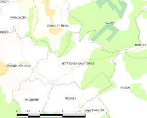
Bettegney-Saint-Brice
- commune in Vosges, France
- Country:
- Postal Code: 88450
- Coordinates: 48° 17' 57" N, 6° 18' 25" E
- GPS tracks (wikiloc): [Link]
- Area: 5.32 sq km
- Population: 166


Gugney-aux-Aulx
- commune in Vosges, France
- Country:
- Postal Code: 88450
- Coordinates: 48° 18' 11" N, 6° 16' 12" E
- GPS tracks (wikiloc): [Link]
- Area: 8.67 sq km
- Population: 152
- Web site: [Link]


Derbamont
- commune in Vosges, France
- Country:
- Postal Code: 88270
- Coordinates: 48° 16' 6" N, 6° 16' 4" E
- GPS tracks (wikiloc): [Link]
- Area: 6.83 sq km
- Population: 104


Regney
- commune in Vosges, France
- Country:
- Postal Code: 88450
- Coordinates: 48° 17' 23" N, 6° 18' 17" E
- GPS tracks (wikiloc): [Link]
- Area: 3.9 sq km
- Population: 84