Magnanville (Magnanville)

- commune in Yvelines, France
- Country:

- Postal Code: 78200
- Coordinates: 48° 58' 2" N, 1° 40' 55" E


- GPS tracks (wikiloc): [Link]
- Area: 4.26 sq km
- Population: 5954
- Web site: http://www.magnanville.fr
- Wikipedia en: wiki(en)
- Wikipedia: wiki(fr)
- Wikidata storage: Wikidata: Q762728
- Wikipedia Commons Category: [Link]
- Freebase ID: [/m/03qf__1]
- Freebase ID: [/m/03qf__1]
- GeoNames ID: Alt: [2996802]
- GeoNames ID: Alt: [2996802]
- SIREN number: [217803543]
- SIREN number: [217803543]
- BnF ID: [15276008v]
- BnF ID: [15276008v]
- MusicBrainz area ID: [4725e77b-5be6-45c8-aab4-baefd457e6aa]
- MusicBrainz area ID: [4725e77b-5be6-45c8-aab4-baefd457e6aa]
- INSEE municipality code: 78354
- INSEE municipality code: 78354
Shares border with regions:


Auffreville-Brasseuil
- commune in Yvelines, France
- Country:
- Postal Code: 78930
- Coordinates: 48° 57' 14" N, 1° 42' 38" E
- GPS tracks (wikiloc): [Link]
- AboveSeaLevel: 32 м m
- Area: 2.37 sq km
- Population: 648
- Web site: [Link]


Soindres
- commune in Yvelines, France
- Country:
- Postal Code: 78200
- Coordinates: 48° 57' 26" N, 1° 40' 31" E
- GPS tracks (wikiloc): [Link]
- Area: 5.19 sq km
- Population: 672


Buchelay
- commune in Yvelines, France
- Country:
- Postal Code: 78200
- Coordinates: 48° 58' 47" N, 1° 40' 22" E
- GPS tracks (wikiloc): [Link]
- Area: 4.94 sq km
- Population: 3049
- Web site: [Link]

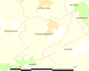
Fontenay-Mauvoisin
- commune in Yvelines, France
- Country:
- Postal Code: 78200
- Coordinates: 48° 57' 51" N, 1° 39' 5" E
- GPS tracks (wikiloc): [Link]
- Area: 3.31 sq km
- Population: 380


Mantes-la-Ville
- commune in Yvelines, France
- Country:
- Postal Code: 78711
- Coordinates: 48° 58' 27" N, 1° 42' 39" E
- GPS tracks (wikiloc): [Link]
- AboveSeaLevel: 36 м m
- Area: 6.06 sq km
- Population: 19778
- Web site: [Link]