Maiolati Spontini (Maiolati Spontini)
.svg)
- Italian comune
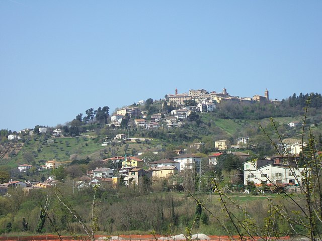
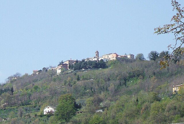
 Hiking in Maiolati Spontini
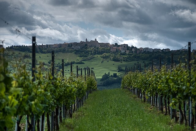
Maiolati Spontini, located in the beautiful region of Marche, Italy, offers a variety of opportunities for hikers to explore its stunning landscapes and rich cultural heritage. Here are some highlights about hiking in this area:
Trails and Natural Features
-
Scenic Routes: The region is characterized by rolling hills, vineyards, and olive groves, providing plenty of scenic views. Popular trails often wind through these landscapes, offering a mix of challenging and manageable hikes for different skill levels.
-
Monte San Vicino: Just a short drive away, this mountain offers various trails with panoramic views of the surrounding valleys and the Adriatic Sea. The flora and fauna in the area are rich, making it a great spot for nature enthusiasts.
-
Gola del Furlo: Although a bit farther away, this natural gorge is well worth the visit for a day hike. The stunning rock formations and the clear waters of the river create a beautiful setting for outdoor activities, including hiking.
Local Culture and Attractions
-
Historical Sites: As you hike, you may come across historical landmarks such as churches, old stone houses, and ruins that reflect the rich history of the area. Be sure to take your time to explore these sites.
-
Typical Cuisine: After a day of hiking, indulge in the local cuisine. The Marche region is known for its delicious food, including local wines, pasta, and truffles. Many agriturismi (farm stays) provide an authentic dining experience.
Hiking Tips
-
Gear Up: Wear appropriate hiking footwear and bring plenty of water, especially during the warmer months. The terrain can vary, so good traction is important.
-
Plan Ahead: While there are marked trails, it's a good idea to have a map or a GPS device. Some areas may have limited signage, and cell service can be spotty in rural regions.
-
Respect Nature: Follow the Leave No Trace principles. Take your trash with you and respect the wildlife that you may encounter.
-
Local Guides: If you're unfamiliar with the area or want to learn more about the local environment and history, consider hiring a local guide. They can enhance your experience by providing insights into the region.
Hiking in Maiolati Spontini can be a rewarding experience that combines nature, culture, and culinary delights. Always ensure you check local conditions and regulations before heading out on your adventure. Enjoy your hike!
- Country:

- Postal Code: 60030
- Local Dialing Code: 0731
- Licence Plate Code: AN
- Coordinates: 43° 28' 38" N, 13° 7' 9" E


- GPS tracks (wikiloc): [Link]
- AboveSeaLevel: 198 м m
- Area: 21.49 sq km
- Population: 6187
- Web site: http://www.comune.maiolatispontini.an.it
- Wikipedia en: wiki(en)
- Wikipedia: wiki(it)
- Wikidata storage: Wikidata: Q124139
- Wikipedia Commons Gallery: [Link]
- Wikipedia Commons Category: [Link]
- Freebase ID: [/m/0gl5r_]
- GeoNames ID: Alt: [6541841]
- OSM relation ID: [42464]
- MusicBrainz area ID: [06b1d948-a7ed-4ec5-a023-24c050325d9c]
- UN/LOCODE: [ITAI7]
- ISTAT ID: 042023
- Italian cadastre code: E837
Shares border with regions:
Belvedere Ostrense
- Italian comune
Hiking in Belvedere Ostrense
Belvedere Ostrense is a picturesque village located in the Marche region of Italy. This charming area offers several hiking opportunities that glide through lush green landscapes, rolling hills, and ancient historical sites. Here are some highlights of hiking in Belvedere Ostrense:...
- Country:
- Postal Code: 60030
- Local Dialing Code: 0731
- Licence Plate Code: AN
- Coordinates: 43° 34' 50" N, 13° 10' 0" E
- GPS tracks (wikiloc): [Link]
- AboveSeaLevel: 251 м m
- Area: 29.45 sq km
- Population: 2203
- Web site: [Link]


Castelbellino
- Italian comune
Hiking in Castelbellino
Castelbellino, a charming town in the Marche region of Italy, is a great destination for hiking enthusiasts. The area is known for its beautiful landscapes, rolling hills, vineyards, and historical sites. Here are some aspects to consider if you're planning a hiking trip in Castelbellino:...
- Country:
- Postal Code: 60030
- Local Dialing Code: 0731
- Licence Plate Code: AN
- Coordinates: 43° 29' 16" N, 13° 8' 45" E
- GPS tracks (wikiloc): [Link]
- AboveSeaLevel: 267 м m
- Area: 6.05 sq km
- Population: 5009
- Web site: [Link]

Castelplanio
- Italian comune
Hiking in Castelplanio
Castelplanio, located in the Marche region of Italy, is a wonderful destination for hiking enthusiasts. The area is characterized by its stunning natural landscapes, rolling hills, and rich cultural heritage. Here are some highlights of hiking in Castelplanio:...
- Country:
- Postal Code: 60031
- Local Dialing Code: 0731
- Licence Plate Code: AN
- Coordinates: 43° 29' 40" N, 13° 4' 51" E
- GPS tracks (wikiloc): [Link]
- AboveSeaLevel: 305 м m
- Area: 15.32 sq km
- Population: 3524
- Web site: [Link]

Cupramontana
- Italian comune
Hiking in Cupramontana
Cupramontana is a charming town located in the Marche region of Italy, nestled among rolling hills and vineyards, making it a delightful destination for hiking enthusiasts. Here are some highlights about hiking in and around Cupramontana:...
- Country:
- Postal Code: 60034
- Local Dialing Code: 0731
- Licence Plate Code: AN
- Coordinates: 43° 26' 46" N, 13° 7' 3" E
- GPS tracks (wikiloc): [Link]
- AboveSeaLevel: 505 м m
- Area: 27.4 sq km
- Population: 4616
- Web site: [Link]


Monte Roberto
- Italian comune
Hiking in Monte Roberto
Monte Roberto, located in the Marche region of Italy, is not as widely known as some other hiking destinations, but it offers beautiful landscapes, scenic views, and a peaceful environment for outdoor enthusiasts. Here’s what you need to know for a hiking trip in the area:...
- Country:
- Postal Code: 60030
- Local Dialing Code: 0731
- Licence Plate Code: AN
- Coordinates: 43° 28' 53" N, 13° 8' 17" E
- GPS tracks (wikiloc): [Link]
- AboveSeaLevel: 348 м m
- Area: 13.51 sq km
- Population: 3088
- Web site: [Link]

Rosora
- Italian comune
Hiking in Rosora
Rosora is a charming town located in the Marche region of Italy, surrounded by picturesque landscapes and rolling hills. It offers several hiking opportunities for outdoor enthusiasts who wish to explore the natural beauty of the area....
- Country:
- Postal Code: 60030
- Local Dialing Code: 0731
- Licence Plate Code: AN
- Coordinates: 43° 28' 58" N, 13° 4' 9" E
- GPS tracks (wikiloc): [Link]
- AboveSeaLevel: 381 м m
- Area: 9.41 sq km
- Population: 1956
- Web site: [Link]
San Marcello, Marche
- Italian comune
Hiking in San Marcello, Marche
San Marcello, located in the Marche region of Italy, is surrounded by beautiful landscapes that make it an excellent base for hiking enthusiasts. The area is characterized by rolling hills, vineyards, and scenic countryside, offering a variety of trails suitable for different skill levels....
- Country:
- Postal Code: 60030
- Local Dialing Code: 0731
- Licence Plate Code: AN
- Coordinates: 43° 34' 37" N, 13° 12' 22" E
- GPS tracks (wikiloc): [Link]
- AboveSeaLevel: 231 м m
- Area: 25.78 sq km
- Population: 2036
- Web site: [Link]


Iesi
- Italian comune
Hiking in Iesi
Iesi, located in the Marche region of Italy, offers a variety of hiking opportunities with its scenic landscapes, historical sites, and charming countryside. Here are some highlights and tips for hiking in and around Iesi:...
- Country:
- Postal Code: 60035
- Local Dialing Code: 0731
- Licence Plate Code: AN
- Coordinates: 43° 31' 22" N, 13° 14' 38" E
- GPS tracks (wikiloc): [Link]
- AboveSeaLevel: 97 м m
- Area: 107.73 sq km
- Population: 40210
- Web site: [Link]