Maison-des-Champs (Maison-des-Champs)

- commune in Aube, France
- Country:

- Postal Code: 10140
- Coordinates: 48° 14' 30" N, 4° 34' 5" E


- GPS tracks (wikiloc): [Link]
- Area: 4.35 sq km
- Population: 34
- Wikipedia en: wiki(en)
- Wikipedia: wiki(fr)
- Wikidata storage: Wikidata: Q1104705
- Wikipedia Commons Category: [Link]
- Freebase ID: [/m/03m8st_]
- GeoNames ID: Alt: [6426452]
- SIREN number: [211002100]
- BnF ID: [15246309d]
- INSEE municipality code: 10217
Shares border with regions:

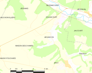
Argançon
- commune in Aube, France
- Country:
- Postal Code: 10140
- Coordinates: 48° 15' 11" N, 4° 36' 13" E
- GPS tracks (wikiloc): [Link]
- Area: 8.2 sq km
- Population: 101


Magny-Fouchard
- commune in Aube, France
- Country:
- Postal Code: 10140
- Coordinates: 48° 14' 34" N, 4° 32' 12" E
- GPS tracks (wikiloc): [Link]
- Area: 15.16 sq km
- Population: 281


Spoy
- commune in Aube, France
- Country:
- Postal Code: 10200
- Coordinates: 48° 13' 41" N, 4° 37' 14" E
- GPS tracks (wikiloc): [Link]
- Area: 10.36 sq km
- Population: 170


Vauchonvilliers
- commune in Aube, France
- Country:
- Postal Code: 10140
- Coordinates: 48° 15' 56" N, 4° 31' 34" E
- GPS tracks (wikiloc): [Link]
- Area: 11.62 sq km
- Population: 160