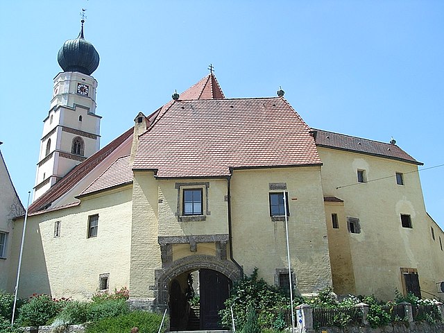
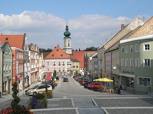
Malching (Malching)
- municipality of Germany
Malching is a lesser-known trekking destination, and specific details about its hiking trails may be limited. However, when exploring any hiking area, it's important to consider a few general tips:
-
Trail Variety: Research the available trails in Malching to find hikes that match your skill level and desired distance. Look for guided hikes or local maps for detailed information.
-
Scenic Views: Many hiking trails offer beautiful vistas, so be sure to check for lookout points or scenic viewpoints along the routes.
-
Terrain: Understand the terrain you'll be hiking on. Some trails may feature rocky paths, steep inclines, or muddy conditions, so be prepared with appropriate footwear and gear.
-
Safety: Always prioritize safety by informing someone of your hiking plans, carrying a first aid kit, staying hydrated, and being aware of weather conditions.
-
Local Wildlife and Flora: Research the local wildlife and plants in the area to enhance your experience. Familiarize yourself with any safety tips regarding local animals.
-
Leave No Trace: Follow the Leave No Trace principles to keep the area pristine for other hikers and preserve the natural environment.
If you have more specific information about Malching or the type of hiking experience you're looking for, I can provide more tailored advice!
- Country:

- Postal Code: 94094
- Local Dialing Code: 08573
- Licence Plate Code: PA
- Coordinates: 48° 19' 0" N, 13° 12' 0" E


- GPS tracks (wikiloc): [Link]
- AboveSeaLevel: 345 м m
- Area: 25.23 sq km
- Population: 1154
- Web site: http://www.malching.de
- Wikipedia en: wiki(en)
- Wikipedia: wiki(de)
- Wikidata storage: Wikidata: Q504208
- Wikipedia Commons Category: [Link]
- Freebase ID: [/m/02q6srq]
- GeoNames ID: Alt: [2874127]
- VIAF ID: Alt: [239476633]
- OSM relation ID: [958119]
- GND ID: Alt: [4100045-6]
- Historical Gazetteer (GOV) ID: [MALIN1JN68OH]
- Bavarikon ID: [ODB_A00001563]
- German municipality key: 09275132
Shares border with regions:
Kirchham
- municipality of Germany
Kirchham is a charming village located in Austria, near the Danube River, and it offers several hiking opportunities for outdoor enthusiasts. The region is characterized by its picturesque landscapes, rolling hills, and scenic views, making it an appealing destination for hikers of all levels....
- Country:

- Postal Code: 94148
- Local Dialing Code: 08533
- Licence Plate Code: PA
- Coordinates: 48° 21' 0" N, 13° 16' 0" E


- GPS tracks (wikiloc): [Link]
- AboveSeaLevel: 335 м m
- Area: 18.47 sq km
- Population: 1969
- Web site: [Link]


Bad Füssing
- municipality of Germany
Bad Füssing, located in Bavaria, Germany, is predominantly known for its thermal spas, but it also provides excellent opportunities for hiking amidst beautiful natural landscapes. The region is characterized by its gentle hills, lush forests, and the scenic landscape of the Isar valley. Here are some highlights of hiking in Bad Füssing:...
- Country:

- Postal Code: 94072
- Local Dialing Code: 08531
- Licence Plate Code: PA
- Coordinates: 48° 21' 0" N, 13° 18' 0" E


- GPS tracks (wikiloc): [Link]
- AboveSeaLevel: 320 м m
- Area: 55.06 sq km
- Population: 6994
- Web site: [Link]


Kößlarn
- municipality of Germany
Kößlarn is a village located in Bavaria, Germany, known for its picturesque landscapes and outdoor activities, including hiking. The region surrounding Kößlarn offers various trails suitable for different skill levels, making it an appealing destination for both novice and experienced hikers....
- Country:

- Postal Code: 94149
- Local Dialing Code: 08536
- Licence Plate Code: PA
- Coordinates: 48° 22' 25" N, 13° 7' 26" E


- GPS tracks (wikiloc): [Link]
- AboveSeaLevel: 425 м m
- Area: 25.48 sq km
- Population: 1696
- Web site: [Link]


Rotthalmünster
- municipality of Germany
Rotthalmünster is a picturesque village located in Bavaria, Germany, offering a variety of hiking opportunities amid beautiful landscapes. When planning a hiking trip in and around Rotthalmünster, here are some highlights and tips to consider:...
- Country:

- Postal Code: 94094
- Local Dialing Code: 08533
- Licence Plate Code: PA
- Coordinates: 48° 21' 35" N, 13° 12' 10" E


- GPS tracks (wikiloc): [Link]
- AboveSeaLevel: 405 м m
- Area: 44.55 sq km
- Population: 4538
- Web site: [Link]


Ering
- municipality in the district of Rottal-Inn in Bavaria in Germany
Ering is a beautiful area that offers a variety of hiking opportunities, characterized by its stunning natural landscapes, diverse flora and fauna, and picturesque views. While specific trails and details can vary, here are some general aspects you can consider while hiking in Ering:...
- Country:

- Postal Code: 94140
- Local Dialing Code: 08573
- Licence Plate Code: PAN
- Coordinates: 48° 18' 0" N, 13° 9' 0" E


- GPS tracks (wikiloc): [Link]
- AboveSeaLevel: 340 м m
- Area: 39.56 sq km
- Population: 1845
- Web site: [Link]

Mühlheim am Inn
- municipality in Austria
Mühlheim am Inn is a charming village located in the region of Upper Austria, offering a variety of opportunities for hiking enthusiasts. The landscape features rolling hills, forests, and picturesque views of the Inn River, making it ideal for both casual walkers and seasoned hikers. Here are some highlights and tips for hiking in and around Mühlheim am Inn:...
- Country:

- Postal Code: 4961
- Local Dialing Code: 07723
- Licence Plate Code: RI
- Coordinates: 48° 17' 0" N, 13° 13' 1" E


- GPS tracks (wikiloc): [Link]
- AboveSeaLevel: 343 м m
- Area: 11 sq km
- Population: 661
- Web site: [Link]
Mining
- municipality in Austria
Hiking in Mining, Austria is a fantastic experience, thanks to the region's stunning natural beauty, rich cultural heritage, and well-maintained trails. While Mining itself is a small village, it's located in proximity to the larger area of Upper Austria, which offers a variety of hiking opportunities in the picturesque landscapes of the Salzkammergut region and the nearby Alps....
- Country:

- Postal Code: 4962
- Local Dialing Code: 07723
- Licence Plate Code: BR
- Coordinates: 48° 16' 40" N, 13° 9' 40" E


- GPS tracks (wikiloc): [Link]
- AboveSeaLevel: 346 м m
- Area: 16.58 sq km
- Population: 1195
- Web site: [Link]

