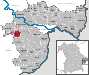
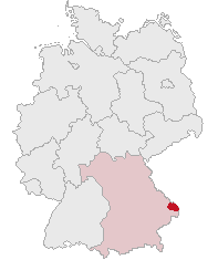
Passau (Landkreis Passau)
- district of Bavaria, Germany
Hiking in the Passau district, located in the southeast of Bavaria, Germany, offers an array of scenic trails and beautiful landscapes characterized by hills, forests, rivers, and charming villages. The Passau area is known for its impressive natural beauty, making it a great destination for hikers of all experience levels. Below are some highlights of hiking in the region:
Trails and Routes
-
Donauwanderweg (Danube Trail): This long-distance trail follows the banks of the Danube River and provides picturesque views of the river and surrounding landscapes. Hikers can enjoy the vibrant nature and picturesque villages along the way.
-
Baumwipfelpfad (Tree Top Walk): Located in nearby Neuschönau, this elevated trail offers stunning views of the Bavarian Forest. It is an accessible option for families and those who may not wish to hike long distances.
-
Vogelpark and Trails Around the Danube: The area around the Danube is rich in nature reserves and parks, providing opportunities for short hikes to appreciate local flora and fauna. Walking trails around the Vogelpark allow for a leisurely experience.
-
Nationalpark Bayerischer Wald (Bavarian Forest National Park): Although a bit further from Passau, the national park offers extensive hiking trails that range from easy to challenging. Interconnected trails take you through pristine forests, past lakes, and over hills.
-
Ilz River Trails: The Ilz is often called the "black river" due to its dark water, and the trails along its banks offer stunning views and a chance to experience the area's biodiversity.
Tips for Hiking in Passau
- Seasonal Considerations: Spring and fall are particularly pleasant for hiking, with mild weather and beautiful landscapes. Summer can be warm, while winter hiking may pose challenges depending on snow conditions.
- Trail Maps and Signage: Most trails are well-marked and maintained, but it’s always beneficial to carry a map or use a hiking app for navigation.
- Local Culture: Take the time to explore the quaint villages and local cuisine after your hikes. The region is known for hearty Bavarian food and traditional beer gardens.
- Safety: Always inform someone of your hiking plans and check weather conditions before heading out. Carry plenty of water, snacks, and a first aid kit.
Conclusion
With its diverse trails and stunning landscapes, hiking in the Passau district is a rewarding experience for outdoor enthusiasts. Whether you prefer leisurely walks along the rivers or more challenging hikes in the nearby national parks, there are numerous options to enjoy the natural beauty of this charming region of Bavaria.
- Country:

- Capital: Passau
- Licence Plate Code: PA
- Coordinates: 48° 30' 0" N, 13° 19' 48" E


- GPS tracks (wikiloc): [Link]
- AboveSeaLevel: 364 м m
- Area: 1530.04 sq km
- Population: 162355
- Web site: http://www.landkreis-passau.de/
- Wikipedia en: wiki(en)
- Wikipedia: wiki(de)
- Wikidata storage: Wikidata: Q10489
- Wikipedia Commons Category: [Link]
- Wikipedia Commons Maps Category: [Link]
- Freebase ID: [/m/01gmrw]
- GeoNames ID: Alt: [3220813]
- VIAF ID: Alt: [129107221]
- OSM relation ID: [62541]
- GND ID: Alt: [4044831-9]
- archINFORM location ID: [2558]
- Library of Congress authority ID: Alt: [n88032018]
- TGN ID: [7077305]
- SUDOC authorities ID: [093666217]
- Historical Gazetteer (GOV) ID: [adm_139275]
- Bavarikon ID: [ODB_A00002378]
- ISNI: Alt: [0000 0004 0415 7662]
- NUTS code: [DE228]
- Ringgold ID: [169327]
- German district key: 09275
Includes regions:
Kirchham
- municipality of Germany
Kirchham is a charming village located in Austria, near the Danube River, and it offers several hiking opportunities for outdoor enthusiasts. The region is characterized by its picturesque landscapes, rolling hills, and scenic views, making it an appealing destination for hikers of all levels....
- Country:

- Postal Code: 94148
- Local Dialing Code: 08533
- Licence Plate Code: PA
- Coordinates: 48° 21' 0" N, 13° 16' 0" E


- GPS tracks (wikiloc): [Link]
- AboveSeaLevel: 335 м m
- Area: 18.47 sq km
- Population: 1969
- Web site: [Link]
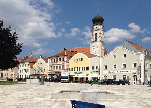

Bad Griesbach im Rottal
- municipality of Germany
 Hiking in Bad Griesbach im Rottal
Bad Griesbach, located in the Rottal area of Bavaria, Germany, is renowned for its beautiful landscapes, spa facilities, and a variety of hiking opportunities. Here’s what you can expect when hiking in this picturesque area:...
- Country:

- Postal Code: 94086
- Local Dialing Code: 08542; 08532
- Coordinates: 48° 27' 0" N, 13° 12' 0" E


- GPS tracks (wikiloc): [Link]
- AboveSeaLevel: 453 м m
- Area: 70.13 sq km
- Population: 8859
- Web site: [Link]


Aidenbach
- municipality of Germany
Aidenbach, located in Bavaria, Germany, is a charming area that offers a variety of beautiful hiking trails. The region is characterized by its rolling hills, lush forests, and picturesque landscapes, making it a delightful destination for both novice and experienced hikers....
- Country:

- Postal Code: 94501
- Local Dialing Code: 08543
- Licence Plate Code: PA
- Coordinates: 48° 34' 0" N, 13° 6' 0" E


- GPS tracks (wikiloc): [Link]
- AboveSeaLevel: 345 м m
- Area: 17.1 sq km
- Population: 2323
- Web site: [Link]


Hauzenberg
- municipality of Germany
Hauzenberg, located in Bavaria, Germany, offers a variety of beautiful hiking trails that showcase the stunning natural landscapes of the region. Nestled in the foothills of the Bavarian Forest, Hauzenberg is known for its lush forests, rolling hills, and picturesque views. Here are some key points about hiking in Hauzenberg:...
- Country:

- Postal Code: 94051; W-8395; 8391; 8395
- Local Dialing Code: 08586
- Licence Plate Code: PA
- Coordinates: 48° 39' 6" N, 13° 37' 25" E


- GPS tracks (wikiloc): [Link]
- AboveSeaLevel: 546 м m
- Area: 82.80 sq km
- Population: 11857
- Web site: [Link]


Fürstenzell
- municipality of Germany
Fürstenzell is a charming municipality located in Bavaria, Germany, known for its picturesque landscapes and outdoor activities, including hiking. The area is characterized by rolling hills, wooded areas, and beautiful countryside, making it an ideal destination for nature enthusiasts and hikers....
- Country:

- Postal Code: 94081
- Local Dialing Code: 08502
- Licence Plate Code: PA
- Coordinates: 48° 31' 21" N, 13° 19' 4" E


- GPS tracks (wikiloc): [Link]
- AboveSeaLevel: 358 м m
- Area: 79.36 sq km
- Population: 6794
- Web site: [Link]

Aicha vorm Wald
- municipality of Germany
Aicha vorm Wald is a beautiful village located in Bavaria, Germany, which offers several opportunities for hiking enthusiasts. The region is characterized by its picturesque landscapes, rolling hills, and lush forests, making it an ideal location for both casual walkers and seasoned hikers....
- Country:

- Postal Code: 94529
- Local Dialing Code: 08544
- Licence Plate Code: PA
- Coordinates: 48° 40' 25" N, 13° 17' 28" E


- GPS tracks (wikiloc): [Link]
- AboveSeaLevel: 360 м m
- Area: 20.35 sq km
- Population: 2026
- Web site: [Link]
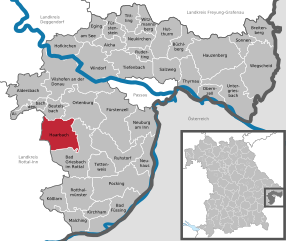
Haarbach
- municipality of Germany
Haarbach, located in Bavaria, Germany, is a lesser-known gem for those interested in hiking and nature exploration. While many people gravitate towards the popular hiking regions in the Alps or along more famous trails, Haarbach offers its own unique experiences. Here are a few highlights for hiking in and around Haarbach:...
- Country:

- Postal Code: 94542
- Local Dialing Code: 08535
- Licence Plate Code: PA
- Coordinates: 48° 30' 0" N, 13° 9' 0" E


- GPS tracks (wikiloc): [Link]
- AboveSeaLevel: 380 м m
- Area: 47.71 sq km
- Population: 2374
- Web site: [Link]
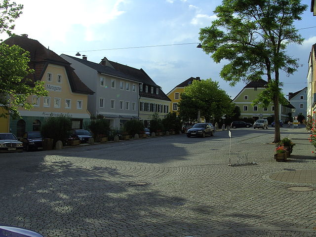

Ortenburg
- municipality of Germany
Ortenburg, located in Bavaria, Germany, offers some beautiful hiking opportunities in a picturesque setting. Situated near the border with Austria, this area is characterized by rolling hills, lush forests, and stunning landscapes that are appealing for both casual walkers and more experienced hikers....
- Country:

- Postal Code: 94496
- Local Dialing Code: 08542
- Licence Plate Code: PA
- Coordinates: 48° 32' 0" N, 13° 13' 0" E


- GPS tracks (wikiloc): [Link]
- AboveSeaLevel: 358 м m
- Area: 60.75 sq km
- Population: 6546
- Web site: [Link]


Obernzell
- municipality of Germany
Obernzell is a charming town in Bavaria, Germany, located along the banks of the Danube River. The area is known for its beautiful natural landscapes, making it an excellent destination for hiking enthusiasts. Here’s what you can expect when hiking in Obernzell:...
- Country:

- Postal Code: 94107; 94130; W-8391; 8391
- Local Dialing Code: 08591
- Licence Plate Code: PA
- Coordinates: 48° 33' 16" N, 13° 38' 17" E


- GPS tracks (wikiloc): [Link]
- AboveSeaLevel: 294 м m
- Area: 18.20 sq km
- Population: 3425
- Web site: [Link]


Vilshofen an der Donau
- municipality of Germany
 Hiking in Vilshofen an der Donau
Vilshofen an der Donau is a picturesque town located in Bavaria, Germany, along the banks of the Danube River. This area offers a variety of hiking opportunities suitable for different skill levels, enhanced by its stunning landscapes, lush forests, and charming riverside views....
- Country:

- Postal Code: 94474
- Local Dialing Code: 08549; 08548; 08541
- Licence Plate Code: PA
- Coordinates: 48° 37' 59" N, 13° 11' 18" E


- GPS tracks (wikiloc): [Link]
- AboveSeaLevel: 308 м m
- Area: 86.29 sq km
- Population: 15142
- Web site: [Link]


Aldersbach
- municipality of Germany
Aldersbach, located in Bavaria, Germany, is a picturesque area that offers a variety of hiking opportunities. Nestled in a scenic landscape, it is an ideal destination for nature lovers and outdoor enthusiasts. Here are some highlights of hiking in Aldersbach:...
- Country:

- Postal Code: 94501
- Local Dialing Code: 08543
- Licence Plate Code: PA
- Coordinates: 48° 35' 17" N, 13° 5' 8" E


- GPS tracks (wikiloc): [Link]
- AboveSeaLevel: 328 м m
- Area: 45.8 sq km
- Population: 3574
- Web site: [Link]

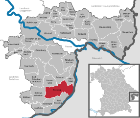
Pocking
- municipality of Germany
Pocking is a town located in Bavaria, Germany, near the border with Austria. While it may not be as widely recognized for hiking as other regions in Bavaria, it offers access to some lovely trails and scenic landscapes....
- Country:

- Postal Code: 94060
- Local Dialing Code: 08531
- Licence Plate Code: PA
- Coordinates: 48° 23' 59" N, 13° 19' 0" E


- GPS tracks (wikiloc): [Link]
- AboveSeaLevel: 323 м m
- Area: 68.86 sq km
- Population: 11152
- Web site: [Link]
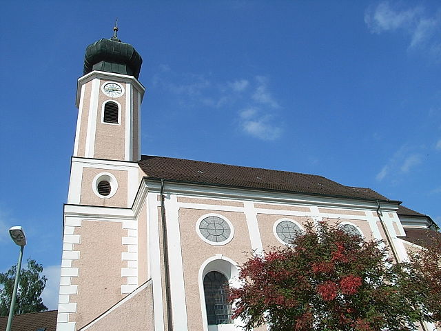

Ruhstorf an der Rott
- municipality in the district of Passau in Bavaria
 Hiking in Ruhstorf an der Rott
Ruhstorf an der Rott is a picturesque village located in Bavaria, Germany, and offers a charming environment for hiking enthusiasts. The surrounding region is characterized by rolling hills, lush meadows, and scenic woodlands, making it an excellent destination for various outdoor activities. Here are some highlights and tips for hiking in and around Ruhstorf an der Rott:...
- Country:

- Postal Code: 94099
- Local Dialing Code: 08531
- Licence Plate Code: PA
- Coordinates: 48° 26' 0" N, 13° 20' 0" E


- GPS tracks (wikiloc): [Link]
- AboveSeaLevel: 317 м m
- Area: 51.46 sq km
- Population: 5844
- Web site: [Link]
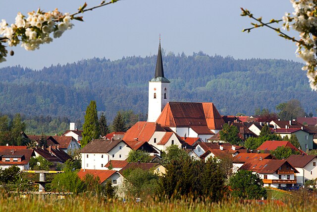

Eging am See
- municipality of Germany
Eging am See, located in Bavaria, Germany, is a charming destination for outdoor enthusiasts, particularly those interested in hiking. The area is known for its scenic landscapes, including the beautiful Egginger See (Eging Lake), lush forests, and rolling hills. Here are some highlights and tips for hiking in Eging am See:...
- Country:

- Postal Code: 94535
- Local Dialing Code: 08544
- Licence Plate Code: PA
- Coordinates: 48° 43' 0" N, 13° 16' 0" E


- GPS tracks (wikiloc): [Link]
- AboveSeaLevel: 399 м m
- Area: 23.66 sq km
- Population: 3208
- Web site: [Link]


Neukirchen vorm Wald
- municipality in Bavaria, Germany
 Hiking in Neukirchen vorm Wald
Neukirchen vorm Wald, located in Bavaria, Germany, is a charming village that offers appealing hiking opportunities in a picturesque natural setting. The region is characterized by rolling hills, lush forests, and beautiful meadows, making it an ideal destination for hikers of all levels....
- Country:

- Postal Code: 94154
- Local Dialing Code: 08504
- Licence Plate Code: PA
- Coordinates: 48° 41' 0" N, 13° 23' 0" E


- GPS tracks (wikiloc): [Link]
- AboveSeaLevel: 466 м m
- Area: 24.3 sq km
- Population: 2071
- Web site: [Link]
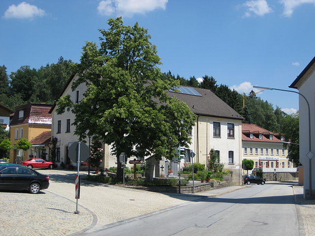

Büchlberg
- municipality of Germany
Büchlberg is a charming village located in Bavaria, Germany, and is surrounded by beautiful landscapes perfect for hiking enthusiasts. The area provides a variety of trails suitable for different skill levels, offering opportunities to explore picturesque countryside, forests, and hills....
- Country:

- Postal Code: 94124
- Local Dialing Code: 08505
- Licence Plate Code: PA
- Coordinates: 48° 40' 5" N, 13° 30' 39" E


- GPS tracks (wikiloc): [Link]
- AboveSeaLevel: 490 м m
- Area: 28.12 sq km
- Population: 3331
- Web site: [Link]

Malching
- municipality of Germany
Malching is a lesser-known trekking destination, and specific details about its hiking trails may be limited. However, when exploring any hiking area, it's important to consider a few general tips:...
- Country:

- Postal Code: 94094
- Local Dialing Code: 08573
- Licence Plate Code: PA
- Coordinates: 48° 19' 0" N, 13° 12' 0" E


- GPS tracks (wikiloc): [Link]
- AboveSeaLevel: 345 м m
- Area: 25.23 sq km
- Population: 1154
- Web site: [Link]


Witzmannsberg
- municipality of Germany
Witzmannsberg is a beautiful hiking destination located in Germany, known for its picturesque landscapes and serene environment. Here are some details that may help you plan your hiking trip there:...
- Country:

- Postal Code: 94104
- Local Dialing Code: 08504
- Licence Plate Code: PA
- Coordinates: 48° 43' 0" N, 13° 25' 0" E


- GPS tracks (wikiloc): [Link]
- AboveSeaLevel: 495 м m
- Area: 18.74 sq km
- Population: 1402
- Web site: [Link]


Hutthurm
- municipality of Germany
Hutthurm, located in Bavaria, Germany, is a small town that serves as an excellent starting point for a variety of outdoor activities, including hiking. The surrounding region is characterized by its beautiful landscapes, rolling hills, forests, and scenic views, making it a delightful place for hikers of all levels....
- Country:

- Postal Code: 94116
- Local Dialing Code: 08505
- Licence Plate Code: PA
- Coordinates: 48° 40' 17" N, 13° 28' 16" E


- GPS tracks (wikiloc): [Link]
- AboveSeaLevel: 465 м m
- Area: 37.2 sq km
- Population: 4935
- Web site: [Link]

Sonnen
- municipality of Germany
Hiking in Sonnen, a small municipality in the Bavaria region of Germany, offers a variety of beautiful trails and scenic views. The area around Sonnen is characterized by rolling hills, lush forests, and picturesque countryside, making it an ideal destination for hikers of all experience levels....
- Country:

- Postal Code: 94164; W-8391; 8391
- Local Dialing Code: 08584
- Licence Plate Code: PA
- Coordinates: 48° 41' 5" N, 13° 43' 25" E


- GPS tracks (wikiloc): [Link]
- AboveSeaLevel: 836 м m
- Area: 16.50 sq km
- Population: 1367
- Web site: [Link]
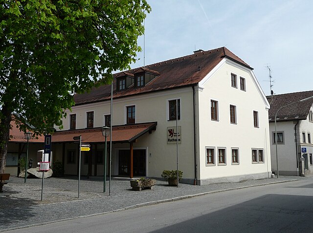

Windorf
- municipality of Germany
Hiking in Windorf can be a fantastic experience, as it often features beautiful landscapes, diverse terrain, and opportunities for outdoor adventure. While specific details about Windorf may vary depending on the region you are referring to (as there are places named Windorf in different countries), I can provide general tips and information that are applicable to hiking in many scenic areas....
- Country:

- Postal Code: 94575
- Local Dialing Code: 08546
- Licence Plate Code: PA
- Coordinates: 48° 37' 30" N, 13° 13' 30" E


- GPS tracks (wikiloc): [Link]
- AboveSeaLevel: 306 м m
- Area: 56.9 sq km
- Population: 4212
- Web site: [Link]

Salzweg
- municipality of Germany
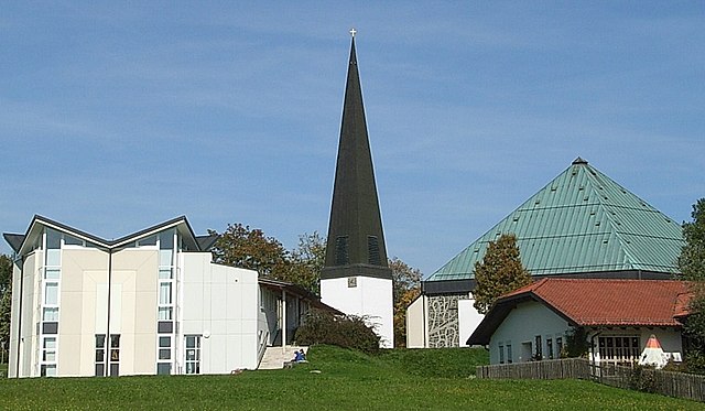
Salzweg is a municipality located in Bavaria, Germany, near Passau, which is known for its beautiful landscapes and outdoor opportunities. Hiking enthusiasts will find plenty to explore in this region, characterized by rolling hills, scenic valleys, and lush forests....
- Country:

- Postal Code: 94121
- Local Dialing Code: 0851
- Licence Plate Code: PA
- Coordinates: 48° 36' 57" N, 13° 28' 57" E


- GPS tracks (wikiloc): [Link]
- AboveSeaLevel: 452 м m
- Area: 31.94 sq km
- Population: 5018
- Web site: [Link]


Thyrnau
- municipality of Germany
Thyrnau is a picturesque village located in the Lower Bavaria region of Germany. Nestled near the Danube River and surrounded by scenic landscapes, it offers various hiking opportunities for outdoor enthusiasts....
- Country:

- Postal Code: 94136
- Local Dialing Code: 08501
- Licence Plate Code: PA
- Coordinates: 48° 36' 54" N, 13° 32' 13" E


- GPS tracks (wikiloc): [Link]
- AboveSeaLevel: 456 м m
- Area: 33.74 sq km
- Population: 3534
- Web site: [Link]

Neuburg am Inn
- municipality of Germany
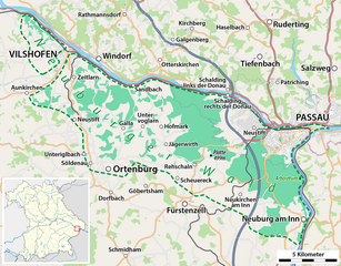
Neuburg am Inn, a picturesque town situated along the Danube River in Bavaria, Germany, offers a variety of hiking opportunities for outdoor enthusiasts. The region is characterized by its beautiful landscapes, including forests, hills, and riverbanks, making it ideal for both easy walks and more challenging hikes....
- Country:

- Postal Code: 94127
- Local Dialing Code: 08507; 08502
- Licence Plate Code: PA
- Coordinates: 48° 30' 22" N, 13° 26' 54" E


- GPS tracks (wikiloc): [Link]
- AboveSeaLevel: 452 м m
- Area: 41.75 sq km
- Population: 3257
- Web site: [Link]


Tettenweis
- municipality of Germany
Tettenweis, a picturesque village in Bavaria, Germany, is surrounded by beautiful landscapes and offers various hiking opportunities for outdoor enthusiasts. The region features gentle rolling hills, lush forests, and charming agricultural landscapes, making it ideal for both casual and experienced hikers....
- Country:

- Postal Code: 94167
- Local Dialing Code: 08534
- Licence Plate Code: PA
- Coordinates: 48° 26' 0" N, 13° 16' 0" E


- GPS tracks (wikiloc): [Link]
- AboveSeaLevel: 335 м m
- Area: 28.7 sq km
- Population: 1658
- Web site: [Link]


Bad Füssing
- municipality of Germany
Bad Füssing, located in Bavaria, Germany, is predominantly known for its thermal spas, but it also provides excellent opportunities for hiking amidst beautiful natural landscapes. The region is characterized by its gentle hills, lush forests, and the scenic landscape of the Isar valley. Here are some highlights of hiking in Bad Füssing:...
- Country:

- Postal Code: 94072
- Local Dialing Code: 08531
- Licence Plate Code: PA
- Coordinates: 48° 21' 0" N, 13° 18' 0" E


- GPS tracks (wikiloc): [Link]
- AboveSeaLevel: 320 м m
- Area: 55.06 sq km
- Population: 6994
- Web site: [Link]

Fürstenstein
- municipality of Germany
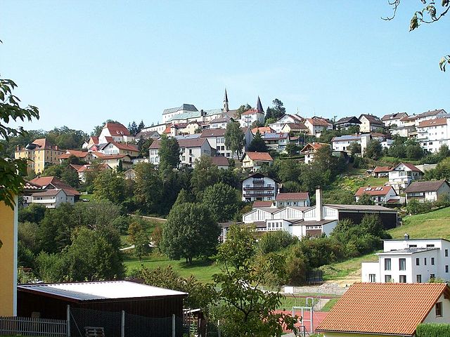
Fürstenstein, located in Bavaria, Germany, is an attractive destination for hiking enthusiasts. The region is known for its picturesque landscapes, beautiful forests, and rolling hills, making it an ideal spot for both casual walkers and seasoned hikers....
- Country:

- Postal Code: 94538
- Local Dialing Code: 08504
- Licence Plate Code: PA
- Coordinates: 48° 43' 0" N, 13° 20' 0" E


- GPS tracks (wikiloc): [Link]
- AboveSeaLevel: 577 м m
- Area: 19.3 sq km
- Population: 3550
- Web site: [Link]

Kößlarn
- municipality of Germany
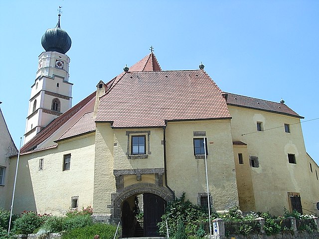
Kößlarn is a village located in Bavaria, Germany, known for its picturesque landscapes and outdoor activities, including hiking. The region surrounding Kößlarn offers various trails suitable for different skill levels, making it an appealing destination for both novice and experienced hikers....
- Country:

- Postal Code: 94149
- Local Dialing Code: 08536
- Licence Plate Code: PA
- Coordinates: 48° 22' 25" N, 13° 7' 26" E


- GPS tracks (wikiloc): [Link]
- AboveSeaLevel: 425 м m
- Area: 25.48 sq km
- Population: 1696
- Web site: [Link]
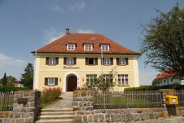

Neuhaus am Inn
- municipality of Germany
Neuhaus am Inn is a charming town located in Bavaria, Germany, near the border with Austria. Surrounded by beautiful landscapes, it serves as an excellent base for hiking enthusiasts. Here are some highlights and tips to consider when hiking in this area:...
- Country:

- Postal Code: 94152
- Local Dialing Code: 08503
- Licence Plate Code: PA
- Coordinates: 48° 27' 38" N, 13° 25' 13" E


- GPS tracks (wikiloc): [Link]
- AboveSeaLevel: 323 м m
- Area: 31.07 sq km
- Population: 3415
- Web site: [Link]

Tiefenbach
- human settlement in Germany
Tiefenbach, near Passau in Germany, is a wonderful area for hiking, boasting beautiful landscapes, scenic views, and a variety of trails suitable for different skill levels. Here are some key points about hiking in this area:...
- Country:

- Postal Code: 94113
- Local Dialing Code: 08509
- Licence Plate Code: PA
- Coordinates: 48° 37' 28" N, 13° 23' 56" E


- GPS tracks (wikiloc): [Link]
- AboveSeaLevel: 373 м m
- Area: 49.71 sq km
- Population: 5524
- Web site: [Link]


Breitenberg
- municipality of Germany
Breitenberg, located in Lower Bavaria, is a fantastic destination for hiking enthusiasts. The region features a mix of scenic landscapes, charming villages, and diverse flora and fauna, making it ideal for both casual hikers and experienced trekkers....
- Country:

- Postal Code: 94139
- Local Dialing Code: 08584
- Licence Plate Code: PA
- Coordinates: 48° 42' 14" N, 13° 47' 39" E


- GPS tracks (wikiloc): [Link]
- AboveSeaLevel: 689 м m
- Area: 29.87 sq km
- Population: 2109
- Web site: [Link]
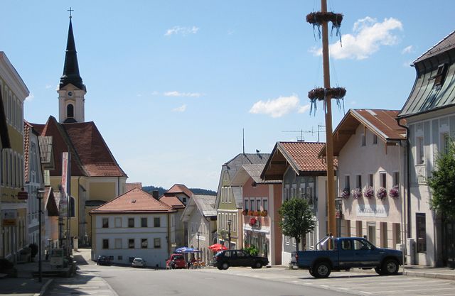

Untergriesbach
- municipality of Germany
Untergriesbach, located in Bavaria, Germany, is a charming area surrounded by beautiful natural landscapes, making it an excellent destination for hiking enthusiasts. Here are some key points about hiking in and around Untergriesbach:...
- Country:

- Postal Code: 94107; W-8391; 8391
- Local Dialing Code: 08593
- Licence Plate Code: PA
- Coordinates: 48° 34' 25" N, 13° 40' 2" E


- GPS tracks (wikiloc): [Link]
- AboveSeaLevel: 556 м m
- Area: 73.61 sq km
- Population: 5814
- Web site: [Link]


Ruderting
- municipality of Germany
Ruderting, a small municipality in Bavaria, Germany, offers a variety of outdoor activities, including hiking. The area is characterized by its beautiful landscapes, including rolling hills, forests, and agricultural fields, making it an appealing destination for nature lovers....
- Country:

- Postal Code: 94161
- Local Dialing Code: 08509
- Licence Plate Code: PA
- Coordinates: 48° 39' 12" N, 13° 24' 31" E


- GPS tracks (wikiloc): [Link]
- AboveSeaLevel: 450 м m
- Area: 12.96 sq km
- Population: 2487
- Web site: [Link]


Tittling
- municipality of Germany
Tittling is a small town located in Germany, specifically in the Bavarian region. It's nestled near the border with Austria and is surrounded by scenic nature, making it ideal for hiking enthusiasts. Here are a few highlights about hiking in and around Tittling:...
- Country:

- Postal Code: 94104
- Local Dialing Code: 08504
- Licence Plate Code: PA
- Coordinates: 48° 43' 33" N, 13° 22' 55" E


- GPS tracks (wikiloc): [Link]
- AboveSeaLevel: 540 м m
- Area: 20.78 sq km
- Population: 3860
- Web site: [Link]
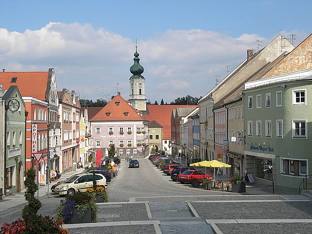

Rotthalmünster
- municipality of Germany
Rotthalmünster is a picturesque village located in Bavaria, Germany, offering a variety of hiking opportunities amid beautiful landscapes. When planning a hiking trip in and around Rotthalmünster, here are some highlights and tips to consider:...
- Country:

- Postal Code: 94094
- Local Dialing Code: 08533
- Licence Plate Code: PA
- Coordinates: 48° 21' 35" N, 13° 12' 10" E


- GPS tracks (wikiloc): [Link]
- AboveSeaLevel: 405 м m
- Area: 44.55 sq km
- Population: 4538
- Web site: [Link]

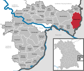
Wegscheid
- municipality of Germany
Wegscheid, located in Bavaria, Germany, is a charming destination for hiking enthusiasts. The area is characterized by its picturesque landscapes, including rolling hills, lush forests, and panoramic views of the surrounding region. Here are some highlights and tips for hiking in Wegscheid:...
- Country:

- Postal Code: 94110; W-8396; 8396
- Local Dialing Code: 08592
- Coordinates: 48° 36' 0" N, 13° 47' 0" E


- GPS tracks (wikiloc): [Link]
- AboveSeaLevel: 718 м m
- Area: 80.64 sq km
- Population: 5393
- Web site: [Link]


Hofkirchen
- municipality of Germany
Hofkirchen, located in the Bavarian region of Germany, is a charming area surrounded by picturesque landscapes that make it a great destination for hiking enthusiasts. While it might not be as famous as some other Bavarian hiking spots, it offers a range of scenic trails suitable for different experience levels....
- Country:

- Postal Code: 94544
- Local Dialing Code: 08545
- Licence Plate Code: PA
- Coordinates: 48° 41' 0" N, 13° 7' 0" E


- GPS tracks (wikiloc): [Link]
- AboveSeaLevel: 309 м m
- Area: 32.7 sq km
- Population: 3122
- Web site: [Link]
Beutelsbach
- municipality of Germany
Beutelsbach, located in the picturesque region of Baden-Württemberg, Germany, offers a variety of hiking opportunities that cater to different skill levels. The area is characterized by its rolling hills, vineyards, and scenic landscapes, making it a delightful destination for outdoor enthusiasts....
- Country:

- Postal Code: 94501
- Local Dialing Code: 08543
- Licence Plate Code: PA
- Coordinates: 48° 33' 0" N, 13° 7' 0" E


- GPS tracks (wikiloc): [Link]
- AboveSeaLevel: 357 м m
- Area: 20.39 sq km
- Population: 1082
- Web site: [Link]
Shares border with regions:
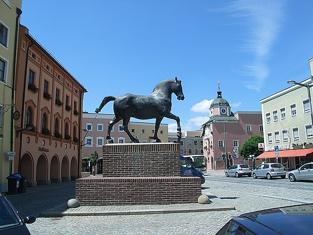

Rottal-Inn
- district of Bavaria, Germany
Rottal-Inn, located in Bavaria, Germany, is a picturesque area known for its natural beauty and diverse landscapes, making it an excellent destination for hiking enthusiasts. The region is characterized by rolling hills, lush forests, and charming villages, providing a variety of hiking trails suitable for all skill levels. Here are some highlights to consider when hiking in Rottal-Inn:...
- Country:

- Capital: Pfarrkirchen
- Licence Plate Code: PAN; VIB; GRI; EG
- Coordinates: 48° 25' 12" N, 12° 55' 12" E


- GPS tracks (wikiloc): [Link]
- AboveSeaLevel: 461 м m
- Area: 1.28 sq km
- Population: 104013
- Web site: [Link]


Deggendorf
- district in Bavaria, Germany
Deggendorf, located in Bavaria, Germany, is a fantastic region for hiking enthusiasts. Nestled at the edge of the Bavarian Forest National Park and alongside the Danube River, it boasts a variety of landscapes and trails suitable for all skill levels....
- Country:

- Capital: Deggendorf
- Licence Plate Code: DEG
- Coordinates: 48° 49' 48" N, 13° 0' 0" E


- GPS tracks (wikiloc): [Link]
- AboveSeaLevel: 309 м m
- Area: 861.00 sq km
- Population: 115005
- Web site: [Link]
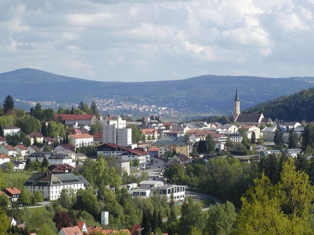
Freyung-Grafenau
- district in Bavaria, Germany
Freyung-Grafenau is a beautiful district located in Bavaria, Germany, known for its stunning landscapes, dense forests, and rugged terrain, making it a great destination for hiking enthusiasts. Here are some highlights and trails to consider when hiking in the area:...
- Country:

- Capital: Freyung
- Licence Plate Code: WOS; GRA; FRG
- Coordinates: 48° 49' 48" N, 13° 30' 0" E


- GPS tracks (wikiloc): [Link]
- AboveSeaLevel: 693 м m
- Area: 984.00 sq km
- Population: 75564
- Web site: [Link]
Rohrbach District
- district of Austria
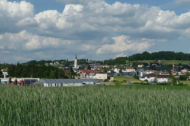
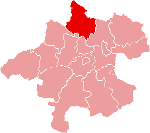
Rohrbach District, located in the southwestern part of Germany, offers a variety of hiking opportunities amidst its scenic landscapes, charming villages, and historical sites. The area is characterized by diverse terrain, including forested hills, meadows, and picturesque valleys, making it an excellent destination for hikers of all skill levels....
- Country:

- Capital: Rohrbach in Oberösterreich
- Licence Plate Code: RO
- Coordinates: 48° 32' 38" N, 13° 58' 23" E


- GPS tracks (wikiloc): [Link]
- AboveSeaLevel: 583 м m
- Area: 817.19 sq km
- Web site: [Link]


Passau
- town in Bavaria, Germany
Passau, located at the confluence of the Danube, Inn, and Ilz rivers in Bavaria, Germany, offers a unique mix of cultural and natural hiking experiences. The surrounding region is characterized by scenic landscapes, historic towns, and well-maintained trails, making it an excellent destination for hikers of all levels....
- Country:

- Postal Code: 94001; 94036; 94034; 94032
- Local Dialing Code: 0851
- Licence Plate Code: PA
- Coordinates: 48° 34' 0" N, 13° 28' 0" E


- GPS tracks (wikiloc): [Link]
- AboveSeaLevel: 312 м m
- Area: 69580000 sq km
- Population: 50566
- Web site: [Link]

Schärding District
- district of Austria
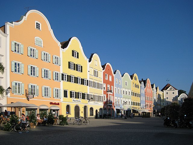
Schärding District, located in Upper Austria, is known for its picturesque landscapes, charming towns, and well-marked hiking trails. The area is characterized by rolling hills, lush forests, and the scenic banks of the Inn River, making it an excellent destination for hikers of all skill levels....
- Country:

- Capital: Schärding
- Licence Plate Code: SD
- Coordinates: 48° 26' 24" N, 13° 34' 41" E


- GPS tracks (wikiloc): [Link]
- AboveSeaLevel: 489 м m
- Area: 618.49 sq km
- Web site: [Link]
