Maltot (Maltot)

- commune in Calvados, France
- Country:

- Postal Code: 14930
- Coordinates: 49° 7' 45" N, 0° 25' 22" E


- GPS tracks (wikiloc): [Link]
- Area: 4.24 sq km
- Population: 1071
- Web site: https://www.maltot.fr/
- Wikipedia en: wiki(en)
- Wikipedia: wiki(fr)
- Wikidata storage: Wikidata: Q536914
- Wikipedia Commons Category: [Link]
- Freebase ID: [/m/0307tz]
- Freebase ID: [/m/0307tz]
- GeoNames ID: Alt: [6427311]
- GeoNames ID: Alt: [6427311]
- SIREN number: [211403969]
- SIREN number: [211403969]
- BnF ID: [152478107]
- BnF ID: [152478107]
- PACTOLS thesaurus ID: [pcrtFf1B5SSMEW]
- PACTOLS thesaurus ID: [pcrtFf1B5SSMEW]
- INSEE municipality code: 14396
- INSEE municipality code: 14396
Shares border with regions:

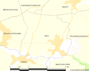
Vieux
- commune in Calvados, France
- Country:
- Postal Code: 14930
- Coordinates: 49° 6' 27" N, 0° 26' 1" E
- GPS tracks (wikiloc): [Link]
- Area: 5.5 sq km
- Population: 716


Éterville
- commune in Calvados, France
- Country:
- Postal Code: 14930
- Coordinates: 49° 8' 38" N, 0° 25' 31" E
- GPS tracks (wikiloc): [Link]
- Area: 4.87 sq km
- Population: 1580


Louvigny
- commune in Calvados, France
- Country:
- Postal Code: 14111
- Coordinates: 49° 9' 28" N, 0° 23' 31" E
- GPS tracks (wikiloc): [Link]
- Area: 5.64 sq km
- Population: 2788
- Web site: [Link]


Fontaine-Étoupefour
- commune in Calvados, France
- Country:
- Postal Code: 14790
- Coordinates: 49° 8' 46" N, 0° 27' 15" E
- GPS tracks (wikiloc): [Link]
- Area: 5.08 sq km
- Population: 2243
- Web site: [Link]


Saint-André-sur-Orne
- commune in Calvados, France
- Country:
- Postal Code: 14320
- Coordinates: 49° 7' 6" N, 0° 22' 59" E
- GPS tracks (wikiloc): [Link]
- Area: 3.68 sq km
- Population: 1802
- Web site: [Link]


Feuguerolles-Bully
- commune in Calvados, France
- Country:
- Postal Code: 14320
- Coordinates: 49° 7' 1" N, 0° 24' 26" E
- GPS tracks (wikiloc): [Link]
- AboveSeaLevel: 90 м m
- Area: 8.18 sq km
- Population: 1418
- Web site: [Link]