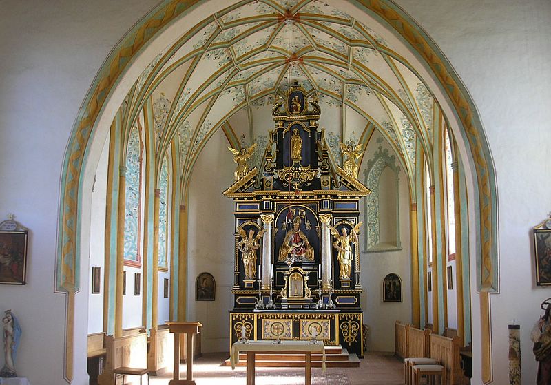
Mammendorf (Mammendorf)

- municipality of Germany
 Hiking in Mammendorf
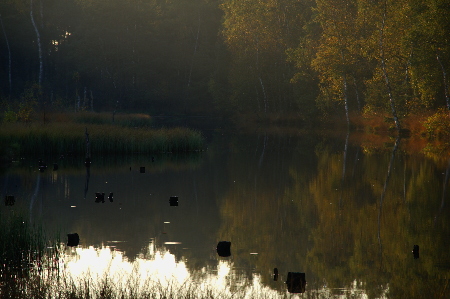
Mammendorf is a small municipality located in Bavaria, Germany, which offers access to scenic landscapes and the natural beauty of the surrounding area. While it may not be as famous as some larger hiking destinations, it can still provide enjoyable experiences for those looking to explore the outdoors. Here are some key points about hiking in and around Mammendorf:
-
Trails and Routes: Mammendorf connects to several local trails that weave through picturesque Bavarian countryside, including fields, forests, and farmlands. Look for marked hiking trails that vary in difficulty, accommodating both beginners and more experienced hikers.
-
Natural Attractions: The area is characterized by charming rural scenery. You can expect to see meadows, small woodlands, and perhaps even some wildlife. The landscape gives a peaceful ambiance, perfect for leisurely hikes.
-
Nearby Hiking Opportunities: Consider exploring neighboring regions or nearby nature parks, such as the Augsburg Western Woods Nature Park, which has a network of trails suitable for various skill levels. It's a short trip from Mammendorf and offers more extensive hiking options.
-
Seasonal Hiking: Each season presents a different experience in Mammendorf. Spring and summer provide lush greenery and blooming flowers, while autumn showcases vibrant foliage. Winter hiking can be magical if there’s snow, but make sure to check trail conditions.
-
Local Culture: As you hike through Mammendorf, take the time to enjoy local Bavarian culture, including traditional food and friendly communities. You might find small farms or villages where you can stop for refreshments.
-
Preparation: Always come prepared with good hiking gear, sufficient water, and maps or a GPS device. Since trails can sometimes be less maintained in rural areas, it's a good idea to know your route.
-
Safety: Be mindful of weather conditions and trail etiquette, especially if you are hiking with a group or with pets. Inform someone of your plans before heading out, especially if you venture into less trafficked areas.
Whether you're looking for a quick nature walk or more extended outdoor adventures, hiking in and around Mammendorf can be a rewarding experience. Enjoy the fresh air and beautiful scenery!
- Country:

- Postal Code: 82291
- Local Dialing Code: 08145
- Licence Plate Code: FFB
- Coordinates: 48° 12' 0" N, 11° 9' 0" E


- GPS tracks (wikiloc): [Link]
- AboveSeaLevel: 536 м m
- Area: 21.21 sq km
- Population: 2593
- Web site: http://mammendorf.de
- Wikipedia en: wiki(en)
- Wikipedia: wiki(de)
- Wikidata storage: Wikidata: Q252426
- Wikipedia Commons Category: [Link]
- Freebase ID: [/m/027zb0f]
- GeoNames ID: Alt: [6556227]
- VIAF ID: Alt: [234768678]
- OSM relation ID: [933535]
- GND ID: Alt: [4494669-7]
- archINFORM location ID: [45304]
- Historical Gazetteer (GOV) ID: [object_300698]
- Bavarikon ID: [ODB_A00001109]
- German municipality key: 09179136
Shares border with regions:


Fürstenfeldbruck
- town in Bavaria, Germany
Hiking in Fürstenfeldbruck
Fürstenfeldbruck is a charming town located in Bavaria, Germany, which offers several opportunities for hiking and outdoor activities. Here's a brief overview of what to expect:...
- Country:
- Postal Code: 82256
- Local Dialing Code: 08141
- Coordinates: 48° 10' 40" N, 11° 15' 20" E
- GPS tracks (wikiloc): [Link]
- AboveSeaLevel: 512 м m
- Area: 32.52 sq km
- Population: 37176
- Web site: [Link]


Oberschweinbach
- municipality of Germany
Hiking in Oberschweinbach
Oberschweinbach, located in Bavaria, Germany, is a quaint village that offers beautiful scenic landscapes and opportunities for hiking. The surrounding area features picturesque countryside, forests, and rolling hills, making it an excellent destination for both casual walkers and avid hikers. Here are some details about hiking in and around Oberschweinbach:...
- Country:
- Postal Code: 82294
- Local Dialing Code: 08145
- Licence Plate Code: FFB
- Coordinates: 48° 15' 0" N, 11° 10' 0" E
- GPS tracks (wikiloc): [Link]
- AboveSeaLevel: 548 м m
- Area: 7.24 sq km
- Population: 1002
- Web site: [Link]


Landsberied
- municipality of Germany
Hiking in Landsberied
Landsberied is a charming village located in Bavaria, Germany, not far from the city of Munich. It's an excellent location for hiking enthusiasts who want to explore the beautiful Bavarian countryside. Here are some highlights and tips for hiking in and around Landsberied:...
- Country:
- Postal Code: 82290
- Local Dialing Code: 08141
- Licence Plate Code: FFB
- Coordinates: 48° 10' 0" N, 11° 10' 0" E
- GPS tracks (wikiloc): [Link]
- AboveSeaLevel: 555 м m
- Area: 10.54 sq km
- Population: 849
- Web site: [Link]


Adelshofen
- municipality of Germany
Hiking in Adelshofen
Adelshofen, a quaint village in Upper Bavaria, is an excellent base for hiking enthusiasts looking to explore the stunning Bavarian countryside. The region is characterized by rolling hills, picturesque landscapes, and a variety of hiking trails that cater to different skill levels....
- Country:
- Postal Code: 82276
- Local Dialing Code: 08146
- Licence Plate Code: FFB
- Coordinates: 48° 11' 0" N, 11° 7' 0" E
- GPS tracks (wikiloc): [Link]
- AboveSeaLevel: 556 м m
- Area: 13.28 sq km
- Population: 1094
- Web site: [Link]


Maisach
- municipality of Germany
Hiking in Maisach
Maisach, located in Bavaria, Germany, offers a peaceful and scenic backdrop for hiking enthusiasts. The region features a variety of trails that cater to different skill levels, from leisurely walks to more challenging hikes....
- Country:
- Postal Code: 82216
- Local Dialing Code: 08142; 08141; 08135
- Licence Plate Code: FFB
- Coordinates: 48° 13' 0" N, 11° 16' 0" E
- GPS tracks (wikiloc): [Link]
- AboveSeaLevel: 514 м m
- Area: 53.45 sq km
- Population: 10007
- Web site: [Link]


Egenhofen
- municipality of Germany
Hiking in Egenhofen
Egenhofen, located in Bavaria, Germany, is a lesser-known hiking destination that can offer a peaceful retreat into nature. The area features scenic landscapes, including rolling hills, forests, and meadows, making it an ideal spot for hikers seeking tranquility away from the busier trails....
- Country:
- Postal Code: 82281
- Local Dialing Code: 08145
- Licence Plate Code: FFB
- Coordinates: 48° 16' 0" N, 11° 10' 0" E
- GPS tracks (wikiloc): [Link]
- AboveSeaLevel: 509 м m
- Area: 33.40 sq km
- Population: 2216
- Web site: [Link]

Jesenwang
- municipality of Germany
Hiking in Jesenwang
Jesenwang is a small municipality located in Bavaria, Germany. While it may not be as well-known for hiking as some of the larger national parks or mountainous regions in Bavaria, it offers some charming options for outdoor enthusiasts looking for a peaceful hike in a picturesque rural setting....
- Country:
- Postal Code: 82287
- Local Dialing Code: 08146
- Licence Plate Code: FFB
- Coordinates: 48° 10' 0" N, 11° 8' 0" E
- GPS tracks (wikiloc): [Link]
- AboveSeaLevel: 558 м m
- Area: 15.30 sq km
- Population: 1044
- Web site: [Link]


Althegnenberg
- municipality of Germany
Hiking in Althegnenberg
Althegnenberg is a small village located in Bavaria, Germany, near the larger town of Fürstenfeldbruck. While it might not be as well-known as more prominent hiking destinations, it offers beautiful trails and scenic views, particularly amidst the picturesque Bavarian countryside....
- Country:
- Postal Code: 82278
- Local Dialing Code: 08202
- Licence Plate Code: FFB
- Coordinates: 48° 14' 0" N, 11° 4' 0" E
- GPS tracks (wikiloc): [Link]
- AboveSeaLevel: 536 м m
- Area: 16.09 sq km
- Population: 1368
- Web site: [Link]

Hattenhofen
- municipality in Bayern, Germany
Hiking in Hattenhofen
Hattenhofen is a charming village located in Bavaria, Germany, known for its picturesque landscapes and proximity to natural attractions. While it's a smaller village, it offers access to several hiking trails that showcase the beautiful Bavarian countryside, rolling hills, and lush forests....
- Country:
- Postal Code: 82285
- Local Dialing Code: 08145
- Licence Plate Code: FFB
- Coordinates: 48° 13' 11" N, 11° 7' 0" E
- GPS tracks (wikiloc): [Link]
- AboveSeaLevel: 556 м m
- Area: 7.17 sq km
- Population: 1090
- Web site: [Link]