Oberschweinbach (Oberschweinbach)

- municipality of Germany
 Hiking in Oberschweinbach
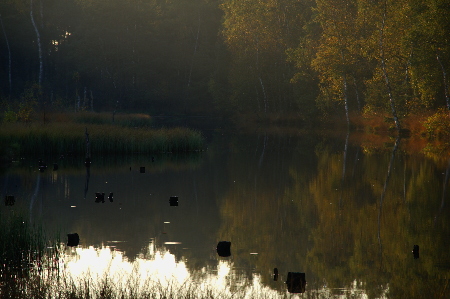
Oberschweinbach, located in Bavaria, Germany, is a quaint village that offers beautiful scenic landscapes and opportunities for hiking. The surrounding area features picturesque countryside, forests, and rolling hills, making it an excellent destination for both casual walkers and avid hikers. Here are some details about hiking in and around Oberschweinbach:
Trails and Routes
-
Local Trails: There are various trails that you can explore in and around the village. These trails often meander through enchanting woodlands, alongside streams, and across open fields, providing a rich natural experience.
-
Nature Parks: The region is close to several nature reserves and parks, which include marked trails of varying difficulties. You can access more extended hiking routes that lead you through the Bavarian countryside.
-
Bayerischer Wald and Nearby Hills: While Oberschweinbach is somewhat flat, exploring the nearby Bavarian Forest (Bayerischer Wald) offers more challenging hikes with varied terrains.
Annual Hiking Events
Keep an eye out for local hiking events or festivals, which may take place seasonally. These events often provide guided hikes and an opportunity to meet fellow outdoor enthusiasts.
Tips for Hiking in Oberschweinbach
-
Weather Awareness: Always check the weather forecast before heading out. The weather can change quickly, especially in elevated areas.
-
Gear Up Accordingly: Wear sturdy hiking boots and comfortable clothing suitable for the conditions. Bringing weatherproof gear might enhance your experience, especially in fall and spring when rain is more frequent.
-
Stay Hydrated: Bring ample water, particularly if you plan to hike for an extended period.
-
Map & Navigation: While local trails are often marked, it's a good idea to have a map or use a hiking app to navigate.
-
Respect Nature: Follow the Leave No Trace principles, ensuring you preserve the natural beauty of the landscape for future visitors.
Exploring the trails around Oberschweinbach can be a rewarding experience, allowing you to connect with nature while enjoying the charm of the Bavarian countryside. Whether you’re a beginner or more experienced, there's likely a hike that suits your preference. Enjoy your adventure!
- Country:

- Postal Code: 82294
- Local Dialing Code: 08145
- Licence Plate Code: FFB
- Coordinates: 48° 15' 0" N, 11° 10' 0" E


- GPS tracks (wikiloc): [Link]
- AboveSeaLevel: 548 м m
- Area: 7.24 sq km
- Population: 1002
- Web site: http://www.oberschweinbach.de
- Wikipedia en: wiki(en)
- Wikipedia: wiki(de)
- Wikidata storage: Wikidata: Q180990
- Wikipedia Commons Category: [Link]
- Freebase ID: [/m/02q37zl]
- GeoNames ID: Alt: [6556230]
- VIAF ID: Alt: [304961748]
- OSM relation ID: [933513]
- GND ID: Alt: [1037856287]
- MusicBrainz area ID: [7ead3193-8a6e-489d-8798-90a770ac14e7]
- Historical Gazetteer (GOV) ID: [object_300706]
- Bavarikon ID: [ODB_A00001112]
- German municipality key: 09179140
Shares border with regions:


Mammendorf
- municipality of Germany
Hiking in Mammendorf
Mammendorf is a small municipality located in Bavaria, Germany, which offers access to scenic landscapes and the natural beauty of the surrounding area. While it may not be as famous as some larger hiking destinations, it can still provide enjoyable experiences for those looking to explore the outdoors. Here are some key points about hiking in and around Mammendorf:...
- Country:
- Postal Code: 82291
- Local Dialing Code: 08145
- Licence Plate Code: FFB
- Coordinates: 48° 12' 0" N, 11° 9' 0" E
- GPS tracks (wikiloc): [Link]
- AboveSeaLevel: 536 м m
- Area: 21.21 sq km
- Population: 2593
- Web site: [Link]


Egenhofen
- municipality of Germany
Hiking in Egenhofen
Egenhofen, located in Bavaria, Germany, is a lesser-known hiking destination that can offer a peaceful retreat into nature. The area features scenic landscapes, including rolling hills, forests, and meadows, making it an ideal spot for hikers seeking tranquility away from the busier trails....
- Country:
- Postal Code: 82281
- Local Dialing Code: 08145
- Licence Plate Code: FFB
- Coordinates: 48° 16' 0" N, 11° 10' 0" E
- GPS tracks (wikiloc): [Link]
- AboveSeaLevel: 509 м m
- Area: 33.40 sq km
- Population: 2216
- Web site: [Link]
Mittelstetten
- municipality of Germany
Hiking in Mittelstetten
Mittelstetten is a small village located in Bavaria, Germany, and while it may not be as widely recognized as other hiking destinations, it offers beautiful scenery and a variety of hiking opportunities in the surrounding area. Here are some insights for hiking in and around Mittelstetten:...
- Country:
- Postal Code: 82293
- Local Dialing Code: 08202
- Licence Plate Code: FFB
- Coordinates: 48° 15' 0" N, 11° 6' 0" E
- GPS tracks (wikiloc): [Link]
- AboveSeaLevel: 514 м m
- Area: 18.62 sq km
- Population: 1294
- Web site: [Link]

Hattenhofen
- municipality in Bayern, Germany
Hiking in Hattenhofen
Hattenhofen is a charming village located in Bavaria, Germany, known for its picturesque landscapes and proximity to natural attractions. While it's a smaller village, it offers access to several hiking trails that showcase the beautiful Bavarian countryside, rolling hills, and lush forests....
- Country:
- Postal Code: 82285
- Local Dialing Code: 08145
- Licence Plate Code: FFB
- Coordinates: 48° 13' 11" N, 11° 7' 0" E
- GPS tracks (wikiloc): [Link]
- AboveSeaLevel: 556 м m
- Area: 7.17 sq km
- Population: 1090
- Web site: [Link]