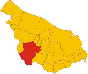
Manduria (Manduria)
.svg)
- Italian comune
 Hiking in Manduria
Manduria, located in the Apulia region of Italy, is known for its rich history, beautiful landscapes, and notable wine production, particularly the robust Primitivo wine. While Manduria itself may not be a renowned hiking destination like some of the larger national parks or mountainous areas in Italy, there are still opportunities to enjoy the natural beauty of the region through various trails and outdoor activities.
Here are some things to consider when hiking in and around Manduria:
Natural Scenery
- Countryside Trails: The surrounding countryside features a mix of olive groves, vineyards, and fields. Many trails can be explored on foot or by bike, offering picturesque views of the rolling hills and rural landscapes.
- Coastal Paths: If you're willing to venture toward the nearby coastline, the area near the Ionian Sea provides stunning views and the chance to explore coastal paths. The beaches near Manduria, such as Torre Colimena and Campomarino, have beautiful shorelines that can be enjoyed on foot.
Historical Sites
- Ancient Ruins: Manduria has a deep historical significance, including archaeological sites such as the Messapian ruins. Hiking to these locations can provide the dual experience of enjoying nature while exploring cultural history.
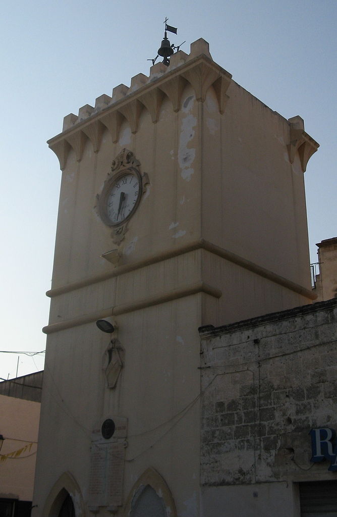
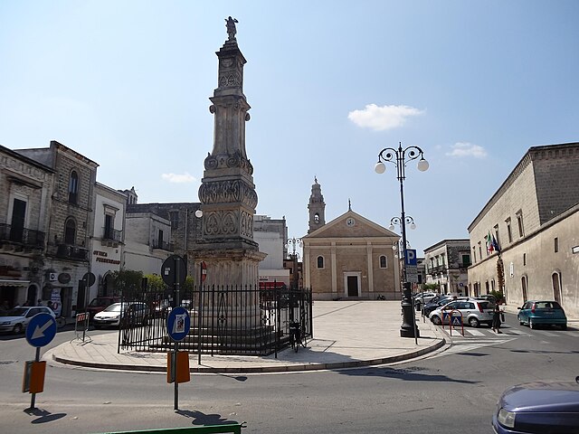
- Historic Town Center: Don’t miss the chance to walk through the charming streets of Manduria, where you can see ancient churches and the famous impressive "Piazza del Rione" while enjoying local culture.
Local Parks
- Natural Parks: Nearby natural parks, like the Natural Park of Porto Selvaggio and Palude del Capitano, offer marked trails suitable for hiking. Although a bit of a drive from Manduria, these parks provide more extensive hiking options, including coastal views, dense forests, and diverse wildlife.
Weather Considerations
- Best Times to Hike: The ideal seasons for hiking in this region are spring (March to June) and fall (September to November), where the weather is milder and more conducive to outdoor activities.
- Heat Precautions: In the summer months, temperatures can soar. It’s essential to start hikes early or later in the day to avoid the hottest parts of the day, and to stay hydrated.
Recommendations
- Guided Tours: If you're new to hiking or the region, consider joining a guided hiking tour. Many locals offer tours that incorporate local history, wine tasting, and exploration of nature, providing a well-rounded experience.
- Local Tips: Always carry enough water, wear appropriate footwear, and keep an eye on trail markers if you're hiking in less familiar areas.
By incorporating a mix of outdoor experiences, history, and local culture, hiking in and around Manduria can be a rewarding and memorable experience for visitors.
- Country:

- Postal Code: 74024
- Local Dialing Code: 099
- Licence Plate Code: TA
- Coordinates: 40° 24' 10" N, 17° 38' 3" E


- GPS tracks (wikiloc): [Link]
- AboveSeaLevel: 79 м m
- Area: 180.41 sq km
- Population: 31159
- Web site: http://www.comunedimanduria.com
- Wikipedia en: wiki(en)
- Wikipedia: wiki(it)
- Wikidata storage: Wikidata: Q52019
- Wikipedia Commons Gallery: [Link]
- Wikipedia Commons Category: [Link]
- Freebase ID: [/m/05zgxl]
- GeoNames ID: Alt: [6538953]
- VIAF ID: Alt: [138974453]
- OSM relation ID: [40426]
- MusicBrainz area ID: [9fc354a0-832a-44ed-8561-a434e821fa5d]
- Quora topic ID: [Manduria]
- UN/LOCODE: [ITZMV]
- Encyclopædia Britannica Online ID: [place/Manduria]
- ISTAT ID: 073012
- Italian cadastre code: E882
Shares border with regions:


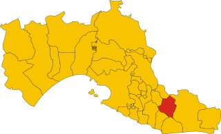
Erchie
- Italian comune
Hiking in Erchie
Erchie is a picturesque village located on the Amalfi Coast in Italy, nestled between the mountains and the sea. It offers stunning views, charming landscapes, and opportunities for hiking enthusiasts....
- Country:
- Postal Code: 72020
- Local Dialing Code: 0831
- Licence Plate Code: BR
- Coordinates: 40° 26' 10" N, 17° 44' 10" E
- GPS tracks (wikiloc): [Link]
- AboveSeaLevel: 68 м m
- Area: 44.63 sq km
- Population: 8671
- Web site: [Link]

Francavilla Fontana
- Italian comune
Hiking in Francavilla Fontana
Francavilla Fontana is a town in the Apulia region of southern Italy, rich in history and culture, and surrounded by beautiful natural landscapes that can provide a great hiking experience. While Francavilla Fontana itself is more known for its architecture and historical sites, its surrounding areas offer opportunities for outdoor activities....
- Country:
- Postal Code: 72021
- Local Dialing Code: 0831
- Licence Plate Code: BR
- Coordinates: 40° 31' 53" N, 17° 35' 9" E
- GPS tracks (wikiloc): [Link]
- AboveSeaLevel: 142 м m
- Area: 177.94 sq km
- Population: 36358
- Web site: [Link]


Oria, Apulia
- Italian comune
Hiking in Oria, Apulia
Oria, located in the Apulia region of Italy, is a charming town rich in history and surrounded by beautiful landscapes ideal for hiking enthusiasts. While Oria itself is known for its historical architecture, including the majestic castle and ancient churches, the surrounding countryside offers a variety of trails showcasing the natural beauty of the region....
- Country:
- Postal Code: 72024
- Local Dialing Code: 0831
- Licence Plate Code: BR
- Coordinates: 40° 30' 0" N, 17° 38' 0" E
- GPS tracks (wikiloc): [Link]
- AboveSeaLevel: 83 м m
- Area: 83.67 sq km
- Population: 15094
- Web site: [Link]

Avetrana
- Italian comune
Hiking in Avetrana
Avetrana, a small town in the Puglia region of Italy, is not particularly known for hiking in the traditional sense, as it is primarily an agricultural area with beautiful countryside landscapes. However, it can serve as a great starting point for exploring the natural beauty and hiking opportunities in the surrounding region....
- Country:
- Postal Code: 74020
- Local Dialing Code: 099
- Licence Plate Code: TA
- Coordinates: 40° 21' 14" N, 17° 44' 9" E
- GPS tracks (wikiloc): [Link]
- AboveSeaLevel: 62 м m
- Area: 73.23 sq km
- Population: 6604
- Web site: [Link]


Maruggio
- Italian comune
Hiking in Maruggio
Maruggio, located in the Puglia region of Italy, is a charming destination for hiking enthusiasts who want to explore both its natural beauty and cultural heritage. Here are some highlights of hiking in and around Maruggio:...
- Country:
- Postal Code: 74020
- Local Dialing Code: 099
- Licence Plate Code: TA
- Coordinates: 40° 19' 22" N, 17° 34' 25" E
- GPS tracks (wikiloc): [Link]
- AboveSeaLevel: 26 м m
- Area: 49.07 sq km
- Population: 5241
- Web site: [Link]
Sava
- Italian comune
Hiking in Sava
Sava, located in the Apulia region of Italy, is a charming little town known for its picturesque landscapes and unique cultural heritage. While it is not a widely-known hiking destination compared to some of Italy's larger national parks, it offers some beautiful trails and natural areas that can be explored. Here are some things to consider when hiking in and around Sava:...
- Country:
- Postal Code: 74028
- Local Dialing Code: 099
- Licence Plate Code: TA
- Coordinates: 40° 24' 1" N, 17° 34' 0" E
- GPS tracks (wikiloc): [Link]
- AboveSeaLevel: 108 м m
- Area: 44.57 sq km
- Population: 16076
- Web site: [Link]


Porto Cesareo
- Italian comune
Hiking in Porto Cesareo
Porto Cesareo, located on the Ionian coast of Puglia, Italy, is primarily known for its beautiful beaches, crystal-clear waters, and vibrant marine life. While it is not traditionally recognized as a hiking destination, there are still opportunities for hiking and exploring natural areas nearby....
- Country:
- Postal Code: 73010
- Local Dialing Code: 0833
- Licence Plate Code: LE
- Coordinates: 40° 16' 0" N, 17° 54' 0" E
- GPS tracks (wikiloc): [Link]
- AboveSeaLevel: 3 м m
- Area: 35.13 sq km
- Population: 6272
- Web site: [Link]