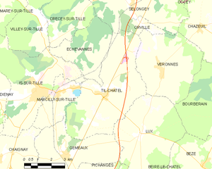
Marcilly-sur-Tille (Marcilly-sur-Tille)

- commune in Côte-d'Or, France
- Country:

- Postal Code: 21120
- Coordinates: 47° 31' 9" N, 5° 7' 55" E


- GPS tracks (wikiloc): [Link]
- Area: 7.27 sq km
- Population: 1663
- Web site: http://www.marcillysurtille.fr
- Wikipedia en: wiki(en)
- Wikipedia: wiki(fr)
- Wikidata storage: Wikidata: Q55343
- Wikipedia Commons Category: [Link]
- Freebase ID: [/m/03mft8s]
- GeoNames ID: Alt: [6428723]
- SIREN number: [212103832]
- BnF ID: [152506702]
- PACTOLS thesaurus ID: [pcrtfqSZl59wSi]
- INSEE municipality code: 21383
Shares border with regions:


Chaignay
- commune in Côte-d'Or, France
- Country:
- Postal Code: 21120
- Coordinates: 47° 28' 36" N, 5° 4' 14" E
- GPS tracks (wikiloc): [Link]
- Area: 25.05 sq km
- Population: 532
- Web site: [Link]
Crécey-sur-Tille
- commune in Côte-d'Or, France
- Country:
- Postal Code: 21120
- Coordinates: 47° 33' 30" N, 5° 7' 42" E
- GPS tracks (wikiloc): [Link]
- Area: 10.77 sq km
- Population: 148


Is-sur-Tille
- commune in Côte-d'Or, France
- Country:
- Postal Code: 21120
- Coordinates: 47° 31' 15" N, 5° 6' 56" E
- GPS tracks (wikiloc): [Link]
- Area: 22.53 sq km
- Population: 4424
- Web site: [Link]


Gemeaux
- commune in Côte-d'Or, France
- Country:
- Postal Code: 21120
- Coordinates: 47° 28' 40" N, 5° 8' 12" E
- GPS tracks (wikiloc): [Link]
- Area: 19.34 sq km
- Population: 882
- Web site: [Link]

Til-Châtel
- commune in Côte-d'Or, France
- Country:
- Postal Code: 21120
- Coordinates: 47° 31' 4" N, 5° 10' 28" E
- GPS tracks (wikiloc): [Link]
- Area: 26.37 sq km
- Population: 1065
- Web site: [Link]