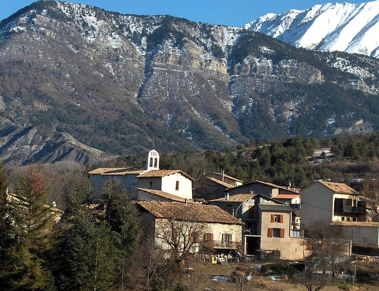
Marcoux (Marcoux)
- commune in Alpes-de-Haute-Provence, France
Marcoux, located in the Alpes-de-Haute-Provence region of France, is a hidden gem for hikers looking to explore a beautiful and varied landscape. This picturesque area is known for its stunning mountain scenery, rich flora and fauna, and charming Provencal villages.
Hiking Trails:
-
GR4 Trail: Part of the long-distance GR (Grande Randonnée) network, the GR4 passes near Marcoux and offers extensive hiking opportunities. This trail takes you through diverse landscapes, including forests, valleys, and panoramic views of the surrounding mountains.
-
Local Hiking Routes: There are various marked local trails around Marcoux that cater to different skill levels. You can find hikes ranging from easy strolls to more challenging ascents.
-
Lac de Bauduen: A short drive away is the scenic Lac de Bauduen. Hiking around the lake offers beautiful vistas and the chance to enjoy water activities as well.
Points of Interest:
- Scenic Vistas: Many trails lead to viewpoints where you can take in the breathtaking landscapes of the Provence region, characterized by rolling hills and dramatic rocky outcrops.
- Wildlife Watching: The area is home to diverse wildlife, making it a great spot for nature enthusiasts. Keep an eye out for different bird species and other animals native to the region.
- Cultural Heritage: As you hike, you may encounter historic villages and sites that reflect the rich cultural heritage of the region, including traditional stone houses and ancient ruins.
Best Time to Hike:
- Spring (April to June) and autumn (September to October) are generally the best times for hiking in Marcoux. The weather is mild, and the landscapes are vibrant with blooming flowers or autumn colors.
Preparation Tips:
- Footwear: Wear sturdy hiking boots for rocky and uneven terrain.
- Hydration: Always carry enough water, especially during the warmer months, as some trails may be remote.
- Weather: Check the local weather forecast before heading out, as conditions can change rapidly in mountainous areas.
- Navigation: Use a map or a GPS device, as some trails may not be well-marked.
Conclusion:
Hiking in Marcoux offers a blend of stunning natural beauty, diverse trails, and cultural exploration. Whether you're a seasoned hiker or a beginner, there’s something here for everyone to enjoy. Make sure to respect the local environment and follow any trail guidelines. Happy hiking!
- Country:

- Postal Code: 04420
- Coordinates: 44° 7' 42" N, 6° 16' 37" E


- GPS tracks (wikiloc): [Link]
- AboveSeaLevel: 957.5 м m
- Area: 32.17 sq km
- Population: 499
- Wikipedia en: wiki(en)
- Wikipedia: wiki(fr)
- Wikidata storage: Wikidata: Q1018575
- Wikipedia Commons Category: [Link]
- Freebase ID: [/m/03m7_dd]
- Freebase ID: [/m/03m7_dd]
- GeoNames ID: Alt: [6425529]
- GeoNames ID: Alt: [6425529]
- SIREN number: [210401139]
- SIREN number: [210401139]
- VIAF ID: Alt: [122913084]
- VIAF ID: Alt: [122913084]
- INSEE municipality code: 04113
- INSEE municipality code: 04113
Shares border with regions:

Digne-les-Bains
- commune in Alpes-de-Haute-Provence, France
Digne-les-Bains, located in the Alpes-de-Haute-Provence region in southeastern France, is a beautiful area known for its stunning landscapes, rich history, and warm climate. The region offers a variety of hiking opportunities suitable for all levels, from easy strolls to challenging mountain trails....
- Country:

- Postal Code: 04000
- Coordinates: 44° 5' 33" N, 6° 14' 8" E


- GPS tracks (wikiloc): [Link]
- Area: 117.07 sq km
- Population: 16246
- Web site: [Link]

Draix
- commune in Alpes-de-Haute-Provence, France
Draix, a charming village in the Alpes-de-Haute-Provence region of France, offers a variety of hiking opportunities set against stunning natural backdrops. The area's mountainous terrain and lush surroundings make it an attractive destination for both novice and experienced hikers....
- Country:

- Postal Code: 04420
- Coordinates: 44° 8' 4" N, 6° 20' 35" E


- GPS tracks (wikiloc): [Link]
- Area: 23.04 sq km
- Population: 113
Le Brusquet
- commune in Alpes-de-Haute-Provence, France
Le Brusquet is a charming village located in the Alpes-de-Haute-Provence region of France, nestled in a picturesque setting that offers plenty of opportunities for hiking and outdoor activities. Here’s what you should know about hiking in and around Le Brusquet:...
- Country:

- Postal Code: 04420
- Coordinates: 44° 9' 40" N, 6° 18' 35" E


- GPS tracks (wikiloc): [Link]
- Area: 22.25 sq km
- Population: 966

Archail
- commune in Alpes-de-Haute-Provence, France
Archail is not a widely recognized hiking destination, so information about it might be limited or could refer to a lesser-known area or a specific locality. It’s possible you may be referring to a region in France, India, or another country with a similar-sounding name....
- Country:

- Postal Code: 04420
- Coordinates: 44° 7' 17" N, 6° 20' 3" E


- GPS tracks (wikiloc): [Link]
- Area: 12.99 sq km
- Population: 16
